Around Corcoué-sur-Logne

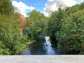
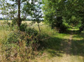
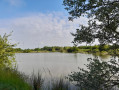
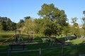
This route follows part of the Logne and the greenway, before climbing towards La Bénate alongside the Loisillière stream.

Details

3343324
Creation:
Last update:
Last review:
  • Walking
    Activity: Walking
  • ↔
    Distance: 7.78 mi
  • ◔
    Average duration: 3h 45 
  • ▲
    Difficulty: Moderate

  • ⚐
    Back to start: Yes
  • ↗
    Ascent: + 217 ft
  • ↘
    Descent: - 210 ft

  • ▲
    Highest point: 180 ft
  • ▼
    Lowest point: 52 ft

Description of the walk

(S/E) Start at the small car park by the cave, near the motorhome area. Leave the car park heading north and cross Rue de la Poste.

(1) Take the first path on the right to cross the bridge. Climb the steps leading up to the church car park.

(2) Head straight on towards the D72, then after about 40 metres, turn right onto the path, keeping the houses on your left. At the end of the field, turn right, then left. Carry on straight ahead until you reach the hamlet of Le Cerclais.

(3) Turn onto the road on the left, then just before the left-hand bend, turn onto the track on the right until you reach the D61. Turn left onto the D61 and follow this road for about 400 m.

(4) Take the track on the right, then at the end turn right towards Le Marchais. At Le Marchais, follow the road by turning left. Follow the Paquetière and carry on straight ahead at the junction.

(5) Take the path on the right until you reach the D261. Cross it and head towards Grossève. Just before the village, at the bend to the right, carry straight on, taking the path that leads down to the greenway.

(6) Join the greenway by turning right and follow it to the D178 road. Cross the road to go over the Logne bridge.

(7) Take the path on the left which runs alongside the Ruisseau de Loisilière and then climbs towards La Bénate. Follow it for 1.3 km. You’ll come out onto a plateau.

(8) Go round the plateau to the left, then after 150 m turn right.

(9) Turn left, then always take the first path on the right to retrace your steps.

(9) Turn left. Follow the path back along the same route to rejoin the greenway at Pont de Loisilière.

(7) Head left and return to the car park where you started (S/E).

Waypoints

  1. S/E : mi 0 - alt. 69 ft - Cave car park
  2. 1 : mi 0.32 - alt. 56 ft - Pont de la - Logne (rivière)
  3. 2 : mi 0.4 - alt. 79 ft - Church Square
  4. 3 : mi 1.08 - alt. 138 ft - Le Cerclais
  5. 4 : mi 2.08 - alt. 157 ft - Track on the right
  6. 5 : mi 2.89 - alt. 157 ft - Cost
  7. 6 : mi 3.77 - alt. 89 ft - Grossève
  8. 7 : mi 4.54 - alt. 62 ft - Pont de Loisilière
  9. 8 : mi 5.35 - alt. 118 ft - Bénate Plateau
  10. 9 : mi 6.12 - alt. 174 ft - Bénate
  11. S/E : mi 7.78 - alt. 69 ft - Cave car park

Reviews and comments

3.9 / 5
Based on 3 reviews

Reliability of the description
3.7 / 5
Ease of following the route
3.3 / 5
Route interest
4.7 / 5
User 17048091
• Edited:

Unmarked route.
No path.
No specific internet access except in Corcoué itself.
I do not recommend this route

Machine-translated

orvaut
orvaut

Overall rating : 3.7 / 5

Date of your route : May 23, 2022
Reliability of the description : ★★★★☆ Good
Ease of following the route : ★★☆☆☆ Disappointing
Route interest : ★★★★★ Very good
Very busy route : No

1 – Walk undertaken on Saturday 21 May in lovely weather
2 – We didn’t meet any other walkers along the route. At the start, there were some joggers, and later on we came across just one local couple walking their dog, with whom we chatted about how busy the route gets: it seems it’s busier on Sunday mornings...
3 – Information to be updated for this route:
- Point 1: By the time you reach the car park, you have already crossed the bridge. Stating that you should cross the bridge after setting off could be misleading
- Point 3: At the “turn right” between points 3 and 4, you find yourself facing a maize field… which we were careful not to cross. This forced us to go round LA MIGNERIE (adding about 2 km) to reach the D61
- At point 9 (LA BENATE), at the start of the route, at the ‘turn right’ sign, a piece of string was blocking the way… which led us to walk through LA BENATE, which was actually quite interesting.

All in all, a 15.18 km walk
And we enjoyed this route through a gently undulating landscape, with well-tended fields, vineyards and cereal crops, wooded sections, and a few inhabited areas which were also well maintained.

Due to the current drought, we were unable to fully appreciate the LOGNE, as the water level was very low.

Jean Orvaut

Machine-translated

randonnee2944
randonnee2944

Overall rating : 4 / 5

Date of your route : Mar 29, 2021
Reliability of the description : ★★★☆☆ Average
Ease of following the route : ★★★★☆ Good
Route interest : ★★★★★ Very good
Very busy route : Yes

A slightly dodgy description of the start.
Between 3 and 4, the crossing leading to the D61 no longer exists. The entire path that ran alongside the field has been converted into farmland
All in all, a very pleasant walk, but not one to be undertaken in winter. The paths along the banks of the Logne can overflow and flood the track.

Machine-translated

avlv
avlv

Before the route around Corcoué appeared on Visorando, I’d already walked sections 1 to 6 of it. As I was looking for a 16km route, I carried on along the Logne. I wanted more woodland, so I did another route starting near the car park – a very pleasant full route of the bird sanctuary, covering about 7km. Then, for the second part, I walked along the Logne, taking the towpath on the way out and returning via the other side of the Logne – a very pretty route. However, to avoid walking the same stretch twice, I turned off not far from Bercy before heading back down into the valley. I had a bit of trouble finding the crossing over a small river – I couldn’t find out its name – which leads back to the Logne.
I find this a very ‘rejuvenating’ route.

Machine-translated

didfly
didfly

Overall rating : 4 / 5

Date of your route : Oct 03, 2020
Reliability of the description : ★★★★☆ Good
Ease of following the route : ★★★★☆ Good
Route interest : ★★★★☆ Good
Very busy route : No

Despite the lack of signposting in places, it was a pleasant walk, even on 3 October amidst gale-force winds and driving rain

Machine-translated

Other walks in the area

For more walks, use our search engine .

The GPS track and description are the property of this route's author. Please do not copy them without permission.