The Choltière Route

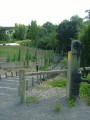
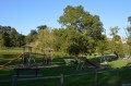
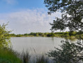
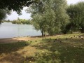
An ideal short walk with children to explore the Bois de la Choltière and the mill site, with its lake, children’s playground, picnic area and pétanque court.

Details

n°208957
Creation:
Last update:
Last review:
  • Walking
    Activity: Walking
  • ↔
    Distance: 1.77 mi
  • ◔
    Average duration: 0h 55 
  • ▲
    Difficulty: Easy

  • ⚐
    Back to start: Yes
  • ↗
    Ascent: + 75 ft
  • ↘
    Descent: - 75 ft

  • ▲
    Highest point: 125 ft
  • ▼
    Lowest point: 46 ft

Photos

Description of the walk

Park at the Moulin car park, Route de La Garnache.

(S/E) Head towards the lake and turn right onto the embankment, which will take you to the mill.

(1) Turn left onto Impasse du Moulin. Before it joins the road, continue straight ahead along a path (not shown on the map) beside the Falleron stream (river).

(2) Cross the stream. Head into the Bois de la Choltière and take the path leading uphill into the woods on your right, following the yellow markings on the trees. After about 250 metres, turn left at a right angle. Further on, start a left-hand bend and head downhill.

(3) Turn left and walk alongside the Blanchardière stream.

(2) Cross the stream again, then cross the D72 road. Take the path opposite the car park that runs alongside the willow grove. Turn right across the field to rejoin the path. Walk down Rue Résidence du Donjon as it continues, then cross Rue de la Tour (watch out for the D72) to take the ‘Pas d’Ane’. Turn left at the Fork in the road, then right at the T-junction that follows to go round the lake and reach the car park (S/E).

Waypoints

  1. S/E : mi 0 - alt. 69 ft - Mill car park, Route de La Garnache.
  2. 1 : mi 0.13 - alt. 62 ft - The mill - Falleron (fleuve)
  3. 2 : mi 0.28 - alt. 52 ft - Stream – Bridge
  4. 3 : mi 0.75 - alt. 56 ft - Path along the Blanchardière stream
  5. S/E : mi 1.77 - alt. 69 ft - Mill car park, Route de La Garnache.

Notes

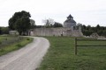
The route starts and finishes at the mill site, which has a car park, toilets, a children’s playground, a picnic area and a lake. There are small shops in the village.

Access: This trail is accessible all year round except during periods of high water.

Worth a visit

The mill site is a former flour mill that operated using water from the Falleron. The site was acquired by the local council in the 1990s and the mill was fully restored in 2000.

Reviews and comments

4 / 5
Based on 2 reviews

Reliability of the description
3.5 / 5
Ease of following the route
5 / 5
Route interest
3.5 / 5
dedebouaye
dedebouaye

Overall rating : 4.3 / 5

Date of your route : Mar 09, 2020
Reliability of the description : ★★★★☆ Good
Ease of following the route : ★★★★★ Very good
Route interest : ★★★★☆ Good

A short, scenic walk, partly through woodland,
the only slight downside is that the path requires you to cross a field, which has been fenced off, so you have to take a slight detour...

Machine-translated

henri57
henri57 ★

Hello;

I’ve looked online and in person,

In the description, you’ll find the starting point coordinates:

Start: N 46°55'40.3 / W 1°44'48.5

If you copy and paste these into Google or a similar service, you can view the route

https://www.google.fr/maps/place/46°55'...

See you soon

Machine-translated

Bigmamma
Bigmamma

Overall rating : 3 / 5

Date of your route : Mar 11, 2019
Reliability of the description : ★★★☆☆ Average
Ease of following the route : Not used / Not applicable
Route interest : ★★★☆☆ Average

"Parking at the Parking du Moulin, Route de La Garnache". No address given for the start of the walk. I searched online and in the area, but there is no ‘Parking du Moulin’ on Route de La Garnache. In fact, Route de La Garnache doesn’t seem to exist, so I took the road leading towards La Garnache (I drove along it in both directions without success). I had noted down ‘Impasse du Moulin’, which is easy to find, however.

Machine-translated

Other walks in the area

For more walks, use our search engine .

The GPS track and description are the property of this route's author. Please do not copy them without permission.