The lakes of La Marne

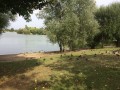
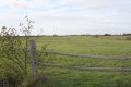
The La Marne lakes route will take you on a tour of the leisure area and its ponds, which are ideal for fishing and relaxation. The walk will take you through wooded countryside and fields, allowing you to explore the area around the village.

Details

21786912
Creation:
Last update:
Last review:
  • Walking
    Activity: Walking
  • ↔
    Distance: 5.01 mi
  • ◔
    Average duration: 2h 20 
  • ▲
    Difficulty: Easy

  • ⚐
    Back to start: Yes
  • ↗
    Ascent: + 30 ft
  • ↘
    Descent: - 30 ft

  • ▲
    Highest point: 75 ft
  • ▼
    Lowest point: 20 ft
  • ⚐ Country: France
  • ⚐ City: La Marne (44270)
  • ⚑
    Start/End: N 46.99513° / W 1.741886°
  • ❏
    IGN map(s): Ref. 1224SB
  • Hour-by-hour weather

Photos

Description of the walk

Park in the church car park.

(S/E) From the car park, turn right onto Rue de la Charrie, go under the D117, cross the D87 and take the path on your left marked in yellow.

(1) Take the path on the left, through the woodland, and cross the Grand Moulin Leisure Park to come out onto a road.

(2) Turn left, then follow the D87 to the right along the path on the right (shared cycle and footpath) as far as the hamlet known as Le Pont.

(3) Then take the path on your right and carry on straight ahead along the path towards the fields.

(4) Turn right for about a hundred metres, then veer left and further on to the right to come out onto a road, not far from a mast.

(5) Follow the road for a few dozen metres, then take the path on your left. At the end of this shaded path, turn right until you reach a junction. Turn left twice to reach a roundabout.

(6) At the roundabout, turn left towards the village of La Marne. Go under the D117 bridge and go round a second roundabout. Take care when crossing roads! Continue along a street, then turn left onto a path running alongside a housing estate.

(7) Turn right, cross a road and continue through the woodland. Carrying on straight ahead, you’ll pass through a housing estate before reaching a wooded area; take the small path on your left through it. First turn right then left to cross a road and follow the yellow markings to the sewage treatment works.

(8) Walk round the treatment works and, when you reach the junction with the Rivière du Tenu, head uphill to the right, taking the path that joins a road.

(9) Near the Parc de Loisirs des Chênes, go through the gate and take the footpath which joins a road near the cemetery.
Turn left to reach the Place de l’Église (S/E).


Waypoints

  1. S/E : mi 0 - alt. 46 ft - Car park - Église Notre-Dame de l'Assomption (La Marne)
  2. 1 : mi 0.37 - alt. 49 ft - Grand Moulin Leisure Park
  3. 2 : mi 0.8 - alt. 36 ft - Road junction
  4. 3 : mi 1.22 - alt. 20 ft - A place known as Le Pont
  5. 4 : mi 1.93 - alt. 39 ft - T-junction
  6. 5 : mi 2.32 - alt. 66 ft - Road junction
  7. 6 : mi 3.2 - alt. 69 ft - Roundabout
  8. 7 : mi 3.71 - alt. 59 ft - T-junction
  9. 8 : mi 4.34 - alt. 26 ft - Wastewater treatment plant. Towards the - Tenu (rivière) - Affluent de l'Acheneau
  10. 9 : mi 4.71 - alt. 26 ft - Parc de Loisirs des Chênes
  11. S/E : mi 5.01 - alt. 46 ft - Église Notre-Dame de l'Assomption (La Marne)

Notes

Parking is available in the church car park.

Worth a visit

It is in this leisure area, with its six hectares of water, that the Fête du Grand Moulin takes place every July. At this outdoor site, you can take the time to have a picnic, go fishing (fishing licence required) or enjoy walks around the ponds.

For families, there is also a permanent orienteering course on the site.

Reviews and comments

4.4 / 5
Based on 3 reviews

Reliability of the description
4.3 / 5
Ease of following the route
5 / 5
Route interest
4 / 5
User 28468143

Overall rating : 4.3 / 5

Date of your route : Sep 08, 2026
Reliability of the description : ★★★★☆ Good
Ease of following the route : ★★★★★ Very good
Route interest : ★★★★☆ Good
Very busy route : No

walk taken on 7 September
easy route
I’d recommend it

Machine-translated

Shoubs
Shoubs

Overall rating : 4.3 / 5

Date of your route : Aug 26, 2024
Reliability of the description : ★★★★☆ Good
Ease of following the route : ★★★★★ Very good
Route interest : ★★★★☆ Good
Very busy route : No

A walk with my dogs in harnesses. A lovely route with beautiful scenery, but the view of the marshes is short-lived – only at the start. That said, the variety of the scenery is a real delight 😊
A bit of town and tarmac – one short stretch isn’t really suitable for walking, in my opinion – but the route is very well signposted!
I’d recommend it 🌼

Machine-translated

ElodieG
ElodieG

Overall rating : 4.7 / 5

Date of your route : Nov 05, 2023
Reliability of the description : ★★★★★ Very good
Ease of following the route : ★★★★★ Very good
Route interest : ★★★★☆ Good
Very busy route : No

A lovely, well-signposted walk in the countryside. The path at the end of the walk was flooded and impassable due to heavy rain

Machine-translated

Other walks in the area

For more walks, use our search engine .

The GPS track and description are the property of this route's author. Please do not copy them without permission.