The Falleron Valley

A peaceful walk awaits you on this route, dotted with typical villages such as La Brosse, La Grivière and L’Épronnière. Winding through the bocage, this route will take you to a beautiful viewpoint overlooking the village of Saint-Étienne de Mer Morte. The path will take you across the little stream known as the Blanchardière, and a ford will allow you to cross the Falleron.

Details

208975
Creation:
Last update:
Last review:
  • Walking
    Activity: Walking
  • ↔
    Distance: 4.62 mi
  • ◔
    Average duration: 2h 15 
  • ▲
    Difficulty: Easy

  • ⚐
    Back to start: Yes
  • ↗
    Ascent: + 135 ft
  • ↘
    Descent: - 115 ft

  • ▲
    Highest point: 128 ft
  • ▼
    Lowest point: 46 ft

Photos

Description of the walk

Mill car park, Route de L’étang (Plessis).

(S/E) Head towards the village of Le Plessis along the road – turn right as you leave the car park and drive through the village.

(1) Turn right on leaving Le Plessis and follow the path for 1.5 km until you reach a road.

(2) Turn right, walk through the village of La Grivière and continue for about 500 metres.

(3) Turn right and walk for 400 metres. Turn left towards the village of L’Épronnière. On leaving the village, head right towards La Brosse. Please note that you will be joining the Departmental Road 72.

(4) Turn left and take care for 100 metres, then turn right to walk through the village of La Brosse. Turn right; you’ll be on a tarmac road for 300 metres before joining a footpath (800 metres). The bridge is on your right.

(5) Cross it and take the path on your right, through the woods, alongside the Falleron. You’ll reach the Saint-Étienne-de-Mer-Morte reed bed filtration system. Turn left into the field to rejoin the track. Walk down Rue du Coteau.

(6) Cross Rue de la Tour (watch out for the D72) to take the “Pas d’Âne”, which continues as a path.

(7) At the mill, take the embankment on your left to return to your starting point (S/E).

Waypoints

  1. S/E : mi 0 - alt. 69 ft - Mill car park, Route de La Garnache.
  2. 1 : mi 0.33 - alt. 115 ft - Leaving the village of Le Plessis
  3. 2 : mi 1.29 - alt. 79 ft - Take the road towards the village of La Grivière
  4. 3 : mi 2.1 - alt. 125 ft - Take the road towards the village of L’Épronnière
  5. 4 : mi 2.91 - alt. 118 ft - D72
  6. 5 : mi 3.74 - alt. 49 ft - The Rambaudières Bridge - Falleron (fleuve)
  7. 6 : mi 4.35 - alt. 105 ft - Le Pas d’Âne
  8. 7 : mi 4.5 - alt. 62 ft - The mill
  9. S/E : mi 4.62 - alt. 69 ft - Mill car park, Route de La Garnache.

Notes

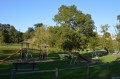
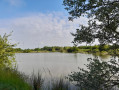
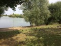
The route starts and ends at the mill site, which has toilets, a children’s playground, a picnic area and a lake. There are small shops in the village.
Access: This trail is accessible all year round except during periods of high water.

Worth a visit

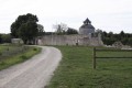
The mill site is a former flour mill that operated using water from the Falleron. The site was acquired by the local council in the 1990s and the mill was fully restored in 2000.

Reviews and comments

4.1 / 5
Based on 3 reviews

Reliability of the description
4 / 5
Ease of following the route
4.3 / 5
Route interest
4 / 5
AIRBUS2016a
AIRBUS2016a

Overall rating : 4.7 / 5

Date of your route : Apr 11, 2022
Reliability of the description : ★★★★★ Very good
Ease of following the route : ★★★★★ Very good
Route interest : ★★★★☆ Good
Very busy route : No

It’s worth noting that you’ll need to drive a few kilometres along a tarmac road before you reach the lovely countryside.

Machine-translated

catherine et  jy
catherine et jy

Overall rating : 4 / 5

Date of your route : Feb 19, 2018
Reliability of the description : ★★★★☆ Good
Ease of following the route : ★★★★☆ Good
Route interest : ★★★★☆ Good

We did this walk in the rain – be warned, some of the paths are quite dirty and muddy – but otherwise it’s a lovely route to take at a leisurely pace. The mill is well worth a visit – it’s absolutely beautiful – and the villages are charming. We’ll definitely do it again.

Machine-translated

chimval
chimval

Hello Bibi
As for the car park, I think it’s best to put ‘Route du Plessis car park’.
For the outward journey, we can’t take a shortcut. From the car park, take Route du Plessis.
On the way back, you can’t take the route between 7 and the finish. You need to turn left halfway between 6 and 7 to get back onto Route du Plessis.
Kind regards

Machine-translated

bibi
bibi ★

Thank you for your feedback. If you have any information we could add to the description to make it more comprehensive and easier to follow, we’d be delighted to hear it.
Kind regards

Machine-translated

chimval
chimval

Overall rating : 3.7 / 5

Date of your route : Dec 03, 2017
Reliability of the description : ★★★☆☆ Average
Ease of following the route : ★★★★☆ Good
Route interest : ★★★★☆ Good

The path is in good condition.
The route is a bit unclear at the start and end of the walk (around the mill).
We parked in the car park on Impasse du Moulin as we couldn’t find the mill’s car park (even on Waze).
The walk went smoothly thanks to Visorando and the sat-nav. The route description is a bit hit-and-miss.

Machine-translated

Other walks in the area

For more walks, use our search engine .

The GPS track and description are the property of this route's author. Please do not copy them without permission.