Around Épinoy

In the heart of Pas-de-Calais, this walking route invites you to discover the peaceful countryside and authentic villages that dot the area between Épinoy and Oisy-le-Verger.

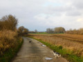
Starting from Épinoy, a charming village with a rural feel, you will pass through Cauchy-Lestrée and Sauchy-Cauchy, two villages marked by history and a gentle way of life. The path winds its way through open fields, quiet lanes and bucolic landscapes, offering an ideal break for lovers of nature and local heritage. The arrival in Oisy-le-Verger, with its typical houses and welcoming atmosphere, brings this walk to a beautiful end.

This route is accessible to all and perfect for recharging your batteries and rediscovering the hidden treasures of our region.

Details

79492580
Creation:
Last update:
Last review:
  • Walking
    Activity: Walking
  • ↔
    Distance: 11.35 mi
  • ◔
    Average duration: 5h 25 
  • ▲
    Difficulty: Moderate

  • ⚐
    Back to start: Yes
  • ↗
    Ascent: + 240 ft
  • ↘
    Descent: - 256 ft

  • ▲
    Highest point: 266 ft
  • ▼
    Lowest point: 131 ft
  • ⚐ Country: France
  • ⚐ City: Épinoy (62860)
  • ⚑
    Start/End: N 50.230928° / E 3.166191°
  • ❏
    IGN map(s): Ref. 2506E
  • Hour-by-hour weather

Description of the walk

Park in front of the church.

(S/E) Stand with your back to the church, at the junction with Rue de la Mairie, then turn right. Take the second street on the left (Rue Verte), passing in front of the town hall.

(1) Turn left again onto Rue du Vieux Chemin de Cambrai. At the next junction, continue straight ahead, leaving the Vieux Chemin de Cambrai on your left. At the fork in the path, take the path on the right.

(2) At the junction with Rue d’Haynecourt, continue straight on along the path. At the next crossroads, continue straight on again. At the junction with the D21E1, cross over and continue straight ahead, then at the next crossroads, go straight ahead.

(3) At the crossroads, turn left. At the junction, turn first left, then immediately right, ignoring the small path on your left.

(4) At the Argilière junction, turn left. At the next crossroads, turn right. At the junction with Rue Gueulette in Sauchy-Lestrée (D15), first turn right then left to cross this main road with care and turn onto Rue Nagot. Pass by the church and, at the next junction, continue straight on along Rue du Cure.

(5) At the junction with Rue du Brûle, turn slightly left. At the end of this road, turn left onto Rue de la Cauchy (Sauchy-Cauchy).

(6) Follow this street, cross the Agache and continue to the Canal du Nord.

(7) Turn right onto Chemin de Baralle, follow the canal, then keep to the right to reach Pont Brichembaut.

(8)Turn right andthen take the second path on the right. At the junction with Rue Alfred Caudrelier in Oisy-le-Verger, turn left.

(9) At the bend in Rue Désiré Catillon, keep left and take the footpath to Rue Charles Jacobs.

(10) At the junction with Rue Charles Canivet, turn left. Immediately, taking care, turn right onto Rue Henri Deloffre. Then take the second street on the right, Place de l’Église. Walk past the church and turn left onto Place du Général Desailly.

(11) At the corner of Rue Louis Gilleron, turn right, then turn right again onto Rue Léon Frénois.

(12) In front of Place André Serrure, turn left onto Rue des Frères Fontaine. Take thefirst right, then left. At the junction, turn right and then left onto Rue Joseph Foulon.

(13) At the junction with Rue Gustave Boudart, turn left and follow the path. At the three-way junction, veer right and follow the path to the end.

(14) At the junction with Chemin des Postes, turn right, ignore the turn-off on the right and continue to the junction with the D21.

(15) Turn left and follow this main road, keeping well to the hard shoulder. Continue to the first track on the left. Turn left and follow the track. Then continue to the right, ignoring the path on your left. Carry straight on along the main track.

(16) Take the small path on the left which turns at a right angle. At the junction with Rue du Presbytère in Épinoy, turn left, then right again onto Rue de Fressies and arrive at the car park in front of the church ( S/E).

Waypoints

  1. S/E : mi 0 - alt. 246 ft - Église Saint-Nicolas (Épinoy)
  2. 1 : mi 0.19 - alt. 233 ft - Rue du Vieux Chemin de Cambrai.
  3. 2 : mi 0.59 - alt. 226 ft - Rue d'Haynecourt.
  4. 3 : mi 1.89 - alt. 161 ft - The Maneresse Trail.
  5. 4 : mi 3 - alt. 213 ft - Chemin de l'Argilière.
  6. 5 : mi 4.36 - alt. 138 ft - Rue du Brûle.
  7. 6 : mi 4.83 - alt. 141 ft - Agache (cours d'eau) - Affluent du canal de Malderrez
  8. 7 : mi 5.1 - alt. 141 ft - Canal du Nord
  9. 8 : mi 5.98 - alt. 151 ft - Rue Paul Marcel.
  10. 9 : mi 6.86 - alt. 174 ft - Rue Désiré Catillon.
  11. 10 : mi 7.07 - alt. 220 ft - Rue Charles Canivet.
  12. 11 : mi 7.35 - alt. 256 ft - Rue Louis Gilleron.
  13. 12 : mi 7.5 - alt. 256 ft - Place André Serrure.
  14. 13 : mi 7.69 - alt. 253 ft - Rue Gustave Boudart.
  15. 14 : mi 8.83 - alt. 157 ft - Chemin des Postes.
  16. 15 : mi 9.52 - alt. 151 ft - D21 road
  17. 16 : mi 10.79 - alt. 233 ft - Crossroads.
  18. S/E : mi 11.35 - alt. 246 ft - Église Saint-Nicolas (Épinoy)

Notes

The route is easy but not signposted. The terrain is earth, grass, cobblestones, pebbles and tarmac. Wear suitable footwear.

(4) Camping l'Épinette.

Worth a visit

(S/E) Saint-Nicolas Catholic Church, Town Hall.

(4) Calvary, Saint-Aubert Catholic Church.

(5) Town Hall, Notre-Dame Catholic Church, Calvary Chapel, Canal du Nord.

(9) Gros Caillou Menhir, Écurie des Étangs.

(11) Saint-Didier Catholic Church, Town Hall.

(12) Municipal Museum.

(14) Calvary.

Reviews and comments

2.7 / 5
Based on 1 review

Reliability of the description
3 / 5
Ease of following the route
3 / 5
Route interest
2 / 5
riboulet
riboulet

Overall rating : 2.7 / 5

Date of your route : Sep 07, 2025
Reliability of the description : ★★★☆☆ Average
Ease of following the route : ★★★☆☆ Average
Route interest : ★★☆☆☆ Disappointing
Very busy route : No

Indications that need to be more precise, with left-right errors.

Machine-translated

Other walks in the area

For more walks, use our search engine .

The GPS track and description are the property of this route's author. Please do not copy them without permission.