


Refine your search for walks in Aubigny-en-Artois
Aubigny-en-Artois walks


 The Chemin Vert in Aubigny-en-Artois
 Visorando Member
 8.83 mi
 +276 ft
 -269 ft
 4h 20
4h 20
 Moderate
 Departure from Aubigny-en-Artois (Pas-de-Calais)
This is a reworking of an existing route, part of which has unfortunately disappeared due to lack of maintenance. The route through Aubignyen-Artois has also been modified to take the old, less busy streets, and a return trip to Villers-Châtel has been added to admire the church and castle.The circuit is done in the opposite direction to the signposting, which allows you to start with the most urban part.See practical information
Le chemin vert depuis Aubigny-en-Artois
 Association / Club / Walk leader
 6.86 mi
+164 ft
-164 ft
3h 20
Moderate
Departure from Aubigny-en-Artois (Pas-de-Calais)
6.86 mi
+164 ft
-164 ft
3h 20
Moderate
Departure from Aubigny-en-Artois (Pas-de-Calais)
Belle randonnée dans les paysages de l'Artois et ses villages.
“La Charbonnière” route from Villers-Châtel
 7.36 mi
+220 ft
-203 ft
3h 35
Moderate
Departure from Villers-Châtel (Pas-de-Calais)
7.36 mi
+220 ft
-203 ft
3h 35
Moderate
Departure from Villers-Châtel (Pas-de-Calais)
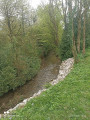
A pleasant walk through the Arrageois plain and the Bois Gauchin, passing through the villages of Caucourt, Béthonval and Mingoval.
Le Chemin de la Vertu bleue au départ d'Hermaville
7.22 mi
+167 ft
-180 ft
3h 30
Moderate
Departure from Hermaville (Pas-de-Calais)
Belle randonnée à faire en famille ou autres, tantôt en sous-bois ou en plaine. Il est possible que vous voyez les cultures bleues dû à la nature du sol selon la météo.
Along the young Scarpe from Frévin-Capelle to Aubigny-en-Artois
 5.12 mi
+92 ft
-85 ft
2h 25
5.12 mi
+92 ft
-85 ft
2h 25
 Easy
Departure from Frévin-Capelle (Pas-de-Calais)
Easy
Departure from Frévin-Capelle (Pas-de-Calais)
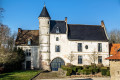
During this walk of just over 8 km, you’ll walk in the shade alongside the Scarpe, which is still narrow here, and pass through three pretty villages with their white-stone farms and churches. You’ll also find a local pub, La Belle Époque, open every lunchtime except Tuesdays, opposite the town hall in Frévin-Capelle.
From the arboretum to the castle
 6.58 mi
+144 ft
-141 ft
3h 10
Moderate
Departure from Cambligneul (Pas-de-Calais)
6.58 mi
+144 ft
-141 ft
3h 10
Moderate
Departure from Cambligneul (Pas-de-Calais)
This hike in the Artois plain will take you along good paths to Villers-Châtel and its castle, park and cave, where you can enjoy the surrounding landscapes, biodiversity and heritage.
Around Les Quatre Vents in Cambligneul
 6.97 mi
+213 ft
-200 ft
3h 25
Moderate
Departure from Cambligneul (Pas-de-Calais)
6.97 mi
+213 ft
-200 ft
3h 25
Moderate
Departure from Cambligneul (Pas-de-Calais)
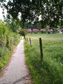
A short walk along good paths and (unfortunately) a few stretches of quiet country roads.
There is little elevation gain and, for enthusiasts, a few fine buildings to see.
La Renarde à Camblain-l'Abbé
 7.34 mi
+335 ft
-331 ft
3h 40
Moderate
Departure from Camblain-l'Abbé (Pas-de-Calais)
7.34 mi
+335 ft
-331 ft
3h 40
Moderate
Departure from Camblain-l'Abbé (Pas-de-Calais)
Randonnée dans l'Artois autour de Villers-au-Bois. Elle vous fera découvrir notre belle région.
Les quatre vents à Camblain-l'Abbé
 7.00 mi
+197 ft
-167 ft
3h 25
Moderate
Departure from Camblain-l'Abbé (Pas-de-Calais)
7.00 mi
+197 ft
-167 ft
3h 25
Moderate
Departure from Camblain-l'Abbé (Pas-de-Calais)
Cette randonnée vous amènera dans la plaine de l'Artois en passant par les villages de Maisnil et Cambligneul.
Les guernoules depuis Camblain-l'Abbé
6.99 mi
+246 ft
-243 ft
3h 25
Moderate
Departure from Camblain-l'Abbé (Pas-de-Calais)
Circuit agréable pour découvrir les villages de l'Artois
La petite renarde à Camblain-l'Abbé
4.93 mi
+217 ft
-207 ft
2h 25
Easy
Departure from Camblain-l'Abbé (Pas-de-Calais)
Agréable randonnée qui vous amène dans les bois de Camblain-l'Abbé et Villers-au-Bois avec des passage en plaine où vous pouvez rencontrer la faune sauvage.
Autour du bois d'Habarcq
 7.27 mi
+190 ft
-213 ft
3h 30
Moderate
Departure from Haute-Avesnes (Pas-de-Calais)
7.27 mi
+190 ft
-213 ft
3h 30
Moderate
Departure from Haute-Avesnes (Pas-de-Calais)
Du porche majestueux de l'ancienne ferme principale de la commanderie des templiers jusqu'à l'église de Hermaville au clocher-tour imposant, édifiée en 1782 et classée "monument historique", une randonnée à travers champs, bosquets et bois sur des chemins en bon état. Cette randonnée emprunte par endroit la randonnée "Sentier des Templiers" éditée par l'Office du Tourisme des"Campagnes de l'Artois".
La vallée de la Scarpe depuis Acq
 6.85 mi
+197 ft
-197 ft
3h 20
Moderate
Departure from Acq (Pas-de-Calais)
6.85 mi
+197 ft
-197 ft
3h 20
Moderate
Departure from Acq (Pas-de-Calais)
Cette randonnée vous emmène dans la plaine de l'Artois et la vallée de la Scarpe.
Discover the splendours of Mont Saint-Éloi, Écoivres & Acq
 5.63 mi
+236 ft
-243 ft
2h 50
Easy
Departure from Acq (Pas-de-Calais)
5.63 mi
+236 ft
-243 ft
2h 50
Easy
Departure from Acq (Pas-de-Calais)
This walk is loosely based on the "Sentier des Pierres du Diable" (Devil's Stone Trail), but allows you to discover, alongside the famous Devil's Stones, the magnificent Mont-Éloi Abbey, the Écoivres war cemetery, the churches of Écoivres, Acq and Mont Saint-Éloi, and the Acq mill.
Trail towards Caucourt Ford
 8.45 mi
+512 ft
-509 ft
4h 20
Moderate
Departure from Caucourt (Pas-de-Calais)
8.45 mi
+512 ft
-509 ft
4h 20
Moderate
Departure from Caucourt (Pas-de-Calais)
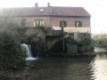
Caucourt is a small village near Olhain.From the church, you cross pleasant plains and villages, especially on sunny days.Avoid this route in very hot weather, as it is not much shade; in rain or fog, the view won't be as good!...
In the direction of the trail, you'll save the best until last, the Gué de Caucourt and its mill.
Around the village of Villers-au-Bois
 6.65 mi
+213 ft
-233 ft
3h 15
Moderate
Departure from Villers-au-Bois (Pas-de-Calais)
6.65 mi
+213 ft
-233 ft
3h 15
Moderate
Departure from Villers-au-Bois (Pas-de-Calais)
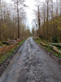
This hike will take you through woods and plains, passing through the Bois Poret. You will then pass the British cemetery and the old train station before crossing the Bois des Baudets. Here you may encounter some beautiful wildlife.
Au Nord-Ouest de Villers-au-Bois
6.37 mi
+190 ft
-213 ft
3h 05
Easy
Departure from Villers-au-Bois (Pas-de-Calais)
This is a short route with little elevation gain, mainly on paths and trails.A big advantage in hot weather is that the start is in the open, but the end of the route is very shady.
The Chartiaux from Villers-au-Bois
 6.71 mi
+200 ft
-203 ft
3h 15
Moderate
Departure from Villers-au-Bois (Pas-de-Calais)
6.71 mi
+200 ft
-203 ft
3h 15
Moderate
Departure from Villers-au-Bois (Pas-de-Calais)
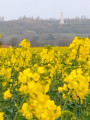
A lovely walk through the Bois de la Loterie and Bois d’Ecoivres. Ascent of Mont Saint-Éloi, returning via the Artois countryside.
The donkeys
 7.64 mi
+266 ft
-269 ft
3h 45
Moderate
Departure from Villers-au-Bois (Pas-de-Calais)
7.64 mi
+266 ft
-269 ft
3h 45
Moderate
Departure from Villers-au-Bois (Pas-de-Calais)
This walk will introduce you to this charming village in Artois and its surroundings. Following good paths across the plains and through the woods, you will reach the entrance to Mont Saint-Éloi, with a view of the old abbey.
Le rideau du diable de Gouves
 7.32 mi
+253 ft
-233 ft
3h 35
Moderate
Departure from Gouves (Pas-de-Calais)
7.32 mi
+253 ft
-233 ft
3h 35
Moderate
Departure from Gouves (Pas-de-Calais)
A lovely walk exploring the villages of Wanquetin and Montenescourt, with a stretch through the Habarcq valley.
Les deux abbayes depuis Mont-Saint-Éloi
 7.56 mi
+167 ft
-180 ft
3h 35
Moderate
Departure from Mont-Saint-Éloi (Pas-de-Calais)
7.56 mi
+167 ft
-180 ft
3h 35
Moderate
Departure from Mont-Saint-Éloi (Pas-de-Calais)
De la plaine de l'Artois au marais de Maroeuil par la traversée du bois, cette randonnée vous fera prendre un bol d'air.
Les Droites Pierres via Mont-Saint-Éloi
 7.99 mi
+295 ft
-289 ft
3h 55
Moderate
Departure from Mont-Saint-Éloi (Pas-de-Calais)
7.99 mi
+295 ft
-289 ft
3h 55
Moderate
Departure from Mont-Saint-Éloi (Pas-de-Calais)
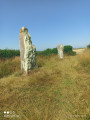
This walk starts in Écoivres, a hamlet in Mont-Saint-Éloi, and takes you through the surrounding villages. Don't forget to visit the Droites Pierres (Straight Stones), or Pierres du Diable (Devil's Stones) according to legend, and climb up to the old abbey.
Noyelle-Vion: in the footsteps of the Gauls
13.40 mi
+266 ft
-276 ft
6h 20
 Difficult
Departure from Noyelle-Vion (Pas-de-Calais)
Difficult
Departure from Noyelle-Vion (Pas-de-Calais)
This is a long route on good paths, which means it can be enjoyed in all seasons.There are a few sections on roads, but apart from the D68 near Avesnes, they are not very busy.The icing on the cake is the crossing of Avesnes-le-Comte via Les Voyettes.
On the Plateau des Atrébates, starting from Frévillers
14.91 mi
+531 ft
-545 ft
7h 20
Difficult
Departure from Frévillers (Pas-de-Calais)
This is a long route without any major difficulties, apart from the distance. It follows a succession of wide paths and small roads, making it safe to walk even in wet weather. It is therefore ideal from October onwards.
Circular Alouettes loop starting from Servins
 6.84 mi
+213 ft
-210 ft
3h 20
Moderate
Departure from Servins (Pas-de-Calais)
6.84 mi
+213 ft
-210 ft
3h 20
Moderate
Departure from Servins (Pas-de-Calais)
The ideal time to visit this variant of Les Alouettes, with its beautiful vegetable gardens, magnificent hydrangea beds and a farmyard with a majestic and somewhat pretentious royal turkey.
Les antennes de Bouvigny
7.55 mi
+135 ft
-141 ft
3h 35
Moderate
Departure from Servins (Pas-de-Calais)
Une autre façon de voir la communauté de Lens-Lievin avec des vues depuis le plateau sur les Monts des Flandres, les terrils de Loos-en-Gohelle etc...
Les alouettes via Estrée-Cauchy
 6.77 mi
+226 ft
-223 ft
3h 20
Moderate
Departure from Servins (Pas-de-Calais)
6.77 mi
+226 ft
-223 ft
3h 20
Moderate
Departure from Servins (Pas-de-Calais)
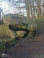
Venez prendre un bol d'air en passant par les villages de Servins, Estrée-Cauchy et Fresnicourt-le-Dolmen.
Circular loop around the Servins mast
7.21 mi
+279 ft
-279 ft
3h 35
Moderate
Departure from Servins (Pas-de-Calais)
A lovely walk starting from Servins, passing through Bouvigny-Boyeffles, Hersin-Coupigny and Verdrel. You’ll walk along stony, grassy paths and a few roads. You’ll enjoy several views of the surrounding countryside.
Circular loop via the Bouvigny mast
5.19 mi
+295 ft
-305 ft
2h 40
Easy
Departure from Servins (Pas-de-Calais)
A lovely circular route through the countryside of Servins, Bouvigny-Boyeffles and Hersin-Coupigny, featuring lovely views and a passage beneath the large antenna. The route follows paths and a short stretch of road.
Short circular loop: Servins – Gouy-Servins
3.24 mi
+72 ft
-72 ft
1h 35
Easy
Departure from Servins (Pas-de-Calais)
Ideal for a family walk, this route passes through the villages of Servins and Gouy-Servins. You’ll walk along grassy and stony paths, as well as tarmac roads. You’ll catch sight of the Bouvigny-Boyeffles mast and enjoy lovely views of the surrounding countryside.
Around Olhain
14.24 mi
+1,083 ft
-1,079 ft
7h 30
Difficult
Departure from Gauchin-Légal (Pas-de-Calais)
A long route with significant elevation gain and some fairly difficult paths.The path between (3) and (4) is very difficult but can be avoided. It was passable in late September 2025 (dry season).There are a few road crossings, but with very little traffic.
La Pierre du Diable depuis Gauchin-Légal
 9.24 mi
+413 ft
-400 ft
4h 35
Moderate
Departure from Gauchin-Légal (Pas-de-Calais)
9.24 mi
+413 ft
-400 ft
4h 35
Moderate
Departure from Gauchin-Légal (Pas-de-Calais)
Au départ, voir la pierre qui, selon la légende, déambulait la nuit et donnait des sueurs froides aux maris trompés et aux femmes infidèles. N'ayez plus peur, elle est solidement accrochée. Puis vous passerez au gué de Caucourt et son moulin.
The Caucourt Ford
 6.75 mi
+240 ft
-226 ft
3h 20
Moderate
Departure from Gauchin-Légal (Pas-de-Calais)
6.75 mi
+240 ft
-226 ft
3h 20
Moderate
Departure from Gauchin-Légal (Pas-de-Calais)
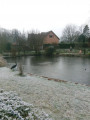
A short route, on paths that are more or less paved, pleasant in all seasons (except during very wet periods) with a passage at the Gué de Caucourt.
1- Hermin Town Hall advises against using the path between points (11) and (12) until the end of 2025. It is now April 2026 and nothing has changed: no works are underway and there are barriers on both sides. I have just walked along it and it is perfectly passable, though still treacherous.
La Cauchy depuis Gauchin-Légal
 7.54 mi
+256 ft
-256 ft
3h 40
Moderate
Departure from Gauchin-Légal (Pas-de-Calais)
7.54 mi
+256 ft
-256 ft
3h 40
Moderate
Departure from Gauchin-Légal (Pas-de-Calais)
Belle randonnée dans la plaine de l'Artois en passant par le gué de Caucourt.
Circuit de Baraffles à Gauchin-Légal
7.64 mi
+433 ft
-417 ft
3h 55
Moderate
Departure from Gauchin-Légal (Pas-de-Calais)
Belle randonnée à travers le Bois d'Olhain, son parc départemental et les villages aux alentours. Belles églises et beaux châteaux au programme.
Woods and hills at Gouy-Servins
15.03 mi
+594 ft
-617 ft
7h 25
Difficult
Departure from Gouy-Servins (Pas-de-Calais)
A long route through the hills of Pas-de-Calais, with 7 to 8 km through woodland (Bois de Mont and Bois de Mont-Saint-Éloi). The route has been designed using sections of marked trails to minimise the amount of tarmac. This is a fairly difficult hike, particularly in wet weather.
La guérisseuse depuis Gouy-Servins
4.69 mi
+177 ft
-177 ft
2h 20
Easy
Departure from Gouy-Servins (Pas-de-Calais)
Petite randonnée, dans le Bois de Mont et le Bois de Marqueffles, en passant par l'oratoire et la tombe d'Arsène Lemaire qui soignait les maladies de peau, et les enfants atteints de la méningite. Elle est enterrée là, suite à sa demande, alors qu'elle a guéri un juge. Sa fille et son petit-fils avaient les mêmes pouvoirs. Je remercie son arrière-petite-fille pour ses informations.
Les têtes d'halaux depuis Servins
 8.03 mi
+269 ft
-292 ft
3h 55
Moderate
Departure from Servins (Pas-de-Calais)
8.03 mi
+269 ft
-292 ft
3h 55
Moderate
Departure from Servins (Pas-de-Calais)
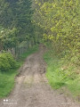
Cette randonnée, dans la plaine de l'Artois, vous verra passer par Bouvignie-Boyeffles, avant de remonter vers Verdrel, pour revenir sur Servins
Le Bois de Mont
 12.15 mi
+709 ft
-732 ft
6h 10
Difficult
Departure from Servins (Pas-de-Calais)
12.15 mi
+709 ft
-732 ft
6h 10
Difficult
Departure from Servins (Pas-de-Calais)
A very green route in the Artois hills, with two beautiful climbs and a minimum of roads.
This route, which is already difficult, becomes very difficult in wet weather. I walked it on 25/02/2026 and some of the paths were barely passable.
Écoivres via the Bois de Marœuil
 4.50 mi
+213 ft
-210 ft
2h 15
Easy
Departure from Marœuil (Pas-de-Calais)
4.50 mi
+213 ft
-210 ft
2h 15
Easy
Departure from Marœuil (Pas-de-Calais)
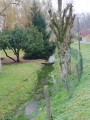
This hike, starting from the Bois de Marœuil, will take you to the hamlet of Bray et Écoivres, along very good paths and through the Franco-British cemetery. The return journey is via the Bois de Marœuil.
Le Bois de Bray et les marais
 6.44 mi
+200 ft
-197 ft
3h 10
Moderate
Departure from Marœuil (Pas-de-Calais)
6.44 mi
+200 ft
-197 ft
3h 10
Moderate
Departure from Marœuil (Pas-de-Calais)
Cette randonnée vous mèneras à travers bois et marais en passant par les village et hameau de Bray, Étrun et Maroeuil.
Le Pont de Gy depuis Duisans
 6.91 mi
+108 ft
-102 ft
3h 15
Moderate
Departure from Duisans (Pas-de-Calais)
6.91 mi
+108 ft
-102 ft
3h 15
Moderate
Departure from Duisans (Pas-de-Calais)
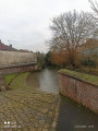
Randonnée, sans difficulté, entre campagne, marais et rivières.
The Table des Fées as seen from Fresnicourt-le-Dolmen
 7.27 mi
+482 ft
-489 ft
3h 45
Moderate
Departure from Fresnicourt-le-Dolmen (Pas-de-Calais)
7.27 mi
+482 ft
-489 ft
3h 45
Moderate
Departure from Fresnicourt-le-Dolmen (Pas-de-Calais)
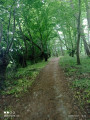
A walk running alongside the golf course, through the Olhain Forest and past the Table des Fées dolmen.
Circular walk around Olhain Park starting from Olhain Castle
 3.62 mi
+305 ft
-322 ft
1h 55
Easy
Departure from Fresnicourt-le-Dolmen (Pas-de-Calais)
3.62 mi
+305 ft
-322 ft
1h 55
Easy
Departure from Fresnicourt-le-Dolmen (Pas-de-Calais)
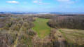
From the car park, you’ll find yourself facing Olhain Castle, one of the most beautiful in the region. The rest of the walk alternates between stunning views and short stretches through the undergrowth (not too dense) before reaching the ‘esplanade’ of Olhain Park. You’ll find yourself facing an exceptional panorama.
If you’re lucky, you might see paragliders taking off (admittedly, this is quite rare), and why not visit during the hot-air balloon festival to watch these huge, colourful balloons take off right before your eyes.
Circular walk through the woods of Parc d'Olhain from Verdrel.
 4.76 mi
+328 ft
-331 ft
2h 30
Moderate
Departure from Fresnicourt-le-Dolmen (Pas-de-Calais)
4.76 mi
+328 ft
-331 ft
2h 30
Moderate
Departure from Fresnicourt-le-Dolmen (Pas-de-Calais)
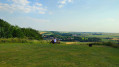
A superb little walk to do in good weather. Ideal in hot weather, this walk offers both the comfort of the forest and beautiful views, as most of the path to Parc d'Olhain runs along the edge of the forest. Views and coolness, what a joy.
Through the Olhain National Forest around Fresnicourt-le-Dolmen
 7.88 mi
+614 ft
-607 ft
4h 10
Moderate
Departure from Fresnicourt-le-Dolmen (Pas-de-Calais)
7.88 mi
+614 ft
-607 ft
4h 10
Moderate
Departure from Fresnicourt-le-Dolmen (Pas-de-Calais)
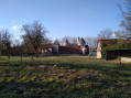
Walk around Fresnicourt le DolmenStarting from Olhain Castle and heading towards the ‘Table aux Fées’ dolmen, you’ll pass two sandstone crosses dating from the 13th and 16th centuries, then the hamlet of Verdrel and the Olhain State Forest with its leisure centre, before returning through the forest. Superb views over the plain and its villages.It’s best to do this walk in dry weather, as the paths can be difficult when wet.
Through the woodland on the hills above Ablin-Saint-Nazaire
 3.90 mi
+243 ft
-246 ft
2h 00
Easy
Departure from Ablain-Saint-Nazaire (Pas-de-Calais)
3.90 mi
+243 ft
-246 ft
2h 00
Easy
Departure from Ablain-Saint-Nazaire (Pas-de-Calais)
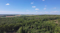
A lovely little walk to enjoy when it’s very hot, as it’s largely shaded but not excessively so. The woodland is magnificent and the place exudes a sense of tranquillity. It’s a little hilly, but again, not excessively so.
However, I wouldn’t recommend doing it during wet weather, as theGR®127can get very muddy.
From Carency to Mont-Saint-Éloi via the Bois Poret
 13.80 mi
+843 ft
-837 ft
6h 00
Moderate
Departure from Carency (Pas-de-Calais)
13.80 mi
+843 ft
-837 ft
6h 00
Moderate
Departure from Carency (Pas-de-Calais)
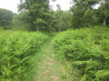
A fairly standard route around Mont-Saint-Éloi (the area is very well signposted), but with three less-travelled sections leading to Villers-au-Bois
It’s a bit winding (’not very logical’, as one of my friends always says), but it allows you to take a few less-travelled paths.
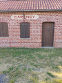
Claudine’s walk from Carency
 4.47 mi
+276 ft
-262 ft
2h 20
Easy
Departure from Carency (Pas-de-Calais)
4.47 mi
+276 ft
-262 ft
2h 20
Easy
Departure from Carency (Pas-de-Calais)
This walk, starting from the old Carency railway station, will take you through the surrounding countryside along good paths, with views of Notre-Dame de Lorette and Mont Saint-Éloi, not to mention the Anneau de la Mémoire.
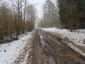
Les deux gares depuis Carency
 6.83 mi
+184 ft
-184 ft
3h 20
Moderate
Departure from Carency (Pas-de-Calais)
6.83 mi
+184 ft
-184 ft
3h 20
Moderate
Departure from Carency (Pas-de-Calais)
This walk takes you through the countryside around Carency and Villers-au-Bois, and along the old narrow-gauge railway line (the railway line linking Lens to Frévent).
After the Battle of the Somme
7.32 mi
+253 ft
-230 ft
3h 35
Moderate
Departure from Carency (Pas-de-Calais)
An easy route offering fine views of the memorial sites of the Battle of the Somme during the First World War: Lorette, Mont-Saint-Éloi, Vimy and the ruined church at Ablain.
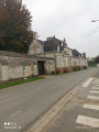
The three castles from Hauteville
 6.08 mi
+187 ft
-187 ft
3h 00
Easy
Departure from Hauteville (Pas-de-Calais) (Pas-de-Calais)
6.08 mi
+187 ft
-187 ft
3h 00
Easy
Departure from Hauteville (Pas-de-Calais) (Pas-de-Calais)
This hike between plains and woods will take you to Barly Castle. Listed as a historic monument, it was built in 1780 by the Blin family. It is open to visitors today. You will also see Fosseux Castle, which was built in 1770 by Parisian architect Villetard at the request of Ferdinand Dubois de Hoves de Fosseux.
The Carency rollercoaster
4.99 mi
+177 ft
-167 ft
2h 25
Easy
Departure from Carency (Pas-de-Calais)
This walk, starting from Carency, is not particularly difficult and will take you through Villers-au-Bois, between the plain and the woods. Carency was a seigneury until around 1620, then became a barony until 1665, before becoming a marquisate.
Les dorés musis depuis Carency
 6.67 mi
+289 ft
-272 ft
3h 20
Moderate
Departure from Carency (Pas-de-Calais)
6.67 mi
+289 ft
-272 ft
3h 20
Moderate
Departure from Carency (Pas-de-Calais)
De Carency à Ablain-Saint-Nazaire en passant dans la plaine et les bords de la Souchez, avec quelques beaux raidillons
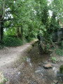
Boucle par Ablain-Saint-Nazaire depuis Carency
 6.66 mi
+289 ft
-262 ft
3h 20
Moderate
Departure from Carency (Pas-de-Calais)
6.66 mi
+289 ft
-262 ft
3h 20
Moderate
Departure from Carency (Pas-de-Calais)
Belle randonnée avec vue sur Notre-Dame-de-Lorette et le Mont Saint-Éloi
Du Bois l'Abbé au Bois de Piéton depuis Carency
 7.58 mi
+394 ft
-394 ft
3h 50
Moderate
Departure from Carency (Pas-de-Calais)
7.58 mi
+394 ft
-394 ft
3h 50
Moderate
Departure from Carency (Pas-de-Calais)
Cette randonnée en forme de huit vous verra passer sur de très bons chemins en passant sous le site de Notre-Dame-de-Lorette et en lisière du Bois l'Abbé.
The upper woodlands of Bouvigny-Boyeffles as seen from the tall mast
 4.59 mi
+131 ft
-131 ft
2h 15
Easy
Departure from Bouvigny-Boyeffles (Pas-de-Calais)
4.59 mi
+131 ft
-131 ft
2h 15
Easy
Departure from Bouvigny-Boyeffles (Pas-de-Calais)
Why ‘the upper undergrowth’? Because this walk takes place along the ridge of Notre Dame de Lorette (without actually going all the way there). The walk starts at the Bouvigny-Boyeffles TV transmission mast, the third-tallest structure in France at 305 metres. The view of it alone is an attraction in itself, as you’ll be parked about fifteen metres from the base – it’s quite dizzying. Even the first few metres offer a panoramic view of the mining basin.
The Lime Tree Avenue in Lignereuil
 18.41 mi
+505 ft
-486 ft
7 hrs
18.41 mi
+505 ft
-486 ft
7 hrs
 Very difficult
Departure from Avesnes-le-Comte (Pas-de-Calais)
Very difficult
Departure from Avesnes-le-Comte (Pas-de-Calais)
After starting on the Avesnes footpaths, we follow the GRP® de l'Artois, then the GR®121 for a long and varied loop.Wide paths across agricultural plains, trails along woods and finally the Allée des Tilleuls in Lignereuil.
All dotted with a few châteaux.
It's enough to make for a good day out, especially as the paths are generally in very good condition, even in wet weather.
The sources of the Lawe
 4.67 mi
+253 ft
-269 ft
2h 20
Easy
Departure from Magnicourt-en-Comte (Pas-de-Calais)
4.67 mi
+253 ft
-269 ft
2h 20
Easy
Departure from Magnicourt-en-Comte (Pas-de-Calais)
The Lawe is a river that rises in Rocourt-en-l’Eau, a hamlet of Magnicourt-en-Comté.
This short walk of around 7.5 km is perfect for families and their canine companions.
You’ll discover the village of Magnicourt-en-Comté, its12th-century church, its wooded surroundings and its paths.
There are a few hills but nothing insurmountable.
Mont de La Comté
8.25 mi
+535 ft
-535 ft
4h 15
Moderate
Departure from Magnicourt-en-Comte (Pas-de-Calais)
This hike takes you to Mont de La Comté, where the view is well worth seeing. You may be lucky enough to spot some roe deer on the edge of the surrounding woods.
You will pass through the pretty village of La Comté with its waterfall, old mill and beautiful church.
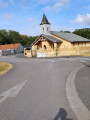
Route du Bois in the Olhain Forest
 6.22 mi
+400 ft
-404 ft
3h 15
Moderate
Departure from Fresnicourt-le-Dolmen (Pas-de-Calais)
6.22 mi
+400 ft
-404 ft
3h 15
Moderate
Departure from Fresnicourt-le-Dolmen (Pas-de-Calais)
This walk through the Olhain State Forest takes you along good paths, which can be a bit muddy in winter. You can visit the arboretum right next to the starting car park and pop into Verdrel for a quick look.
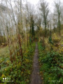
La véranda depuis Bouvigny-Boyeffles
 6.60 mi
+400 ft
-384 ft
3h 25
Moderate
Departure from Bouvigny-Boyeffles (Pas-de-Calais)
6.60 mi
+400 ft
-384 ft
3h 25
Moderate
Departure from Bouvigny-Boyeffles (Pas-de-Calais)
Randonnée qui va vous emmener sur les hauteurs de Bouvigny à travers bois et plaine. Faites un arret à l'oratoire entre le point 4 et 5
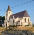
Le Bois de Mont (short version)
 6.15 mi
+512 ft
-505 ft
3h 15
Moderate
Departure from Bouvigny-Boyeffles (Pas-de-Calais)
6.15 mi
+512 ft
-505 ft
3h 15
Moderate
Departure from Bouvigny-Boyeffles (Pas-de-Calais)
Lots of paths, a beautiful crossing of the Bois (with decent tracks) and a beautiful view as you reach the plateau (but frequent fog in autumn).
2021: I've gone back to the original route, which is more pleasant.
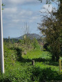
The upper reaches of Coupigny
 4.94 mi
+223 ft
-246 ft
2h 30
Easy
Departure from Hersin-Coupigny (Pas-de-Calais)
4.94 mi
+223 ft
-246 ft
2h 30
Easy
Departure from Hersin-Coupigny (Pas-de-Calais)
At the start, a short walk around the ponds is a must. The walk then descends towards Hersin, passing the town hall and its green walls. You then need to cross the park before reaching the Coron Béclet. After that, head back up towards the ponds. The route follows paths and a short stretch of tarmac.
The Motte de Notre-Dame de Lorette trail
 5.28 mi
+325 ft
-318 ft
2h 45
Easy
Departure from Bouvigny-Boyeffles (Pas-de-Calais)
5.28 mi
+325 ft
-318 ft
2h 45
Easy
Departure from Bouvigny-Boyeffles (Pas-de-Calais)
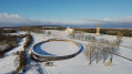
A very beautiful walk starting from Marqueffles, in the commune of Bouvigny-Boyeffles, leading to Notre-Dame de Lorette.
Along the way, you’ll enjoy two superb panoramic views: one towards the ruins of Mont Saint-Éloi, and on the other side, the mining basin will unfold before you. A few forest paths and magnificent trees will line your route.
Around Cuvigny
 6.79 mi
+354 ft
-384 ft
3h 25
Moderate
Departure from Rebreuve-Ranchicourt (Pas-de-Calais)
6.79 mi
+354 ft
-384 ft
3h 25
Moderate
Departure from Rebreuve-Ranchicourt (Pas-de-Calais)
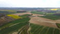
A short walk on good paths in the hills above La Comté. On a clear day, the panorama is superb, and if you're luckier than me, you'll spot a few deer.
Le château depuis Rebreuve-Ranchicourt
 7.69 mi
+433 ft
-446 ft
3h 55
Moderate
Departure from Rebreuve-Ranchicourt (Pas-de-Calais)
7.69 mi
+433 ft
-446 ft
3h 55
Moderate
Departure from Rebreuve-Ranchicourt (Pas-de-Calais)
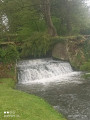
Cette randonnée vous permettra de découvrir de jolis paysages et, sur le retour, le Château de Ranchicourt
Sentier du bout du monde (End of the World Trail) from Warlus
 7.18 mi
+236 ft
-233 ft
3h 30
Moderate
Departure from Warlus (Pas-de-Calais)
7.18 mi
+236 ft
-233 ft
3h 30
Moderate
Departure from Warlus (Pas-de-Calais)
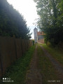
An easy hike on beautiful paths that will take you through Simencourt and Berneville. Warlus was the seat of a seigneury before the revolution. This hike in the plains, with a few wooded sections, is ideal for families.
GR® et PR® du parc à Mesnil-lès-Ruitz
6.82 mi
+679 ft
-682 ft
3h 45
Moderate
Departure from Maisnil-lès-Ruitz (Pas-de-Calais)
Très belle randonnée dans le parc, en sous-bois et avec une belle vue sur le golf et le château.
La source de la Lawe
 13.99 mi
+741 ft
-755 ft
7h 05
Difficult
Departure from La Comté (Pas-de-Calais)
13.99 mi
+741 ft
-755 ft
7h 05
Difficult
Departure from La Comté (Pas-de-Calais)
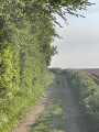
Randonnée au départ de La Comté qui nous mène près de la source de la Lawe.
Paysage très agréable et quelques vallonnements.
The wolf trail from Lignereuil
6.91 mi
+138 ft
-141 ft
3h 20
Moderate
Departure from Lignereuil (Pas-de-Calais)
This hike in Artois will take you through beautiful villages between plains and woodlands on good quality paths, returning via the 1,350-metre-long Allée des Tilleuls, lined with 898 hundred-year-old trees planted in 1745 by Louis Benoit de Hamel, and Lignereuil Castle.
La hersinoise depuis Hersin-Coupigny
 7.17 mi
+367 ft
-367 ft
3h 35
Moderate
Departure from Hersin-Coupigny (Pas-de-Calais)
7.17 mi
+367 ft
-367 ft
3h 35
Moderate
Departure from Hersin-Coupigny (Pas-de-Calais)
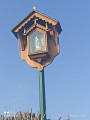
Un peu d'histoire. Coupigny provient d'une grande famille de noble de l'Artois, de Saint-Martin-en-Artois, et deviendras Hersin-Coupigny.
Une habitante de Hersin-Coupigny fut une rescapée du Titanic.
Le Val de Loisnes via Le Blanc-Mont
4.84 mi
+105 ft
-105 ft
2h 20
Easy
Departure from Hersin-Coupigny (Pas-de-Calais)
This hike starting from Parc Germinal will take you along the old cavaliers (railway tracks from the mining era), passing through the hamlet of Blanc Mont. You will walk along the Loisnes before returning to Hersin to cross the public garden and the slag heap.
The Hersin ponds
 6.48 mi
+328 ft
-341 ft
3h 15
Moderate
Departure from Hersin-Coupigny (Pas-de-Calais)
6.48 mi
+328 ft
-341 ft
3h 15
Moderate
Departure from Hersin-Coupigny (Pas-de-Calais)
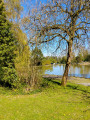
This local hike will take you up to the heights of Coupigny, then past the Étangs des Claires Fontaines, the Corons Beclet and, of course, the slag heap. The hike is on good paths and offers beautiful biodiversity.
From Hersin via Bracquencourt
7.49 mi
+420 ft
-427 ft
3h 50
Moderate
Departure from Hersin-Coupigny (Pas-de-Calais)
This hike takes you along good paths through Verdrel, Bracquencourt and Barlin's Cité n°9, without any major difficulties.A bit of history: Coupigny gave its name to a large noble family from Artois. Its official name appeared in 1801.
The tour of the trinquettes in Hersin-Coupigny
 1.96 mi
+148 ft
-148 ft
1h 00
Easy
Departure from Hersin-Coupigny (Pas-de-Calais)
1.96 mi
+148 ft
-148 ft
1h 00
Easy
Departure from Hersin-Coupigny (Pas-de-Calais)
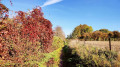
A short, very picturesque walk in the countryside south of Hersin-Coupigny. Amidst fields, meadows and gardens, you can admire the countryside of the mining basin.
The source of the Lawe from Bajus
 7.83 mi
+341 ft
-325 ft
3h 55
Moderate
Departure from Bajus (Pas-de-Calais)
7.83 mi
+341 ft
-325 ft
3h 55
Moderate
Departure from Bajus (Pas-de-Calais)
This hike will take you from the plains to the woods via Thieuloye and Rocourt en l'Eau, where the Lawe river has its source. Bajus was a village where French troops rested before going to the front during the First World War
The horsetails of Bajus
 9.95 mi
+453 ft
-446 ft
5h 00
Moderate
Departure from Bajus (Pas-de-Calais)
9.95 mi
+453 ft
-446 ft
5h 00
Moderate
Departure from Bajus (Pas-de-Calais)
A walk between Ternois and Artois, taking you past the villages of La Thieuloye, Dieval, Ourton, Beugin and La Comté. You’ll be walking mainly on paths, some of which may be muddy in wet weather.
On the Hazois plateau, you can enjoy a lovely 360° view in fine weather.
Les presles de Bajus
 8.13 mi
+394 ft
-364 ft
4h 05
Moderate
Departure from Bajus (Pas-de-Calais)
8.13 mi
+394 ft
-364 ft
4h 05
Moderate
Departure from Bajus (Pas-de-Calais)
Très belle randonnée un peu vallonnée pour découvrir la région.
Let’s go for a walk in the Maisnil-lès-Ruitz woods
 12.47 mi
+1,089 ft
-1,099 ft
7h 05
Difficult
Departure from Maisnil-lès-Ruitz (Pas-de-Calais)
12.47 mi
+1,089 ft
-1,099 ft
7h 05
Difficult
Departure from Maisnil-lès-Ruitz (Pas-de-Calais)
A long route that winds through the Bois d’Olhain. A difficult route, and even very difficult in wet weather.As with all routes through woodland, the route description isn’t very clear, so I recommend using the app.
The upper Lawe valley
 7.39 mi
+453 ft
-433 ft
3h 50
Moderate
Departure from Beugin (Pas-de-Calais)
7.39 mi
+453 ft
-433 ft
3h 50
Moderate
Departure from Beugin (Pas-de-Calais)
A very pleasant trail, between river, forest and valleys.
Le hazois à Beugin
 7.84 mi
+469 ft
-469 ft
4h 00
Moderate
Departure from Beugin (Pas-de-Calais)
7.84 mi
+469 ft
-469 ft
4h 00
Moderate
Departure from Beugin (Pas-de-Calais)
Très belle randonnée en plaine, bois, et rivière qui vous fera passer par Dieval
La Folie Comté depuis Beugin
 6.32 mi
+135 ft
-135 ft
3h 00
Moderate
Departure from Beugin (Pas-de-Calais)
6.32 mi
+135 ft
-135 ft
3h 00
Moderate
Departure from Beugin (Pas-de-Calais)
Entre bois et rivière, cette jolie randonnée vous fera passer par le village de la Comté avec sa cascade et son moulin.
Le château d'eau à Aix-Noulette
 7.60 mi
+299 ft
-299 ft
3h 45
Moderate
Departure from Aix-Noulette (Pas-de-Calais)
7.60 mi
+299 ft
-299 ft
3h 45
Moderate
Departure from Aix-Noulette (Pas-de-Calais)
Randonnée variée autour Aix-Noulette et au pied de Notre-Dame-de-Lorette.
La motte depuis Aix-Noulette
 7.06 mi
+400 ft
-400 ft
3h 35
Moderate
Departure from Aix-Noulette (Pas-de-Calais)
7.06 mi
+400 ft
-400 ft
3h 35
Moderate
Departure from Aix-Noulette (Pas-de-Calais)
Très jolie randonnée en passant par le site de Notre-Dame-de-Lorette et le Bois de Marqueffles.
Val de Loisne from Hersin-Coupigny
 6.99 mi
+171 ft
-167 ft
3h 20
Moderate
Departure from Hersin-Coupigny (Pas-de-Calais)
6.99 mi
+171 ft
-167 ft
3h 20
Moderate
Departure from Hersin-Coupigny (Pas-de-Calais)
This hike will allow you to discover another side of Hersin-Coupigny, passing through Nœux-les-Mines, Coron number 3 and the Ferme du Blanc-Mont, not to mention the Loisne and all the biodiversity in the surrounding area.
Les boucles d'Hersin
 7.97 mi
+174 ft
-197 ft
3h 50
Moderate
Departure from Hersin-Coupigny (Pas-de-Calais)
7.97 mi
+174 ft
-197 ft
3h 50
Moderate
Departure from Hersin-Coupigny (Pas-de-Calais)
Randonnée sans difficulté, entre ville et campagne, sans oublier le terril.
The woods around Notre-Dame de Lorette from Aix-Noulette
7.68 mi
+545 ft
-515 ft
4h 00
Moderate
Departure from Aix-Noulette (Pas-de-Calais)
This walk, starting from the community hall next to the town hall, alternates between town and woodland with a lovely climb and a descent that is well worth the detour but should be avoided after heavy rain.
The Bois de Noulette
5.04 mi
+226 ft
-217 ft
2h 30
Easy
Departure from Aix-Noulette (Pas-de-Calais)
A short walk that takes you past some of Aix-Noulette’s little lanes and through the woods. This area is quite busy, especially on Sundays.
The footpaths of Aix-Noulette
 4.02 mi
+194 ft
-187 ft
2h 00
Easy
Departure from Aix-Noulette (Pas-de-Calais)
4.02 mi
+194 ft
-187 ft
2h 00
Easy
Departure from Aix-Noulette (Pas-de-Calais)
This walk will take you on a tour of Aix-Noulette via the narrow paths (voyettes), then through the woods. Aix-Noulette was a front line during the First World War, defended by the 11th Infantry Brigade and the 24th and 28th Infantry Regiments.
Le tour d'Aix-Noulette par Marqueffles
 5.04 mi
+335 ft
-305 ft
2h 35
Easy
Departure from Aix-Noulette (Pas-de-Calais)
5.04 mi
+335 ft
-305 ft
2h 35
Easy
Departure from Aix-Noulette (Pas-de-Calais)
This walk will take you through open countryside and woodland
En passant par Lorette (avec mes croquenots)
 13.84 mi
+755 ft
-755 ft
7h 00
Difficult
Departure from Aix-Noulette (Pas-de-Calais)
13.84 mi
+755 ft
-755 ft
7h 00
Difficult
Departure from Aix-Noulette (Pas-de-Calais)
After a fairly gentle start on wide farm tracks, the walk becomes more challenging as you cross the Bois des Bruyères in Angres, where the paths are very wet.Next comes the climb up Lorette, ending with a double crossing of the equally damp Bois de Noulette.
ROUTE CHANGED IN SEPTEMBER 2025. However, as the trail between points 19 and 20 is very difficult in wet weather, I have noted the end of the old route, from point 15, in the practical information section.
More walks in Aubigny-en-Artois
Select a point of interest below: