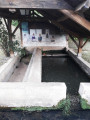
The Miélan Tannery Trail

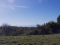
A circular walk through the woods and along the River Bouès. A beautiful view of the Pyrenees on a clear day. On arrival, walk through the old village of Miélan and its covered market.

Details

1755423
Creation:
Last update:
Last review:
  • Walking
    Activity: Walking
  • ↔
    Distance: 7.20 mi
  • ◔
    Average duration: 3h 40 
  • ▲
    Difficulty: Moderate

  • ⚐
    Back to start: Yes
  • ↗
    Ascent: + 417 ft
  • ↘
    Descent: - 423 ft

  • ▲
    Highest point: 925 ft
  • ▼
    Lowest point: 607 ft

Photos

Description of the walk

Park in the church car park.

(S/E) Cross the main road (Avenue Jean Sénac) with care, turn left, then take the first right. Walk alongside the houses, take the first right; the path is signposted. Leave the path and take a track leading down to the left; follow this track until you reach a path, then continue to the junction.

(1) Turn left and carry on straight ahead along this track, which becomes a tarmac road (Chemin de Braquet), until you reach a junction with a forest track on the left.

(2) Turn left, heading south-west, and follow this track until you reach the three-way junction.

(3) At the three-way junction, veer to the right and continue along this track, which leads downhill to the junction with the forest tracks.

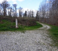
(4) Take the path furthest to the right, almost directly opposite, and follow it as it leaves the forest and runs alongside it. Continue along this path, with the forest on your right and the River Le Bouès on your left, until you reach a junction with a tarmac road.

(5) Cross the road and take the path opposite, still with the forest on your right and the River Le Bouès on your left. Follow this path until you reach a hairpin bend to the right (Bidou).

(6) Turn right at the hairpin bend, heading south-east, onto the path that climbs up through the forest, and continue along this path until you reach a junction with a tarmac road.

(7) On the road, turn left, then take the first right and then right again (Crabé), until you reach the four-way junction.

(8) Turn left, pass a house on your left, then take the next track on the right. Continue straight on along this track until you reach a tarmac road. You’ll see a chapel on your left; carry on straight ahead. Pass the four-way crossroads and head straight on until you reach the T-junction.

(9) Turn right, then, at the next T-junction, turn left. Carry on straight ahead until you reach the N21 main road.

(10) Turn right, walk along the pavement for a few metres, then turn right again. Walk past the gendarmerie and turn left until you reach the main road.

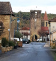
(11) Cross the main road carefully and take the street opposite (Avenue Douat). Continue strolling through the streets of Mièlan to visit the covered market and the old 14th-century houses. Return to the church car park via Rue Saint-Barthélémy (S/E).


Waypoints

  1. S/E : mi 0 - alt. 922 ft - Church car park
  2. 1 : mi 0.22 - alt. 892 ft - Turn left
  3. 2 : mi 0.57 - alt. 919 ft - Forest track on the left
  4. 3 : mi 0.91 - alt. 873 ft - Turn right
  5. 4 : mi 1.38 - alt. 650 ft - On the right, almost directly opposite
  6. 5 : mi 3.02 - alt. 620 ft - Cross the road > path opposite, near the - Bouès (rivière) - Affluent de l'Arros
  7. 6 : mi 3.63 - alt. 607 ft - On the right at the hairpin bend, a path leading uphill
  8. 7 : mi 4.32 - alt. 856 ft - Turn left onto the road
  9. 8 : mi 4.95 - alt. 860 ft - Turn left at the four-way crossroads
  10. 9 : mi 6.12 - alt. 837 ft - Turn right at the T-junction
  11. 10 : mi 6.65 - alt. 866 ft - Turn right onto the N21
  12. 11 : mi 7.03 - alt. 899 ft - Crossing the N21
  13. S/E : mi 7.2 - alt. 922 ft - Church car park

Worth a visit

Visit to the village of Miélan
Swimming is possible in Lake Miélan in summer

Reviews and comments

3.8 / 5
Based on 4 reviews

Reliability of the description
3.8 / 5
Ease of following the route
4.3 / 5
Route interest
3.5 / 5
ritournelle
ritournelle

Overall rating : 3.7 / 5

Date of your route : May 13, 2024
Reliability of the description : ★★★★☆ Good
Ease of following the route : ★★★★☆ Good
Route interest : ★★★☆☆ Average
Very busy route : Yes

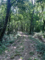
ROUTE COMPLETED ON 21 APRIL; the only problem encountered was on the section through the woods, where there were deep ruts caused by 4x4 off-road vehicles, which may also be found on the PR.
It would be advisable to alter the route.
Otherwise, no other problems.
Same old, same old

Machine-translated

lecbalcaz
lecbalcaz

Overall rating : 4 / 5

Date of your route : Nov 21, 2023
Reliability of the description : ★★★★☆ Good
Ease of following the route : ★★★★☆ Good
Route interest : ★★★★☆ Good
Very busy route : No

.A pleasant walk. This route tends to be used more by 4x4s than by walkers. But even though quads and 4x4s use the tracks, they aren’t closed off (a blessing in disguise). There are some lovely views of the surrounding area and the Pyrenees.

Machine-translated

lousquarantapes
lousquarantapes

Overall rating : 4.3 / 5

Date of your route : Oct 31, 2022
Reliability of the description : ★★★★★ Very good
Ease of following the route : ★★★★★ Very good
Route interest : ★★★☆☆ Average
Very busy route : No

a route that is more or less signposted.

Machine-translated

bichou65
bichou65

Overall rating : 3.3 / 5

Date of your route : Sep 23, 2020
Reliability of the description : ★★☆☆☆ Disappointing
Ease of following the route : ★★★★☆ Good
Route interest : ★★★★☆ Good
Very busy route : No

After the sign marking the start of the walk, there were no signposts in the forest; we came across several paths without knowing which one to take. Throughout the entire route, the only signposts were along the edges of tarmac roads.
It was, however, a pleasant walk.

Machine-translated

Other walks in the area

For more walks, use our search engine .

The GPS track and description are the property of this route's author. Please do not copy them without permission.