Along the border at Blaugies

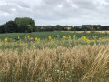
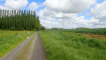
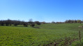
A peaceful walk starting from Blaugies towards the French border, taking you through hills and valleys with lovely open views. In sunny weather, the walk offers little shade (bring water) and is a great way to get plenty of fresh air. The idyllic landscapes and quiet paths make for a peaceful walk.

Details

18519625
Creation:
Last update:
Last review:
  • Walking
    Activity: Walking
  • ↔
    Distance: 5.93 mi
  • ◔
    Average duration: 2h 45 
  • ▲
    Difficulty: Easy

  • ⚐
    Back to start: Yes
  • ↗
    Ascent: + 36 ft
  • ↘
    Descent: - 39 ft

  • ▲
    Highest point: 472 ft
  • ▼
    Lowest point: 404 ft
  • ⚐ Country: Belgium
  • ⚐ City: Dour 
  • ⚑
    Start/End: N 50.373317° / E 3.804222°
  • ❏
    IGN map(s): Ref. 2706OT
  • Hour-by-hour weather

Photos

Description of the walk

The route starts at the square by the church in Blaugies, where parking is available.

(S/E) With the church behind you, turn left onto Rue de la Frontière.

(1) Turn right onto Rue de Bavay and walk past the Chapel of Notre-Dame de Tongres, also known as the Chapelle Carline. Continue for about 500 metres.

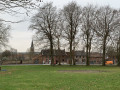
(2) Just past the ponds, turn right and continue along the dirt track until you reach the road (Rue de Leuses). After a good hundred metres, turn right onto Rue Longue towards the church at Erquennes, which dates from the 16th century. On your left is a former school known as the “School for Girls, founded in 1876”.

(3) Just past this building, take a small path on your left and, after a good hundred metres, turn right to reach the Place du Joncquois, opposite a former farm.

(4) Turn left onto Rue de la Grosse Croix and carry on until you reach Rue du Touquet.

(5) Turn left onto this street and carry on straight ahead, leaving the tarmac road and taking the dirt track in front of you for about 600 metres. Cross the French-Belgian border and you’ll come to a T-junction.

(6) Take Chemin des Potiers on the left. At the first junction, keep left and carry on straight ahead, crossing over the Ruisseau de La Petite Honnelle.

(7) At the four-way junction, you will see the Saint-Ghislain Chapel on your left; turn right onto Rue Ruinsette and carry on to the next hamlet. Take Rue de Trieu Jean-Sart on your left, continuing straight on until you reach the entrance to the hamlet.

(8) Turn left onto Rue de Fonteny, then continue by turning right onto Rue Canarderie. Turn left onto Rue de Baudinchamp, then left again at the hairpin bend onto Rue Hardret, continuing along it until you reach Rue de Trieu Jean-Sart.

(9) Turn right, staying on the same street, pass through the hamlet of Hardret and carry on until you reach Rue de la Frontière.

(10) Follow Rue de la Frontière on your right for 30 metres and take the first left, onto Rue Saussette. About a hundred metres further on, turn left onto Voie Blanche, which will take you back to Blaugies Church (S/E).

Waypoints

  1. S/E : mi 0 - alt. 443 ft - Place de Blaugies
  2. 1 : mi 0.12 - alt. 433 ft - Rue de Bavay
  3. 2 : mi 0.74 - alt. 433 ft - Ponds, on the right
  4. 3 : mi 1.31 - alt. 413 ft - Erquennes
  5. 4 : mi 1.47 - alt. 404 ft - Place du Joncquois
  6. 5 : mi 1.62 - alt. 423 ft - Rue du Touquet
  7. 6 : mi 2.21 - alt. 436 ft - Chemin des Potiers
  8. 7 : mi 2.67 - alt. 449 ft - Saint-Ghislain Chapel, on the right
  9. 8 : mi 4.09 - alt. 446 ft - Trieu Jean-Sart
  10. 9 : mi 4.67 - alt. 443 ft - Rue de Trieu Jean-Sart
  11. 10 : mi 5.4 - alt. 443 ft - Rue de la Frontière
  12. S/E : mi 5.93 - alt. 440 ft - Place de Blaugies

Worth a visit

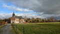
(S/E) Blaugies Church, built during the second half of the 16th century in the Gothic style, is dedicated to Saint Aubin.

Between (1) and (2) lies the Chapel of Our Lady of Tongre, built in 1761 as indicated by the inscription above the door. At the rear of the chapel, on the outer wall, is a small white stone set into the wall bearing the inscription: “Anno Domini 1741, Our Lady of Tongre, pray for us.”

(4) Place du Joncquois is situated in the centre of the village of Erquennes. It was built towards the end of the 18th century using the remains of an old farm. Of the houses on the square, five are listed in the inventory of architectural heritage for the commune of Honnelles.

(6) The Petite Honnelle has the same character as its bigger sister. Originating in France, in the ‘Petite Suisse’ region that stretches from Bavay, it flows through Bellignies, Gussignies, Erquennes and Athis.

Reviews and comments

4.1 / 5
Based on 3 reviews

Reliability of the description
4 / 5
Ease of following the route
4.3 / 5
Route interest
4 / 5
Pirenne
Pirenne

Overall rating : 4.7 / 5

Date of your route : Jul 21, 2025
Reliability of the description : ★★★★★ Very good
Ease of following the route : ★★★★★ Very good
Route interest : ★★★★☆ Good
Very busy route : No

Pretty countryside but almost entirely asphalt, although there are some small, quiet roads. Best enjoyed by bike?

Machine-translated

Tipoune
Tipoune

Overall rating : 4.3 / 5

Date of your route : Jul 14, 2024
Reliability of the description : ★★★★☆ Good
Ease of following the route : ★★★★★ Very good
Route interest : ★★★★☆ Good
Very busy route : No

A lovely walk in the summer sunshine (at last!). Do make sure you wear walking shoes, though, especially after a spell of rain

Machine-translated

Daniel Poley
Daniel Poley

Overall rating : 3.3 / 5

Date of your route : Feb 06, 2023
Reliability of the description : ★★★☆☆ Average
Ease of following the route : ★★★☆☆ Average
Route interest : ★★★★☆ Good
Very busy route : No

Hello
A lovely walk overall; we had a bit of trouble finding the path after Erquennes church. Was it the one that ran alongside the stream upstream?
In any case, it’s a lovely spot and we ended up at the Place du Joncquois...
A walk we’d definitely recommend.

Machine-translated

Other walks in the area

For more walks, use our search engine .

The GPS track and description are the property of this route's author. Please do not copy them without permission.