Au Cœur du Nivernais depuis l'église romane de Jailly

Circuit à partir de l'église de Jailly, en grande partie en forêt de Saint-Saulge.

Details

43983810
Creation:
Last update:
Last review:
  • Walking
    Activity: Walking
  • ↔
    Distance: 5.00 mi
  • ◔
    Average duration: 2h 35 
  • ▲
    Difficulty: Easy

  • ⚐
    Back to start: Yes
  • ↗
    Ascent: + 374 ft
  • ↘
    Descent: - 374 ft

  • ▲
    Highest point: 1,316 ft
  • ▼
    Lowest point: 1,024 ft
  • ⚐ Country: France
  • ⚐ City: Jailly (58330)
  • ⚑
    Start/End: N 47.095975° / E 3.47757°
  • ❏
    IGN map(s): Ref. 2624SB
  • Hour-by-hour weather

Description of the walk

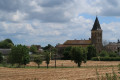
Départ de l'église de Jailly (stationnement possible).

(S/E) Partir à l'Est, laisser l'église sur la droite et longer le cimetière, à main droite. Entrer dans un bois et monter.

(1) Prendre le premier sentier à gauche. Au bout du chemin, suivre une petite route à droite. Ignorer un premier départ de chemin sur la gauche.

(2) S'engager à gauche dans le chemin suivant. Au croisement en T, tourner à droite (Nord-Est). Ignorer quatre départs; successifs, sur la droite.

(3) À la cinquième intersection, virer à droite.

(4) Déboucher sur une petite route et la suivre à droite. Ignorer une autre route venant de la gauche et, environ 400 m plus loin, repérer sur la gauche le départ d'une route forestière.

(5) Suivre cette route forestière, à gauche. Plus loin, prolonger sur un chemin, cap Sud - Sud-Est (dolmen de la Pierre du sacrifice à proximité). Ignorer tous les départs sur la gauche.

(6) Au croisement, tourner à droite. À la fourche qui se présente peu après, obliquer à droite. Ignorer des départs sur la droite.

(7) Retrouver le goudron et traverser le lieu-dit La Brulée. Suivre la petite route jusqu'à un carrefour en triangle, au lieu-dit La Croix.

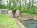
(8) Obliquer alors à droite, toujours sur la route. Passer devant le Vieux Château, ignorer une route sur la gauche et dépasser un lavoir. Juste après, retrouver l'église de Jailly (S/E).

Waypoints

  1. S/E : mi 0 - alt. 1,119 ft - Église Saint-Sylvestre (Jailly)
  2. 1 : mi 0.35 - alt. 1,273 ft - Junction
  3. 2 : mi 0.78 - alt. 1,299 ft - Start of the trail
  4. 3 : mi 1.76 - alt. 1,299 ft - Junction
  5. 4 : mi 2.29 - alt. 1,316 ft - Junction
  6. 5 : mi 2.78 - alt. 1,302 ft - Forest track
  7. 6 : mi 3.79 - alt. 1,070 ft - Crossroads
  8. 7 : mi 4.37 - alt. 1,086 ft - La Brulée
  9. 8 : mi 4.68 - alt. 1,037 ft - La Croix
  10. S/E : mi 5 - alt. 1,119 ft - Église Saint-Sylvestre (Jailly)

Notes

Pas de point d'eau potable sur le circuit.
Gîte à Saint Martin.
Commerces à Saint-Saulge.

Worth a visit

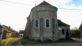
Église romane de Jailly (XIe-XIIe), dont une partie en ruines.
Source et lavoir à proximité et vieux château.
Pierre du sacrifice (dolmen) en forêt, entre (5) et (6).

Reviews and comments

4 / 5
Based on 1 review

Reliability of the description
4 / 5
Ease of following the route
4 / 5
Route interest
4 / 5
MARCHE CSI
MARCHE CSI

This map is already a bit out of date, and unfortunately it’s possible that farmers or foresters may have ‘encroached’ on some of the paths at the start. Unless it’s down to a lack of maintenance by the local council.
With a GPS, you should be able to find your way around.
It’s not safe to walk in 38°C heat!
As for updating the route, as soon as I get the chance to go back, I’ll check it and make any necessary changes.
But if anyone can do it using GPS data and Google Earth, that’s fine.

Machine-translated

Jean-Pierre
Jean-Pierre

We tried to do this hike but couldn’t find the path at the start!
As it was very hot on 14 August 2026 (around 38°), we quickly gave up.
What a shame!
Perhaps the start of this walk needs changing, but I don’t know how to go about it!
Jean-Pierre Levis

Machine-translated

Tony et Marion
Tony et Marion

Overall rating : 4 / 5

Date of your route : Oct 19, 2025
Reliability of the description : ★★★★☆ Good
Ease of following the route : ★★★★☆ Good
Route interest : ★★★★☆ Good
Very busy route : No

A very pretty hike, with lots of forests and easily accessible paths. Be careful, two paths no longer exist at the very beginning, but thanks to GPS, it's easy to find your way.

I will do it again after an autumn rain; the smells and sensations of a fairly dry early autumn were already exquisite...

Many thanks...

pS: I couldn't find any information about this sacrificial stone...

Machine-translated

Other walks in the area

For more walks, use our search engine .

The GPS track and description are the property of this route's author. Please do not copy them without permission.