


Refine your search for walks in Assac
Assac walks


 Wind turbines at the mill in Assac
 Visorando Member
 3.29 mi
 +663 ft
 -663 ft
 2h 05
2h 05
 Easy
Easy
 Departure from Assac (Tarn)
A shaded descent takes you to the Gaycre stream, which you follow for a while to the murmur of the water and the song of the birds, then wide paths lead back up to the Assac plateau.
Yellow markings
Hills and valleys in Villeneuve-sur-Tarn
 10.18 mi
+1,762 ft
-1,778 ft
6h 15
10.18 mi
+1,762 ft
-1,778 ft
6h 15
 Moderate
Departure from Curvalle (Tarn)
Moderate
Departure from Curvalle (Tarn)
A mainly woodland walk leading up to the heights of Villeneuve-sur-Tarn, from where the view stretches over the surrounding hills and the Tarn valley. Small valleys and refreshing streams are also part of this pleasant route, suitable for all seasons. Summer is particularly recommended as the woods offer welcome shelter, and the return journey along the Tarn may provide an opportunity for a swim to round off the day in style.
The rolling Tarn, Négoriou and Merlassou valleys
6.81 mi
+1,365 ft
-1,365 ft
4h 20
Moderate
Departure from Curvalle (Tarn)
A slightly longer variation of the "Sentier des Sources" hike is available in the commune of Trébas. It passes by an old mineral water spring and climbs to the heights for a view of the Tarn valley. The route starts in Villeneuve, allowing you to cross the bridge over the river.
The hilly Tarn, Malagousse valley
8.62 mi
+1,486 ft
-1,496 ft
5h 15
Moderate
Departure from Curvalle (Tarn)
Hike in the hills above the Malagousse stream valley, with a detour to the village of Saint-André, then a climb to the top of a small hill for a view of the Tarn valley.
On the hillsides of Trébas
 8.11 mi
+1,312 ft
-1,306 ft
4h 50
Moderate
Departure from Trébas (Tarn)
8.11 mi
+1,312 ft
-1,306 ft
4h 50
Moderate
Departure from Trébas (Tarn)
A walk to discover the local heritage above Trébas.
A route that takes you through rural landscapes and lush woodlands.
From Bonneval to the banks of the Tarn via Saint-André
 10.01 mi
+1,864 ft
-1,857 ft
6h 15
Moderate
Departure from Ambialet (Tarn)
10.01 mi
+1,864 ft
-1,857 ft
6h 15
Moderate
Departure from Ambialet (Tarn)
This is a trail with varied landscapes that takes walkers from the heights of Saint-André to the banks of the Tarn. You will follow theGR®36for half of the route.
Route of Deux Puechs and Cabannes above Ambialet
 9.28 mi
+1,847 ft
-1,844 ft
5h 55
Moderate
Departure from Ambialet (Tarn)
9.28 mi
+1,847 ft
-1,844 ft
5h 55
Moderate
Departure from Ambialet (Tarn)
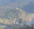
A beautiful hike in the Ambialet Piedmont. Ascents towards Les Puechs and descents through the undergrowth follow one another in a series of gentle undulations. As you descend towards La Condomine and Ambialet, two pretty little villages, you will appreciate the charms and tranquillity of the banks of the Tarn.
The panoramic Tarn at Ambialet
9.98 mi
+1,640 ft
-1,634 ft
6h 00
Moderate
Departure from Ambialet (Tarn)
A route that runs along the heights of one of the most beautiful meanders of the Tarn, passing by the Puech du Point de Vue, before descending for a visit to the site of Ambialet.
Circuit des Deux Puechs
 5.83 mi
+1,506 ft
-1,493 ft
4h 00
Moderate
Departure from Ambialet (Tarn)
5.83 mi
+1,506 ft
-1,493 ft
4h 00
Moderate
Departure from Ambialet (Tarn)
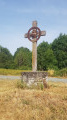
A lovely circular route that will take you, amongst valleys and hilltops, through unspoilt countryside.Woods and open countryside punctuate the route until you return to a superb viewpoint over the remarkable Ambialet isthmus, a splendid peninsula that has been a listed site since 1948.The priory overlooks the circular Tarn loop; it marks the end of the beautiful Way of the Cross, which begins around the Chapel of Saint-Gilles, set into the rock.
Route des Cabannes in Ambialet
 4.54 mi
+928 ft
-951 ft
2h 55
Easy
Departure from Ambialet (Tarn)
4.54 mi
+928 ft
-951 ft
2h 55
Easy
Departure from Ambialet (Tarn)
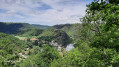
This circular offers a view of the remarkable isthmus of Ambialet, a peninsula that has been classified as a protected site since 1948.
The priory overlooks the circular Tarn and is the end point of the beautiful Way of the Cross, which begins around the Saint-Gilles Chapel, set into the rock.
Some fairly sustained effort will be required at the start, but then the route becomes varied, alternating between bucolic landscapes and woodland paths. Finally, a long stretch along the banks of the Tarn itself will provide a welcome opportunity to cool off.
The Corniches du Tarn in Fraissines
 5.38 mi
+814 ft
-791 ft
3h 10
Easy
Departure from Fraissines (Tarn)
5.38 mi
+814 ft
-791 ft
3h 10
Easy
Departure from Fraissines (Tarn)
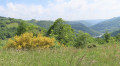
Fraissines is a small village overlooking the Tarn valley. Balcony paths wind their way up the steep slopes covered with tree heath. This ancient path once linked the villages of Trébas and Combradet. Viewpoints over the Tarn and Aveyron valleys, a spring, a waterfall and abundant, varied vegetation enhance this pretty route.
Yellow markings.
From Combradet to Frayssines
 4.88 mi
+951 ft
-968 ft
3h 05
Easy
Departure from Réquista (Aveyron)
4.88 mi
+951 ft
-968 ft
3h 05
Easy
Departure from Réquista (Aveyron)
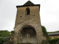
Two small villages nestled on the slopes of the Tarn, amidst magnificent and peaceful countryside. The River Tarn winds its way through the valley, and the paths lined with low dry-stone walls that once linked the two villages are steeped in history.
Combradet Trail
 5.81 mi
+1,102 ft
-1,089 ft
3h 40
Moderate
Departure from Réquista (Aveyron)
5.81 mi
+1,102 ft
-1,089 ft
3h 40
Moderate
Departure from Réquista (Aveyron)
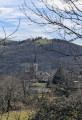
Combradet, a hamlet in the commune of Réquista, is built on a ridge overlooking the La Croux Dam on the River Tarn.This circular walk offers numerous views of the Tarn valley.
The short version of the Méridienne trail
 7.94 mi
+1,109 ft
-1,109 ft
4h 35
Moderate
Departure from Sérénac (Tarn)
7.94 mi
+1,109 ft
-1,109 ft
4h 35
Moderate
Departure from Sérénac (Tarn)
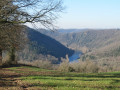
Hike in the Ségala Tarnais, which offers a variety of agricultural and forest landscapes on a schistose subsoil deeply carved by numerous streams and rivers that flow into the Tarn.
This route descends towards the Tarn valley, which you follow for a while before returning to the plateau via the right bank of the Aygou.
This is a yellow-markedPR® trail with signposts at major crossroads.
The long version of the Méridienne trail
 9.95 mi
+1,598 ft
-1,594 ft
6h 00
Moderate
Departure from Sérénac (Tarn)
9.95 mi
+1,598 ft
-1,594 ft
6h 00
Moderate
Departure from Sérénac (Tarn)
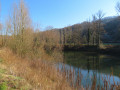
A walk through the Ségala Tarnais, offering a variety of agricultural and woodland landscapes on schist bedrock deeply carved by numerous streams and tributaries of the Tarn.
This route descends towards the Tarn valley, which you follow for a while before returning to the plateau via the left bank of the Aygou.
See practical information regarding the shorter version of this walk.
From (10 to 11) there are no signposts. After that,PR® signposts lead you back to the starting point.
La Clauze route starting from Saint-Jean-Delnous
6.53 mi
+728 ft
-735 ft
3h 40
Moderate
Departure from Saint-Jean-Delnous (Aveyron)
Walk from the village of Saint-Jean-Delnous. Much of the route runs through woodland, alongside the Ruisseau de Farradet, passing from farm to farm. The route presents no particular difficulty.
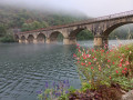
From the Ségala plateau to the Tarn valley
 9.12 mi
+1,637 ft
-1,627 ft
5h 35
Moderate
Departure from Réquista (Aveyron)
9.12 mi
+1,637 ft
-1,627 ft
5h 35
Moderate
Departure from Réquista (Aveyron)
From Réquista, situated to the south of the Ségala plateau, to Lincou, on the banks of the Tarn.
Numerous viewpoints overlooking the Tarn valley and the Réquista countryside, a land of livestock farming, particularly the Lacaune sheep, whose milk is used to make Roquefort.
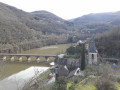
The Lincou trail starting from Réquista
 8.73 mi
+1,526 ft
-1,503 ft
5h 20
Moderate
Departure from Réquista (Aveyron)
8.73 mi
+1,526 ft
-1,503 ft
5h 20
Moderate
Departure from Réquista (Aveyron)
From the Ségala plateau to Lincou on the banks of the Tarn.
There are numerous vantage points overlooking the Tarn valley and the Requistan countryside, home to the Lacaune sheep, whose milk is used to make Roquefort.
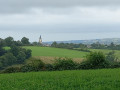
The meandering Giffou river as it flows out of Réquista
 6.45 mi
+814 ft
-810 ft
3h 40
Moderate
Departure from Réquista (Aveyron)
6.45 mi
+814 ft
-810 ft
3h 40
Moderate
Departure from Réquista (Aveyron)
Réquista is France’sleading sheep-farming canton. Here, the Lacaune ewe reigns supreme. It is from her milk that the famous Roquefort is made. And it is here, in Réquista, that the Société dairy is located, where the cheeses are produced before being sent to the cellars of Roquefort to be matured.
Every year, on thefirst weekend in June, the Sheep Festival is held: walks, meals, street entertainment, a dance… and more.