Country:

 City:
City:


(S) From Arolla, follow a track heading south-southeast which leads to the local hydroelectric power station.
(1) Continue in the same direction (south-south-east).
(2) Cross a torrent and you’ll soon reach the Arolla water intake (the glacier reached this point in 1980).
(3) Carry on south-southeast and you’ll soon reach a fork in the path.
(4) Turn right to return to the stream. Continue south-south-east.
(5) The path turns eastwards and you pass at the foot of some rocks.
(6) We climb a small ladder and continue eastwards. We make our way through the space left by the retreating glacier and head south-south-east.
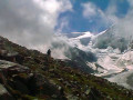
(7) You have the choice between ascending the glacier on the left (south-southeast) and, as shown on the map, crossing the glacial torrent to take the moraine on the right (south-southwest). This takes you directly up to the Col de Collon.
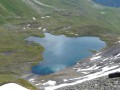
(8) Descend on the other side and walk alongside an unnamed lake on your left. Continue south-west.
(9) Turn left and descend steeply (ignore the path branching off to the right towards the Nakamuli Hut). Follow a stream on your left.
(10) Cross the stream and head downwards south-south-west. You’ll come across the stream again further on and continue the descent alongside it (south-east).
(11) Pass the Garda mountain pasture and continue south-east to the Grand Oren mountain pasture.
(12) Continue south-east to reach Praz Mondou Desot.
(13) Follow the path eastwards to reach the Prarayer mountain hut quickly (E).
 Visorando Member
 Moderate
 Very difficult
 Easy
Easy