


Circular Ferpecle and views of the glaciers


A short hike/walk around Ferpecle with views of the Swiss glaciers halfway along the route. The route starts in the heart of the mountains, with accessible car parks on several levels. You can also take a bus. There is a slight incline and a section alongside the dam. You’re bound to come across some cows (very friendly ones). Please do open the gates – they’re there to stop the animals from escaping.
Details
Creation:
Last update:
Last review:
–
–
-
 Activity: Walking
 -
 Distance: 3.19 mi
 -
 Average duration: 2h 05
 -
 Difficulty: Easy
 -
-
 Back to start: Yes
 -
 Ascent: + 722 ft
 -
 Descent: - 722 ft
 -
-
 Highest point: 6,562 ft
 -
 Lowest point: 5,840 ft
-
 Country:
Switzerland
Country:
Switzerland
-
 Area: Alps
 -
 City:
Evolène
City:
Evolène -
 Start/End: N 46.064868° / E 7.544944°
 -


 Hour-by-hour weather


Waypoints
- S/E : mi 0 - alt. 5,840 ft - Route de Ferpècle
- 1 : mi 0.91 - alt. 6,201 ft - Ferpècle Dam
- 2 : mi 1.62 - alt. 6,388 ft - Crossing the Borgne de Ferpècle
- S/E : mi 3.19 - alt. 5,840 ft - Route de Ferpècle
Other walks in the area
From La Forclaz to Les Mayens de Bréonna
 Visorando Member
 2.71 mi
+1,106 ft
-1,112 ft
2h 15
2.71 mi
+1,106 ft
-1,112 ft
2h 15
 Moderate
 Departure from Evolène (Valais)
A short but fascinating route. It climbs steadily, avoiding the hairpin bends of the white track used by 4x4s. Magnificent views of the Dent Blanche and the neighbouring peaks. The traditional Mayens are an absolute must-see, as is the very well-preserved centre of the village of La Forclaz. The descent through the larch trees is pleasant.
Can be extended via the Tsalè refreshment hut – Total: 6 km, 480 m
La Sage - Grimentz
 10.59 mi
+4,331 ft
-4,593 ft
8h 40
10.59 mi
+4,331 ft
-4,593 ft
8h 40
 Very difficult
Departure from Evolène (Valais)
Very difficult
Departure from Evolène (Valais)
This tenth stage takes place once again in the high mountains and, depending on the season, may involve crossing snowfields. This day is spent in the company of peaks over 4,000 metres high.From La Sage or Villa, there are two passes that allow you to cross from the Val d'Hérens to the Val d'Anniviers: the Col de Torrent and the Col du Tsaté. Closer to the high peaks and glaciers, we will opt for the Col du Tsaté. From La Sage, follow the signs for Moteau and Le Tsaté (an old abandoned hamlet). The trail continues to a cattle farm (Remointse du Tsaté), then to the small Lac du Tsaté. From there, the Col du Tsaté is visible on the Val d'Anniviers side, and the path joins the Lac de Moiry to the dam. At the foot of this structure, a well-marked trail leads to Grimentz.
Lac Bleu near Arolla Val d’Hérens
 2.41 mi
+984 ft
-991 ft
2h 00
Moderate
Departure from Evolène (Valais)
2.41 mi
+984 ft
-991 ft
2h 00
Moderate
Departure from Evolène (Valais)
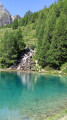
A small, turquoise-blue lake, surrounded by Swiss stone pines and venerable larch trees – this is the destination of your hike. With views of the peaks as a bonus. You’ll pass through hamlets with magnificent wooden chalets featuring slate roofs. A cosy Valais-style café and restaurant awaits you beside the lake. This route is short, but you’ll get a good workout given the elevation gain.
Circular route to the Cabane des Aiguilles Rouges via Lac Bleu
 8.65 mi
+3,914 ft
-3,894 ft
7h 25
8.65 mi
+3,914 ft
-3,894 ft
7h 25
 Difficult
Departure from Evolène (Valais)
Difficult
Departure from Evolène (Valais)
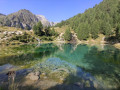
A lovely circular hike with magnificent scenery. Among the highlights of the hike are theview of the Aiguilles Rouges (a striking rocky landscape), theview of the glaciers throughout the descent, thefragrantforestsof larch and European larch, and a brief stop at Lac Bleu with its intense blue colour (and its many tourists)
Lodge de la Sage - Bella Tola Hut
 14.05 mi
+4,770 ft
-2,523 ft
10h 35
Difficult
Departure from Evolène (Valais)
14.05 mi
+4,770 ft
-2,523 ft
10h 35
Difficult
Departure from Evolène (Valais)
Long climb up the Col de Torrent before reaching Lac de Moiry, then Saint-Luc by bus, Tignousa by funicular railway and finally Bella Tola on foot.
Remember to adjust the distance using the information provided by the points (6) and (7): you need to subtract 10 km.
Cabane Moiry - Cabane des Becs de Bosson
 9.96 mi
+3,425 ft
-2,927 ft
7h 35
Difficult
Departure from Grimentz (Valais)
9.96 mi
+3,425 ft
-2,927 ft
7h 35
Difficult
Departure from Grimentz (Valais)
For this fifth stage, you will leave the Moiry hut and the snow-capped peaks for another hut in a very different world. You will once again follow the Lac de Moiry, but on its other shore. You will cross large grassy expanses to the Alpage de Torrent. From this mountain pasture to the Pas de la Lona, you will follow part of the famous Verbier-Grimentz mountain bike trail. The final climb will take you to the foot of the Becs de Bosson for a night at almost 3,000 metres.
Arolla - La Sage
 6.76 mi
+1,644 ft
-2,762 ft
4h 30
Moderate
Departure from Evolène (Valais)
6.76 mi
+1,644 ft
-2,762 ft
4h 30
Moderate
Departure from Evolène (Valais)
This ninth stage is more relaxing than the previous ones. Many hikers skip this section by taking a bus transfer from Arolla to La Sage or Villa. Although short and easy, this stage really has its place in the route. The trail passes by Lac Bleu and crosses the beautiful hamlet of La Gouille, typical of the Val d'Hérens, then the villages of Les Haudères and La Sage. From La Gouille to Les Haudères, the trail follows the "La Borgne d'Arolla" torrent. In the centre of Les Haudères, a sign indicates the path that climbs up to the village of La Sage.
Arolla – Prarayer Mountain Hut
10.60 mi
+3,701 ft
-3,727 ft
8h 05
Difficult
Departure from Evolène (Valais)
This is the longest stage of the route but presents no difficulties other than its length and the elevation gain. The section across the glacier can be avoided by taking the moraines, which allow you to climb more directly to the right (see the route map).
For more walks, use our search engine .
The GPS track and description are the property of this route's author. Please do not copy them without permission.

