


1-2: a good climb
2–3: a pleasant descent
3-4: narrow path (a few dizzying sections – the path isn’t very wide)


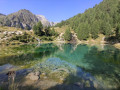
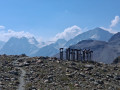
A lovely circular hike with magnificent scenery. Among the highlights of the hike are theview of the Aiguilles Rouges (a striking rocky landscape), theview of the glaciers throughout the descent, thefragrantforestsof larch and European larch, and a brief stop at Lac Bleu with its intense blue colour (and its many tourists)


 Country:
Switzerland
Country:
Switzerland

 City:
Evolène
City:
Evolène 


1-2: a good climb
2–3: a pleasant descent
3-4: narrow path (a few dizzying sections – the path isn’t very wide)
Lac Bleu near Arolla Val d’Hérens 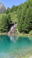 2.41 mi
+984 ft
-991 ft
2h 00
2.41 mi
+984 ft
-991 ft
2h 00
 Moderate
 Departure from Evolène (Valais)
Arolla - La Sage
Departure from Evolène (Valais)
Arolla - La Sage 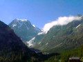 6.76 mi
+1,644 ft
-2,762 ft
4h 30
Moderate
Departure from Evolène (Valais)
Arolla – Prarayer Mountain Hut 10.60 mi
+3,701 ft
-3,727 ft
8h 05
Difficult
Departure from Evolène (Valais)
Arolla - Prarayer Refuge
6.76 mi
+1,644 ft
-2,762 ft
4h 30
Moderate
Departure from Evolène (Valais)
Arolla – Prarayer Mountain Hut 10.60 mi
+3,701 ft
-3,727 ft
8h 05
Difficult
Departure from Evolène (Valais)
Arolla - Prarayer Refuge  10.43 mi
+3,970 ft
-3,871 ft
10 hrs
10.43 mi
+3,970 ft
-3,871 ft
10 hrs
 Very difficult
Departure from Evolène (Valais)
From La Forclaz to Les Mayens de Bréonna
Very difficult
Departure from Evolène (Valais)
From La Forclaz to Les Mayens de Bréonna  2.71 mi
+1,106 ft
-1,112 ft
2h 15
Moderate
Departure from Evolène (Valais)
Circular Ferpecle and views of the glaciers 3.19 mi
+722 ft
-722 ft
2h 05
2.71 mi
+1,106 ft
-1,112 ft
2h 15
Moderate
Departure from Evolène (Valais)
Circular Ferpecle and views of the glaciers 3.19 mi
+722 ft
-722 ft
2h 05
 Easy
Departure from Evolène (Valais)
Lodge de la Sage - Bella Tola Hut
Easy
Departure from Evolène (Valais)
Lodge de la Sage - Bella Tola Hut 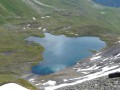 14.05 mi
+4,770 ft
-2,523 ft
10h 35
Difficult
Departure from Evolène (Valais)
La Sage - Grimentz
14.05 mi
+4,770 ft
-2,523 ft
10h 35
Difficult
Departure from Evolène (Valais)
La Sage - Grimentz  10.59 mi
+4,331 ft
-4,593 ft
8h 40
Very difficult
Departure from Evolène (Valais)
10.59 mi
+4,331 ft
-4,593 ft
8h 40
Very difficult
Departure from Evolène (Valais)
For more walks, use our search engine .
The GPS track and description are the property of this route's author. Please do not copy them without permission.
Scan this QR code with your smartphone's camera.
To open this route on your smartphone, you must have the Visorando app installed. If not, got to the Apple Store (iPhone) or Google Play Store (Android) to download the app.
 Visorando Member
