Refine your search for walks in Col de Collon (3069 m)
Col de Collon (3069 m) walks


 Arolla – Prarayer Mountain Hut
 Visorando Member
 10.60 mi
 +3,701 ft
 -3,727 ft
 8h 05
8h 05
 Difficult
 Departure from Evolène (Valais)
This is the longest stage of the route but presents no difficulties other than its length and the elevation gain. The section across the glacier can be avoided by taking the moraines, which allow you to climb more directly to the right (see the route map).
Walks near Col de Collon (3069 m)
Rifugio Prarayer - Breuil Cervinia
 10.96 mi
+4,705 ft
-4,738 ft
9h 10
10.96 mi
+4,705 ft
-4,738 ft
9h 10
 Very difficult
Departure from Bionaz (Aosta Valley)
Very difficult
Departure from Bionaz (Aosta Valley)
This is a classic stage of the Tour du Cervin, passing through the highest point of the hike, the Col de Valcournera, at an altitude of 3,075 metres.
Hike with a brief description, to be followed with the Visorando app.
Prarayer refuge - Perrucco Vuillermoz refuge
 3.61 mi
+3,625 ft
-696 ft
5 hrs
Very difficult
Departure from Bionaz (Aosta Valley)
3.61 mi
+3,625 ft
-696 ft
5 hrs
Very difficult
Departure from Bionaz (Aosta Valley)
The stage starts in the mountain pastures and quickly enters the high mountains with the passage of the Col de Valcornera.
La Léchère - Prarayer Refuge
 2.77 mi
+515 ft
-472 ft
1h 45
2.77 mi
+515 ft
-472 ft
1h 45
 Easy
Departure from Bionaz (Aosta Valley)
Easy
Departure from Bionaz (Aosta Valley)
A warm-up walk along the right bank of the lake to reach the Prarayer refuge.
Tour of the Matterhorn
97.02 mi
+38,215 ft
-37,972 ft
10 days
Difficult
Departure from Bionaz (Aosta Valley)
This 10-day tour of the Matterhorn is remarkable. It allows you to walk alongside the 4,000-metre peaks of this Alpine range every day. Located in two countries, Italy and Switzerland, it also allows you to familiarise yourself with three European languages: Italian, German and French in the Valais region of Switzerland.
Important note: Two stages of this route take place partly on glaciers. It is highly advisable to bring crampons and a rope for maximum safety. Crampons will make it easier to walk, and the rope can be used to form a rope team to secure the participants.
Arolla - Prarayer Refuge
 10.43 mi
+3,970 ft
-3,871 ft
10 hrs
Very difficult
Departure from Evolène (Valais)
10.43 mi
+3,970 ft
-3,871 ft
10 hrs
Very difficult
Departure from Evolène (Valais)
Today's high mountain stage requires the use of crampons to cross the Arolla glacier. This long stage requires an early start.
Tour of the Matterhorn – Stage 7b: Perruco Mountain Hut – Breuil
6.78 mi
+974 ft
-3,930 ft
4h 00
 Moderate
Departure from Valtournenche (Aosta Valley)
Moderate
Departure from Valtournenche (Aosta Valley)
This is the second part of the classic stage of the Tour du Cervin, running from Prarayer to Breuil. The final section of the route can be avoided if you are tired once you reach the road. It is also possible to head towards Varvoie and Lake Perrères to rejoin the road more quickly.
Perrucco Vuillermoz Refuge - Gandeg Hut
 12.01 mi
+5,302 ft
-4,872 ft
10h 10
Difficult
Departure from Valtournenche (Aosta Valley)
12.01 mi
+5,302 ft
-4,872 ft
10h 10
Difficult
Departure from Valtournenche (Aosta Valley)
Today, discover the giant of the area, the splendid Matterhorn, before seeing it up close in the evening at the Gandeg Cabin.
Arolla - La Sage
 6.76 mi
+1,644 ft
-2,762 ft
4h 30
Moderate
Departure from Evolène (Valais)
6.76 mi
+1,644 ft
-2,762 ft
4h 30
Moderate
Departure from Evolène (Valais)
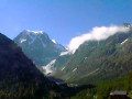
This ninth stage is more relaxing than the previous ones. Many hikers skip this section by taking a bus transfer from Arolla to La Sage or Villa. Although short and easy, this stage really has its place in the route. The trail passes by Lac Bleu and crosses the beautiful hamlet of La Gouille, typical of the Val d'Hérens, then the villages of Les Haudères and La Sage. From La Gouille to Les Haudères, the trail follows the "La Borgne d'Arolla" torrent. In the centre of Les Haudères, a sign indicates the path that climbs up to the village of La Sage.
Cabane des Dix - Arolla
 6.72 mi
+974 ft
-3,934 ft
3h 55
Difficult
Departure from Hérémence (Valais)
6.72 mi
+974 ft
-3,934 ft
3h 55
Difficult
Departure from Hérémence (Valais)
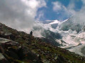
This eighth stage takes place in high mountains and, depending on the season, may involve crossing snowfields. From the Cabane des Dix, return to the Pas de Chèvres / Col de Riedmaten junction. Return to the Pas de Chèvres after a long passage through scree and large boulders. Ladders provide access to the Pas des Chèvres. The descent to Arolla follows a good path. Views of Mont Collon and Pigne d'Arolla.Pas de Chèvres or Col de Riedmaten? See the "Practical information" section.