


Refine your search for walks in Ancienne Distillerie des Chartreux (Saint-Laurent-du-Pont)
Ancienne Distillerie des Chartreux (Saint-Laurent-du-Pont) walks


 Côte Curt art trail
 Visorando Member
 2.81 mi
 +722 ft
 -702 ft
 1h 55
1h 55
 Easy
Easy
 Departure from Saint-Laurent-du-Pont (Isère)
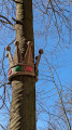
This short 1½-hour walk is suitable for families.An artistic discovery route: all along the route, you can admire and discover works of art set against the backdrop of the old Sardinian road.
From distillery to distillery in Saint-Laurent-du-Pont
 Tourist office
 8.19 mi
+781 ft
-804 ft
4h 25
8.19 mi
+781 ft
-804 ft
4h 25
 Moderate
Departure from Saint-Laurent-du-Pont (Isère)
Moderate
Departure from Saint-Laurent-du-Pont (Isère)
The Fourvoirie site marks one of the entrances to the Chartreuse Desert. One of the bridges, built in the 13th century, gave its name to the village of Saint-Laurent-du-Pont. On the right bank of the Guiers Mort, the Carthusians once started a major metallurgical industry, which continues today in the Saint-Laurent plain. On the other bank, the monks established a distillery, which was destroyed by a landslide in 1935.
Walks near Ancienne Distillerie des Chartreux (Saint-Laurent-du-Pont)
Col de Bellefont via Le Chaos and back via the Col de Saulce
6.85 mi
+3,720 ft
-3,678 ft
6h 25
 Difficult
Departure from Saint-Pierre-de-Chartreuse (Isère)
Difficult
Departure from Saint-Pierre-de-Chartreuse (Isère)
A beautiful, wild hike in the heart of the Chartreuse and on the edge of its nature reserve. The route starts in the woodland, to the sound of the waterfall and the source of the Guiers, climbs up the cliff face, crosses the wild and rugged Chaos de Bellefont, passes through mountain pastures, and reaches the ridge with its stunning views.
 Cabane de Pravouta - La Plagne
15.41 mi
+4,469 ft
-6,211 ft
12 hrs
 Very difficult
Departure from Saint-Pierre-de-Chartreuse (Isère)
Very difficult
Departure from Saint-Pierre-de-Chartreuse (Isère)
Third and final day of this trip to the Chartreuse to collect the car.
Tour of the two highest peaks in the Chartreuse
 17.39 mi
+6,673 ft
-8,005 ft
7 hrs
Very difficult
Departure from Sarcenas (Isère)
17.39 mi
+6,673 ft
-8,005 ft
7 hrs
Very difficult
Departure from Sarcenas (Isère)
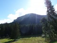
Chamechaude (2,082 m) and the Dent de Crolles (2,062 m) are the two highest peaks in the Chartreuse; allow for a walk of around 30 km – fancy a go?
From Col du Coq to Sainte-Marie-du-Mont
 14.29 mi
+4,423 ft
-5,938 ft
10h 25
Very difficult
Departure from Saint-Pancrasse (Isère)
14.29 mi
+4,423 ft
-5,938 ft
10h 25
Very difficult
Departure from Saint-Pancrasse (Isère)
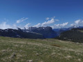
The route runs mainly through the Chartreuse Natural Park, passing through the massif's iconic passes and mountains. The route combines fairly steep climbs, passages through plateaus, mountain pastures and a village.
Aulp du Seuil Hut – Pravouta Hut
6.81 mi
+2,815 ft
-3,009 ft
8 hrs
Very difficult
Departure from Saint-Bernard (Isère) (Isère)
Day2 of this trip via the Col de Bellefont to reach the Dent de Crolles plateau.Descent via the pass above the Trou du Glaz, then down to the Col des Ayes and up the Roc d’Arguille to the Col de Pravouta and the hut of the same name.
⚠️ 27/11/2025: Route modified following a rockfall. It is no longer possible to take the path via the Trou du Glaz (5). The area remains particularly dangerous due to the high risk of further rockfall and falling boulders. Following this incident, the municipality of Saint-Pierre de Chartreuse has issued a by-law to close several hiking trails (for walking, snowshoeing and ski touring). For an ascent of the Dent de Crolles, it is possible to take the route via the Pas de l’Oeille.
You can also go via the Guiers waterfalls to reach (E).
Manival - Côte Bonne
 4.52 mi
+1,434 ft
-1,421 ft
3h 20
Easy
Departure from Saint-Ismier (Isère)
4.52 mi
+1,434 ft
-1,421 ft
3h 20
Easy
Departure from Saint-Ismier (Isère)
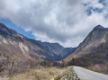
Footprints in the snow for this walk, which can be enjoyed in the summer sun or in the shade of oak and fir trees...
Le Pal de Fer
1.43 mi
+2,001 ft
-0 ft
2h 25
Moderate
Departure from Crolles (Isère)
An original outing that allows you to discover the superb work carried out here for the construction of the Touvet funicular railway. The ascent is on foot and the descent, to relieve the knees, is by funicular.
(Please note): This route is currently closed. See explanations here
(Comment from a hiker) dated 18 June 2023: small difficult section: crossing the scree slope where you need to use two ropes to reach the path in the forest.
From Sassenage to Noyarey on the slopes of the Vercors
 3.77 mi
+1,125 ft
-1,119 ft
2h 45
Moderate
Departure from Sassenage (Isère)
3.77 mi
+1,125 ft
-1,119 ft
2h 45
Moderate
Departure from Sassenage (Isère)
This exploratory hike along the paths on the northern flank of the Vercors should be treated as a training session if it is cold higher up. There are three viewpoints, two of which have been developed.
That said, the constant change in gradient along this route is sure to please any hiker or runner hoping to tackle the drovers' road leading to the Sornin plateau at a later date.
This walk is only enjoyable in dry weather, as the slopes become slippery after rain.