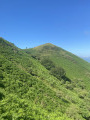
Ainhoa – Col des Veaux

Thefirst stage of a challenging hike linking Ainhoa to the Esteben farm at the Col des Veaux, via Mondarrain and Artzamendi. The return route is described in a second stage.
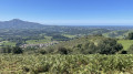
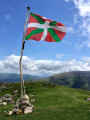
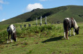
As well as the numerous 360° views offered by the various peaks climbed during this hike, you may also come across many birds of prey, horses, sheep and cows roaming freely.

Details

10627774
Creation:
Last update:
Last review:
  • Walking
    Activity: Walking
  • ↔
    Distance: 10.75 mi
  • ◔
    Average duration: 8h 50 
  • ▲
    Difficulty: Difficult

  • ⚐
    Back to start: No
  • ↗
    Ascent: + 4,462 ft
  • ↘
    Descent: - 2,995 ft

  • ▲
    Highest point: 2,421 ft
  • ▼
    Lowest point: 374 ft

Photos

Description of the walk

Park in the car park to the east of Ainhoa Church.

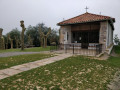
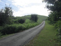
(S) Take the tarmac road heading eastwards towards the mountains. At the water point, continue along the road to the right, and a few dozen metres further on, begin the ascent by following theGR®10along the path that branches off to the left. Continue climbing, following the red and white markings ofthe GR®10, until you reach the Chapel of the Hawthorn.

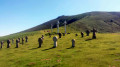
(1) Pass the cemetery with the three crosses on your left, then leave theGR®10by taking the path that climbs quite steeply to the right. Begin the ascent of Mont d’Errebi here. Reach the summit.

(2) Continue straight ahead downhill to reach the Col des Trois Croix.

(3) Take the path straight ahead which climbs up to the Col Soporro, then descend to rejoin theGR®10. Continue until you reach a junction with a building on your left.

(4) Leave theGR®10and turn left onto the path leading to the Pic d’Ourrezti. Once at the summit, head north towards the Mondarrain. Then make your way to the foot of this peak.

(5) Take the path on the left to climb to the summit of Mondarrain. Enjoy the view from here.

(6) Return to the previous junction.

(5) Turn left to begin the descent, reaching the Gerastoko Bidea road at the Harlephoa farm.

(7) Turn right onto this road and follow it. Cross a bridge over a stream. Continue along this road until you reach a hairpin bend.

(8) Leave the road here and take a small path to begin the ascent of Artzamendi. Continue along the path as it climbs until you reach a fork on a small plateau near the Abilaenborda farms.

(9) Take the path that climbs to the left; be careful here, as the path is not always very visible and is sometimes narrow – stay alert so as not to stray off the path. You will reach the foot of Artzamendi.

(10) Continue on level ground and then begin a descent, keeping parallel to the mountain. Carry on in this way until you join theGR®10at the car park at the Col de Mehatse.

(11) Here you have two options:
- head left up towards Pic Iguzki, then descend to reach the Col des Veaux,
- follow theGR®10to the right to reach the Col des Veaux directly.

(12) Continue along theGR® to reach the rest stop at the Esteben farm (E).

Waypoints

  1. S : mi 0 - alt. 384 ft - Car park at the - Église Notre-Dame-de-l'Assomption (Ainhoa)
  2. 1 : mi 1.3 - alt. 1,273 ft - Chapelle Notre-Dame d'Arantza (Ainhoa)
  3. 2 : mi 1.92 - alt. 1,903 ft - Errebi (583m)
  4. 3 : mi 2.3 - alt. 1,680 ft - Col des Trois Croix (512m)
  5. 4 : mi 3.63 - alt. 1,457 ft - Junction for Mondarrain
  6. 5 : mi 4.53 - alt. 2,224 ft - Crossroads below Mondarrain
  7. 6 : mi 4.71 - alt. 2,329 ft - Mondarrain
  8. 7 : mi 6.1 - alt. 997 ft - Gerastoko Bidea route
  9. 8 : mi 7.1 - alt. 587 ft - Hairpin bend
  10. 9 : mi 7.67 - alt. 1,152 ft - Abilaenborda crossroads
  11. 10 : mi 8.48 - alt. 2,224 ft - Beneath Artzamendi
  12. 11 : mi 9.29 - alt. 2,346 ft - Col de Mehatze ou col Méhatché (716m)
  13. 12 : mi 10.51 - alt. 1,850 ft - Col des Veaux (548m)
  14. E : mi 10.75 - alt. 1,841 ft - Esteben Farm

Notes

There is a drinking water tap right at the start of the walk, just as you leave Ainhoa, before turning off the road onto the footpath.
::A: You can stay at the lodge or find a place to camp.

Worth a visit

Several points of interest, including:
- The Aubepine Chapel
- Mount Errebi
- Mondarrain: views across the Basque Country as far as the sea in good weather
- Artzamendi, though you don’t need to go all the way to the summit

Always be cautious and plan ahead when you're outdoors. Visorando and the author of this route cannot be held responsible for any accidents occurring on this route.

The GR® and PR® markings are the intellectual property of the Fédération Française de Randonnée Pédestre.

Reviews and comments

4.8 / 5
Based on 2 reviews

Reliability of the description
5 / 5
Ease of following the route
4.5 / 5
Route interest
5 / 5
Bertho
Bertho

Overall rating : 4.7 / 5

Date of your route : Jul 18, 2021
Reliability of the description : ★★★★★ Very good
Ease of following the route : ★★★★☆ Good
Route interest : ★★★★★ Very good
Very busy route : No

A lovely walk with beautiful scenery – and sunshine to boot.

Machine-translated

Cha33
Cha33

Overall rating : 5 / 5

Date of your route : Jul 09, 2021
Reliability of the description : ★★★★★ Very good
Ease of following the route : ★★★★★ Very good
Route interest : ★★★★★ Very good
Very busy route : No

A really lovely walk – a bit of a slog at the start, but the scenery is well worth it. It’s best to do the circular walk over two days, stopping off at the Esteben Borda farm in Itxassou. You can have a drink, a bite to eat and so on there. I’d highly recommend this walk – the views are stunning and the route is interesting. There’s a wide variety of flora and fauna to spot along the way.

Machine-translated

Other walks in the area

For more walks, use our search engine .

The GPS track and description are the property of this route's author. Please do not copy them without permission.