


Col des Veaux depuis Ainhoa, par Le Mondarrain et l'Azrtamendi et retour

Une rando physique en 2 jours, qui relie Ainhoa à la ferme Esteben au col des Veaux, en passant par le Mondarrain et l'Artzamendi :
1er jour: 18 km / 1340 d+
2ème jour : 11 km / 230 d+
Outre les nombreux points de vue à 360° offerts par les différents sommets gravis durant cette rando, vous pourrez également rencontrer de nombreux rapaces, chevaux, brebis, et vaches, qui se promènent en liberté.
Details
Creation:
Last update:
-
 Activity: Walking
 -
 Distance: 17.67 mi
 -
 Average duration: 2 days
 -
 Difficulty: Difficult
 -
-
 Back to start: Yes
 -
 Ascent: + 5,171 ft
 -
 Descent: - 5,184 ft
 -
-
 Highest point: 2,398 ft
 -
 Lowest point: 377 ft
-
 Country:
France
Country:
France
-
 Areas: Pyrenees, Basque Country
 -
 City:
Ainhoa (64250)
City:
Ainhoa (64250) -
 Start/End: N 43.306827° / W 1.497735°
 -


 Hour-by-hour weather


Photos
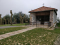
Stages of the route
This route needs several days, find the details below:
Other walks in the area
Ainhoa – Col des Veaux
 Visorando Member
10.75 mi
+4,462 ft
-2,995 ft
8h 50
Difficult
Visorando Member
10.75 mi
+4,462 ft
-2,995 ft
8h 50
Difficult
 Departure from Ainhoa (Pyrénées-Atlantiques)
Thefirst stage of a challenging hike linking Ainhoa to the Esteben farm at the Col des Veaux, via Mondarrain and Artzamendi. The return route is described in a second stage.
As well as the numerous 360° views offered by the various peaks climbed during this hike, you may also come across many birds of prey, horses, sheep and cows roaming freely.
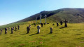
Chapel of Aubépine d'Aïnhoa via the Murruaenea farm
 5.46 mi
+1,699 ft
-1,690 ft
4h 00
5.46 mi
+1,699 ft
-1,690 ft
4h 00
 Easy
Departure from Ainhoa (Pyrénées-Atlantiques)
Easy
Departure from Ainhoa (Pyrénées-Atlantiques)
Climb up to the oratory overlooking Aïnhoa through the forest to enjoy a magnificent view of the Atlantic coast and the most important Basque peaks.
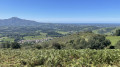
The Mont Errebi loop starting from Ainhoa
 5.34 mi
+1,634 ft
-1,621 ft
3h 55
5.34 mi
+1,634 ft
-1,621 ft
3h 55
 Moderate
Departure from Ainhoa (Pyrénées-Atlantiques)
Moderate
Departure from Ainhoa (Pyrénées-Atlantiques)
This hike starts in one of the most beautiful villages in the Basque Country. The route takes you up a series of climbs to the Col des Trois Croix. From there, you climb to the summit of Errebi. The view stretches from the ocean to the mountains of Labourd.
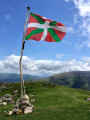
Mondarrain Peak from Ainhoa
 8.89 mi
+3,205 ft
-3,179 ft
6h 55
Moderate
Departure from Ainhoa (Pyrénées-Atlantiques)
8.89 mi
+3,205 ft
-3,179 ft
6h 55
Moderate
Departure from Ainhoa (Pyrénées-Atlantiques)
This walk takes you past the Chapel of l’Aubépine, Mount Errebi, Mount Soporro, the Pic d’Ourrezti, and finally the Pic du Mondarrain. The return journey follows part of theGR®10, avoiding the steep climbs of the previous mountains. You’ll have the pleasure of encountering sheep and wild horses. At the Pic du Mondarrain, you’ll be rewarded with the chance to take a photo beneath a giant Basque Country flag, with views stretching all the way to the sea.
Bistaeder from Ainhoa
 Local authority
 5.41 mi
+1,362 ft
-1,368 ft
3h 40
Moderate
Departure from Ainhoa (Pyrénées-Atlantiques)
5.41 mi
+1,362 ft
-1,368 ft
3h 40
Moderate
Departure from Ainhoa (Pyrénées-Atlantiques)
Ainhoa, ranked among the most beautiful villages in France, invites you to discover its gentle environment. The shimmering half-timbered houses in the village centre give way to peaceful countryside dotted with isolated farms. A steady but relatively short climb in the company of pottoks and flocks of sheep takes you up the hillsides and mountains. This is followed by a magnificent open balcony path, offering a vast panorama of Spain, the Nivelle valley, the Rhune and, further away, the coast. Three huge white crosses proudly dominating the village of Ainhoa and facing the pyramidal summit of Atxuria guide your steps towards Notre-Dame de l'Aubépine, a divine spot for a picnic. Here, splendid Basque steles add to the spiritual dimension of this unique viewpoint.
Circuit from the chapel to Aïnhoa
 4.88 mi
+1,050 ft
-1,043 ft
3h 10
Moderate
Departure from Ainhoa (Pyrénées-Atlantiques)
4.88 mi
+1,050 ft
-1,043 ft
3h 10
Moderate
Departure from Ainhoa (Pyrénées-Atlantiques)
A magnificent route that will take you up high and offer superb views of the village and the Rhune.
 Association / Club / Walk leader
For more walks, use our search engine .
The GPS track and description are the property of this route's author. Please do not copy them without permission.

