Mondarrain Peak from Ainhoa

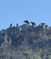
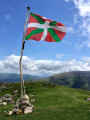
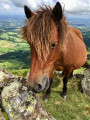
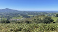
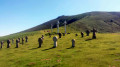
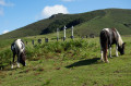
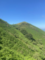
This walk takes you past the Chapel of l’Aubépine, Mount Errebi, Mount Soporro, the Pic d’Ourrezti, and finally the Pic du Mondarrain. The return journey follows part of theGR®10, avoiding the steep climbs of the previous mountains. You’ll have the pleasure of encountering sheep and wild horses. At the Pic du Mondarrain, you’ll be rewarded with the chance to take a photo beneath a giant Basque Country flag, with views stretching all the way to the sea.

Details

3688667
Creation:
Last update:
Last review:
  • Walking
    Activity: Walking
  • ↔
    Distance: 8.89 mi
  • ◔
    Average duration: 6h 55 
  • ▲
    Difficulty: Moderate

  • ⚐
    Back to start: Yes
  • ↗
    Ascent: + 3,205 ft
  • ↘
    Descent: - 3,179 ft

  • ▲
    Highest point: 2,451 ft
  • ▼
    Lowest point: 371 ft

Photos

Description of the walk

Park in the car park in the centre of the village of Ainhoa.

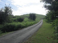
(S/E) Head downhill towards the wayside shrine. At the cross, leave the one-way road and the access to the hotel on your left. Follow the red and white markings ofthe GR®10to the right, heading up the road. The road continues, flanked by high, wooded embankments. Once you have passed the first houses, at the crossroads, continue to the right; the oratory is signposted at the foot of a water source adorned with a red shutter. Follow the Way of the Cross to reach thefourth cross.

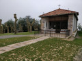
(1) Take the path on the right and, further up, cross a pasture to reach the Chapelle de l’Aubépine with its crosses. Continue on to a crossroads with several directions.

(2) Take the path on the left, which runs parallel to theGR®10, and continue the climb to reach Mont Errebi.

(3) Begin a short descent across the plateau, then follow a gentle climb to reach the Col des Trois Croix.

(4) Walk past some hunting hides for wood pigeons and easily reach Mont Soporro.

(5) Descend to theGR®10junction near the Gainekoborda barn.

(6) Take the path running parallel to the track and arrive at another junction with several directions.

(7) Leave the track and turn left onto the steep path to reach the summit of Pic d’Ourrezti.

(8) Take the ridge path to the left to reach the summit of Pic du Mondarrain.

(9) Retrace your steps along the previous route until you reach the junction at the Gainekoborda barn.

(6) Take theGR®10on the left and follow thisGR® route to the Col des Trois Croix.

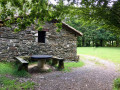
(4) Leave theGR® here and turn left. Continue downhill until you reach the junction with the path leading to the Erramuntenborda barn.

(10) Ignore this path; take the one on the right, continue downhill and rejoin theGR®10at the junction you passed on the way out.

(2) Follow the route you took on the way there in the opposite direction to return to the Ainhoa car park (S/E).

Waypoints

  1. S/E : mi 0 - alt. 371 ft - Car park in the village of Ainhoa
  2. 1 : mi 0.48 - alt. 715 ft - Crossroads at Cross 4
  3. 2 : mi 1.02 - alt. 1,312 ft - Crossroads of the circular loop - Chapelle Notre-Dame d'Arantza (Ainhoa)
  4. 3 : mi 1.58 - alt. 1,883 ft - Errebi (583m)
  5. 4 : mi 1.93 - alt. 1,686 ft - Col des Trois Croix (512m)
  6. 5 : mi 2.3 - alt. 2,018 ft - Mount Soporro
  7. 6 : mi 2.89 - alt. 1,427 ft - Gainekoborda
  8. 7 : mi 3.19 - alt. 1,460 ft - Junction of track and footpath
  9. 8 : mi 3.66 - alt. 2,113 ft - Pic d’Ourrezti
  10. 9 : mi 4.23 - alt. 2,451 ft - Mondarrain
  11. 10 : mi 6.99 - alt. 1,424 ft - Erramuntenborda crossroads
  12. S/E : mi 8.89 - alt. 374 ft - Car park in the village of Ainhoa

Notes

The walking time was 4 hours without breaks. Allow 5 hours 30 minutes including a picnic and breaks

Worth a visit

Discover the pidgeon hunting huts along the way and come across wild horses.
Each hill offers a new viewpoint, culminating in the view from Mondarrain.

Always be cautious and plan ahead when you're outdoors. Visorando and the author of this route cannot be held responsible for any accidents occurring on this route.

The GR® and PR® markings are the intellectual property of the Fédération Française de Randonnée Pédestre.

Reviews and comments

4.6 / 5
Based on 3 reviews

Reliability of the description
5 / 5
Ease of following the route
4 / 5
Route interest
4.7 / 5
Uxel85
Uxel85

Overall rating : 4.7 / 5

Date of your route : Jul 22, 2025
Reliability of the description : ★★★★★ Very good
Ease of following the route : ★★★★☆ Good
Route interest : ★★★★★ Very good
Very busy route : No

A very beautiful hike, safe but nevertheless quite physically demanding with an elevation gain of 1,000 metres, completed in just under 5 hours without rushing.

Machine-translated

Ducrum
Ducrum

Overall rating : 4.3 / 5

Date of your route : Aug 26, 2024
Reliability of the description : ★★★★★ Very good
Ease of following the route : ★★★★☆ Good
Route interest : ★★★★☆ Good
Very busy route : No

A fairly challenging hike – 16 km and almost 1,000 metres of elevation gain – but the view is definitely worth the effort

Machine-translated

Lilian P
Lilian P

Overall rating : 4.7 / 5

Date of your route : Apr 20, 2024
Reliability of the description : ★★★★★ Very good
Ease of following the route : ★★★★☆ Good
Route interest : ★★★★★ Very good
Very busy route : Yes

A lovely walk in fine weather with some fairly steep slopes. The track below Urrezti isn’t easy to find – make sure you follow the GPS track closely. The return route takes you past the peaks.

Machine-translated

Other walks in the area

For more walks, use our search engine .

The GPS track and description are the property of this route's author. Please do not copy them without permission.