Refine your search for walks in Aiguille de l'Épaisseur (3230 m)
Aiguille de l'Épaisseur (3230 m) walks


 Aiguille de l’Épaisseur
 Visorando Member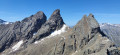
 8.62 mi
 +5,062 ft
 -5,062 ft
 8 hrs
8 hrs
 Very difficult
 Departure from Valloire (Savoie)
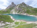
Although it looks like a large hill from its south-eastern slope, the ascent of the Aiguille de l’Épaisseur is very physically demanding in its final section, from the refuge, with 970 m of elevation gain over 3 km, representing an average gradient of over 35 per cent. However, it probably offers the finest view of the Aiguilles d’Arves you can get, not to mention a magnificent 360° panorama.
This hike is not very popular, which is hardly surprising given the final ascent. It is reserved for seasoned hikers who are not too prone to vertigo.
Walks near Aiguille de l'Épaisseur (3230 m)
La Grave – Goléon Mountain Hut
4.72 mi
+3,271 ft
-108 ft
5h 00
 Difficult
Departure from La Grave (Hautes-Alpes)
Difficult
Departure from La Grave (Hautes-Alpes)
The idea behind this three-day self-supported trek is to link the Goléon massif to the Grandes Rousses massif via the ridges to the north of the Plateau d’Emparis.
It’s a wild hike requiring not only good physical fitness but also the ability to read maps and the terrain.
Thefirst day is just a warm-up.
From Goléon to Les Grandes Rousses: La Grave / Clavans
86.50 mi
+29,537 ft
-26,375 ft
3 days
Very difficult
Departure from La Grave (Hautes-Alpes)
From the Goléon massif to the Grandes Rousses massif, via the ridges between Emparis and Arves.A multi-day hike, with a bivouac, along the ridges between Emparis and Arves.
La Grave - Alpe de Villar-d'Arêne mountain hut
 6.87 mi
+2,618 ft
-669 ft
5h 25
Difficult
Departure from La Grave (Hautes-Alpes)
6.87 mi
+2,618 ft
-669 ft
5h 25
Difficult
Departure from La Grave (Hautes-Alpes)
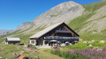
After a rest day in La Grave, set off on this8th stage, which presents no technical difficulties and involves no significant elevation gain. A route that circles La Meije, initially following the Romanche torrent. You will pass close to Villar d'Arène. Thesecond section, starting from Pont d'Arsine, is slightly more challenging and much wilder, taking in the Pas d'Anna Falque and the Plan d'Alpe before reaching the Refuge de l'Alpe de Villar-d'Arêne, which offers breathtaking views of the surrounding mountains.
From Grange Bernard to the Refuge de Terre Rouge
 Association / Club / Walk leader
 5.14 mi
+1,896 ft
-33 ft
4h 00
5.14 mi
+1,896 ft
-33 ft
4h 00
 Moderate
Departure from Valmeinier (Savoie)
Moderate
Departure from Valmeinier (Savoie)
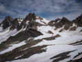
First stage of the Petit tour du Mont Thabor hike
Lac des Cerces - Lacs de la Madeleine via Pointe des Cerces
 7.84 mi
+3,963 ft
-3,261 ft
8 hrs
Very difficult
Departure from Valloire (Savoie)
7.84 mi
+3,963 ft
-3,261 ft
8 hrs
Very difficult
Departure from Valloire (Savoie)
Day 2 in the Clarée Valley: ascent of Pointe des Cerces (unmarked mountain route), passage to Lac and Source de la Clarée and climb to the second bivouac at Lacs de la Madeleine (off-trail on the final section).
As with the other parts of this circular, this route is intended for experienced hikers who are accustomed to high mountains.
From the Col du Lautaret to the Alpe de Villard d'Arène
 3.99 mi
+463 ft
-315 ft
2h 15
Moderate
Departure from Villar-d'Arêne (Hautes-Alpes)
3.99 mi
+463 ft
-315 ft
2h 15
Moderate
Departure from Villar-d'Arêne (Hautes-Alpes)
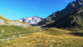
Stage1 of the Tour du Combeynot: From the Col du Lautaret to the Alpe de Villar-d'Arêne refuge via the schistose crevasse trail overlooking the Romanche valley. Unique view of the Écrins and Meije peaks.
Valmeinier 1800 – Refuge du Thabor
 9.69 mi
+5,079 ft
-2,690 ft
10 hrs
Very difficult
Departure from Valmeinier (Savoie)
9.69 mi
+5,079 ft
-2,690 ft
10 hrs
Very difficult
Departure from Valmeinier (Savoie)
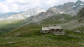
The route begins on theGRP® Tour du Mont Thabor trail, starting from the Petite Station in Valmeinier 1800. You’ll pass the Col des Marches, Lake Bissorte, the Refuge des Marches, Lake des Batailléres, the pass of the same name, Lake Long and Lake Rond before arriving at the Refuge du Thabor.
From the Terre Rouge Refuge to the Mont Thabor Refuge
8.39 mi
+3,740 ft
-2,651 ft
7h 05
Difficult
Departure from Valmeinier (Savoie)
Second stage of the short Mont Thabor circuit hike
Refuge de Terre Rouge - Le Prec
 8.76 mi
+2,165 ft
-3,848 ft
5h 55
Difficult
Departure from Valmeinier (Savoie)
8.76 mi
+2,165 ft
-3,848 ft
5h 55
Difficult
Departure from Valmeinier (Savoie)
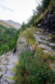
This is the last stage of this three-day route, with one last beautiful climb. A final alpine pass, a few lakes, and the return via the Fenêtre du Prec to round off this lovely Tour du Thabor.