Adarra Mendia

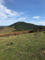
Adarra Mendia is a small peak above San Sebastián, situated above the village of Urnietta in Gipuzkoa.

Details

n°22523157
Creation:
Last update:
Last review:
  • Walking
    Activity: Walking
  • ↔
    Distance: 5.23 mi
  • ◔
    Average duration: 3h 50 
  • ▲
    Difficulty: Moderate

  • ⚐
    Back to start: Yes
  • ↗
    Ascent: + 1,663 ft
  • ↘
    Descent: - 1,647 ft

  • ▲
    Highest point: 2,628 ft
  • ▼
    Lowest point: 961 ft

Description of the walk

To reach the start point, on leaving Urnieta, turn left and climb a small pass towards the Besabi neighbourhood (signposted). Park near the restaurant.

(S/E) Take the track suitable for vehicles which starts to the left of the tourist information signs. Follow the red and white markings. Ignore the paths branching off to the right, pass through a small valley and arrive at a three-way junction.

(1) Leave the track and turn right. Follow the markings and head uphill. At the next junction, turn right, follow the edge of the woodland and then continue through the undergrowth.

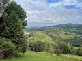
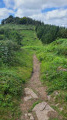
(2) On emerging from the woods, cross a track and head up the slope opposite, due south up a grassy slope to a plateau with unobstructed views and a cromlech.

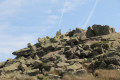
(3) Continue to the left, follow theGR® and then head south up towards the rocky ridge of the Adarra, following the signposts.

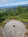
(4) At the summit of the Adarra, enjoy the beautiful view of the coast and the surrounding mountains, then continue due south downhill to rejoin theGR®. Take a short detour to the left and you’ll reach a semi-buried hut.

(5) Take a break here, then continue downhill.

(6) When you reach a menhir, turn right towards the north-east. The path approaches the forest and continues downhill.

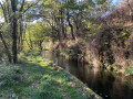
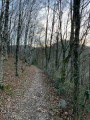
(7) At the fork, continue in the same direction, cross a stream, then pass through a gully and join a track suitable for vehicles. Follow this track to reach Besabi (S/E).

Waypoints

  1. S/E : mi 0 - alt. 965 ft - Besabi
  2. 1 : mi 0.81 - alt. 1,047 ft - Three-way junction, to the right
  3. 2 : mi 1.33 - alt. 1,414 ft - Grassy slope opposite
  4. 3 : mi 1.54 - alt. 1,732 ft - Cromlech
  5. 4 : mi 2.71 - alt. 2,615 ft - Adarra
  6. 5 : mi 3.06 - alt. 2,333 ft - Semi-underground hut
  7. 6 : mi 3.36 - alt. 2,287 ft - Menhir, on the right
  8. 7 : mi 4.23 - alt. 1,827 ft - Crossroads, go straight on
  9. S/E : mi 5.23 - alt. 981 ft - Besabi

Notes

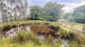
(6) Sheepfold, shelter available.

Always be cautious and plan ahead when you're outdoors. Visorando and the author of this route cannot be held responsible for any accidents occurring on this route.

The GR® and PR® markings are the intellectual property of the Fédération Française de Randonnée Pédestre.

Reviews and comments

4.7 / 5
Based on 1 review

Reliability of the description
5 / 5
Ease of following the route
5 / 5
Route interest
4 / 5
Richard 64600
Richard 64600
• Edited:

Overall rating : 4.7 / 5

Date of your route : Jun 27, 2026
Reliability of the description : ★★★★★ Very good
Ease of following the route : ★★★★★ Very good
Route interest : ★★★★☆ Good
Very busy route : Yes

.

Machine-translated

Other walks in the area

For more walks, use our search engine .

The GPS track and description are the property of this route's author. Please do not copy them without permission.