


Refine your search for walks in Abbaye Ruinée de Saint-Orens
Abbaye Ruinée de Saint-Orens walks


 Lac d'Isaby via the Paspich and Pradets waterfalls, starting from Ortiac
 Visorando Member
 8.88 mi
 +3,205 ft
 -3,225 ft
 6h 50
6h 50
 Difficult
 Departure from Villelongue (Hautes-Pyrénées)
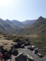
Here is another way to reach Lac d’Isaby from Ortiac. Along the way, you will visit the ruins of Saint-Orens Abbey and the Paspich and Pradets waterfalls before reaching Lac d’Isaby and climbing up to the Cabane Picourlet.
Saint-Orens Abbey and Lake Isaby from Ortiac
 7.88 mi
+2,608 ft
-2,608 ft
5h 55
7.88 mi
+2,608 ft
-2,608 ft
5h 55
 Moderate
Departure from Villelongue (Hautes-Pyrénées)
Moderate
Departure from Villelongue (Hautes-Pyrénées)
A beautiful hike that leads to Lake Isaby via the ruins of Saint-Orens Abbey and the Isaby Valley. A pleasant trail, sometimes steep, mostly in the forest before coming out onto the lake and the surrounding peaks (Soum and Pic de Léviste, Soum Arrouy, Soum de Lascours).
Walks near Abbaye Ruinée de Saint-Orens
3 days in the Central Pyrenees Park from Cauterets
 30.88 mi
+10,197 ft
-10,226 ft
3 days
Difficult
Departure from Cauterets (Hautes-Pyrénées)
30.88 mi
+10,197 ft
-10,226 ft
3 days
Difficult
Departure from Cauterets (Hautes-Pyrénées)
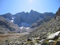
Explore the Pyrenees National Park (central section) with a trip to Spain, lakes and mountain passes at an altitude of 2,600 metres.
With an average elevation gain of ± 1,230 m and a distance of 17 km per day, this trip is, all in all, quite strenuous.
Please take into account the cumulative elevation gain and the distance to be covered.
The trip takes place between 1000 m and 2655 m altitude.
The start of this route is accessible by public transport (coaches and shuttle bus from Cauterets in summer).
From Cauterets to Ilhéou
 9.24 mi
+4,295 ft
-1,217 ft
8h 00
Moderate
Departure from Cauterets (Hautes-Pyrénées)
9.24 mi
+4,295 ft
-1,217 ft
8h 00
Moderate
Departure from Cauterets (Hautes-Pyrénées)
First day of a three-day route in the Central Pyrenees National Park.
This circular is best done from mid-June until the first cold spells.
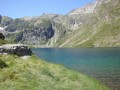
Ascent to Lac Noir, Col d'Ilhéou, Ilhéou Refuge and Lac d'Ilhéou.
Tournaboup - Bastan Refuge
 8.80 mi
+4,337 ft
-1,742 ft
7h 50
Difficult
Departure from Barèges (Hautes-Pyrénées)
8.80 mi
+4,337 ft
-1,742 ft
7h 50
Difficult
Departure from Barèges (Hautes-Pyrénées)
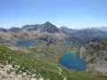
First stage of the Three Days in the Néouvielle Nature Reserve and its lakes.From the Tournaboup car park to the Bastan refuge.A fairly challenging hike due to its elevation gain and short distance.At point (6), it is possible to shorten the route and reduce the elevation gain. See Practical Information.At (7), it is possible to shorten the route and reduce the elevation gain slightly by taking a south-facing, balcony-style path.
Please note: the refuge has been closed by the authorities since May 2025
From Tournaboup to Lac de l’Oule
11.29 mi
+3,957 ft
-2,785 ft
8h 40
Difficult
Departure from Barèges (Hautes-Pyrénées)
First day of a three-day circular route, from the Tournaboup car park to Lac de l’Oule. The first section up to the Col de Madamète is quite stony and requires good footwear, but after that it’s a real pleasure to walk past the magnificent Néouvielle lakes, including, amongst others, Lac d’Aumar, Lac d’Aubert and Lac de l’Oule.
Pont d'Espagne - Bayssellance Refuge
7.06 mi
+4,147 ft
-279 ft
6h 50
Difficult
Departure from Cauterets (Hautes-Pyrénées)
Approach walk starting from Pont d'Espagne, passing by the magnificent Lac de Gaube, the Oulettes de Gaube and the refuge of the same name. The stage continues with a steeper climb to the Lacs d'Arraillé, then the Hourquette d'Ossoue pass before descending to the Refuge de Bayssellance.
From the Col de Couraduque to the Col du Soulor via Lac de Soum
 5.01 mi
+1,083 ft
-738 ft
3h 15
Moderate
Departure from Aucun (Hautes-Pyrénées)
5.01 mi
+1,083 ft
-738 ft
3h 15
Moderate
Departure from Aucun (Hautes-Pyrénées)
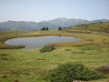
An easy walk with some lovely views. Using two cars (one at Couraduque and one at Soulor) makes this walk accessible to everyone. Otherwise, you can return via the same route in the opposite direction.
From the Ilhéou Refuge to the Wallon Refuge via the Opale Lakes
 8.41 mi
+3,114 ft
-3,507 ft
6h 35
Difficult
Departure from Estaing (Hautes-Pyrénées) (Hautes-Pyrénées)
8.41 mi
+3,114 ft
-3,507 ft
6h 35
Difficult
Departure from Estaing (Hautes-Pyrénées) (Hautes-Pyrénées)
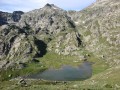
Second day of a three-day route in the Central Pyrenees National Park.The day will begin with a fairly steep climb, but will allow you to see a multitude of high-altitude lakes before arriving at the Wallon refuge.If there is not enough time, the visit to the Opale lakes can be omitted.
Lac de Gaube - Cabane des Tousaus
 13.88 mi
+3,950 ft
-3,638 ft
9h 50
Difficult
Departure from Cauterets (Hautes-Pyrénées)
13.88 mi
+3,950 ft
-3,638 ft
9h 50
Difficult
Departure from Cauterets (Hautes-Pyrénées)
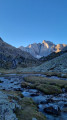
Second stage of the four-day adventure from Cauterets to Luz-Saint-Sauveur via Petit Vignemale and Gavarnie. It can be done in one day, but I think it would be more enjoyable to split it into two days to take the time to appreciate the magnificent scenery!
Aygues-Cluses Refuge - Campana de Cloutou Refuge
 4.62 mi
+2,146 ft
-1,867 ft
4h 00
Difficult
Departure from Barèges (Hautes-Pyrénées)
4.62 mi
+2,146 ft
-1,867 ft
4h 00
Difficult
Departure from Barèges (Hautes-Pyrénées)
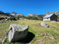
Day three of the four-day Tour du Massif de Néouvielle, the shortest route of the four days, but no less magnificent.This hike is classified as difficult due to the ascent of Pic d'Aygues-Cluses (T5 ridge). See the variants if you wish to avoid the peak or climb it in the other direction (less complicated).
The Henri IV Trail
 20.70 mi
+732 ft
-1,421 ft
10h 10
Difficult
Departure from Lourdes (Hautes-Pyrénées)
20.70 mi
+732 ft
-1,421 ft
10h 10
Difficult
Departure from Lourdes (Hautes-Pyrénées)
A beautiful route linking Lourdes to Pau along an ancient Roman road steeped in history. The Henri IV trail stretches across the Hautes-Pyrénées and Pyrénées-Atlantiques departments, along the foothills of the Pyrenees.