Country:

 City:
City:


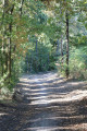
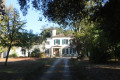
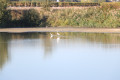
The car park is situated along the Allée de Panchon. Alternatively, during school holidays, you can use the car park at the Collège Panchon d’Arsac.
(S/E) Take the Allée de Panchon towards the woods, heading south-east. When the road turns sharply left towards the hamlet of Panchon, take the path opposite, passing through the barrier blocking access to motor vehicles.
(1) After about fifty metres, turn right onto the DFCI track no. 50, known as ‘Cabane’, heading south.
(2) At a triangular junction, turn left onto track No. 54, known as ‘Paradis’. The track heads east-southeast and soon runs alongside a clearing on the left used for horse breeding. Shortly afterwards, just as the track makes a right-angle bend to the right, take the small path opposite, crossing a shallow gully. Continue until you reach a wider track which forms part of one of the Camino de Santiago routes (GR® 81).
(3) Turn left to follow this new track northwards. After about three hundred metres, the path curves in an ‘S’ shape to the right. The route leaves the GR®81. Continue to a ‘T’-junction. Turn left to follow track no. 49, known as Monteil. You are now back on the GR®81. Further on, it crosses the Ruisseau du Fond de Martian (which may be dry during a heatwave). When you reach the Allée des Monteils, pass through the barrier blocking motorised traffic. The route arrives at the junction with Rue de la Lagune, which is quite busy.
(4) Cross it carefully and take the footpath to the right, which runs alongside it behind a low hedge, heading south-east. At the junction with the Allée de Canot, turn left onto it.
(5) About 200 m after the junction, turn right onto track no. 34, known as Pinque, which heads east. Go through the barrier blocking motorised traffic. The track crosses the Ruisseau du Fond de Martian once again and veers to the right, heading south-east.
(6) At the junction with track no. 14, known as ‘Pas Martin’, turn left and follow it northwards. Shortly afterwards, the track crosses the Ruisseau du Fond de Martian, then a second seasonal stream, the Ruisseau de Lesclause, before joining Rue de Guiton. Turn right for about thirty metres before turning left onto track no. 57, known as Faudaugey. Pass the barrier prohibiting motorised vehicles. Follow the track until you run alongside a gravel pit on your right and come out onto Avenue Jean-Luc Vanderheyden. Turn right and follow the road with care, keeping to the right-hand verge. The road runs between two gravel pits and arrives at the entrance to the Domaine de Cordet.
(7) Cross the road carefully and take the track leading straight ahead towards the north. Shortly afterwards, the track runs between two gravel pits. At the corner of the one on the right, turn right to continue running alongside it. A little further on, the vineyards on the left give way to another gravel pit.
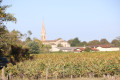
(8) At the eastern corner of the gravel pit, turn onto the path running alongside it on your left, with vineyards on your right. At the next corner of the gravel pit, turn left to continue running alongside it. At the next junction, at the western corner of the gravel pit, take the path on the right which leads towards a track serving the hamlet of Bel-Air. When you reach this track, turn left and, at the next junction, turn right to follow a gravel pit on your left. The path heads west towards Montbrison Castle. As you approach the castle, the route takes you through vineyard plots. When you reach the level ground, admire the castle on your right and its beautiful driveway leading to it on the left. Continue straight on. Further on, the path, heading towards the hamlet of Tricot, veers to the right.
(9) Turn left onto the sandy white track heading south. When you reach Avenue Jean-Luc Vanderheyden, cross it carefully and follow the Allée des Graves opposite, which leads into the woods. On emerging from the woods, continue straight on along Rue du Bois de Lagunate. At the junction with Rue de Guiton, take the unnamed road on the right.
(10) At the junction with Rue du Gravier, turn left, then right after about fifty metres onto Allée de Matalin. Towards the end of the lane, take the track on the left, No. 50, known as Cabane. Follow it until you reach the gate you passed on the way there.
(1) Continue to the right towards Allée de Panchon and return to the car park. (S/E).
 Visorando Member


 Moderate
 Association / Club / Walk leader