In search of the Tortillard

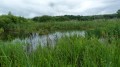
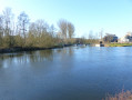
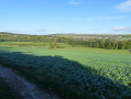
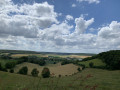
The route has the advantage of being more than 80 per cent on paths through more or less undulating countryside and runs alongside the old Tortillard railway line.
It partly follows theGR®125.

Details

68216
Creation:
Last update:
Last review:
  • Walking
    Activity: Walking
  • ↔
    Distance: 16.19 mi
  • ◔
    Average duration: 8h 15 
  • ▲
    Difficulty: Moderate

  • ⚐
    Back to start: Yes
  • ↗
    Ascent: + 889 ft
  • ↘
    Descent: - 873 ft

  • ▲
    Highest point: 479 ft
  • ▼
    Lowest point: 164 ft
  • ⚐ Country: France
  • ⚐ City: Molliens-Dreuil (80540)
  • ⚑
    Start/End: N 49.884219° / E 2.020223°
  • ❏
    IGN map(s): Ref. 2208E, 2208O, 2209E, 2209O
  • Hour-by-hour weather

Description of the walk

Start from the church in Molliens-Dreuil.

(S/E) With your back to the church in Molliens-Dreuil, turn left onto the street heading towards Bougainville.
You are now on theGR®125; after 150 metres uphill, turn right onto Rue d’en Haut and continue to the end of the street (GR®125).
Turn left, still on theGR®125, towards Saint-Aubin-Montenoy.
As you approach Saint-Aubin-Montenoy, theGR® veers to the left. Carry on straight ahead, leaving the GR®.

(1) At the entrance to the village, turn right twice. Take the path that climbs gently across the fields. You’ll reach a crossroads 1.3 km further on.

(2) Turn left onto the path leading down towards Gouy l’Hôpital and enter Gouy.

(3) After the first right-hand bend, at the wayside cross, turn right onto a small grassy path that climbs.
At the top of the path, continue along the track to the right. Walk for about 1 km.

(4) At the edge of the woods, take the path on the left which will lead you to Lincheux Hallivillers.
Head down into the village and make your way to the church.

(5) Opposite the church, walk up the street on your right (Rue du Commandant EARD) and take the first street on the right as you leave the village.
On the hill, take the second path on the left.

(6) Turn onto this path and go straight on until you reach the county road, which you cross. Continue along the path until you reach the country lane.

(7) Take this on the left for 300 metres and turn right. Head towards the village of Aumont.

(8) At the entrance to the village, by the wayside cross, turn left onto the path round the village. Cross the road and continue along the path which takes you to the village outskirts. At the wayside cross, turn left onto the departmental road for 150 metres.

(9) At the cemetery, take the path on the right. At the end of this path, at the foot of an embankment, take the path on the left and join the route (GR®125).

(10) Follow this road to the right. Go up the hill and, at the first junction, take the second left, still on theGR®125. Carry on straight ahead, cross the RD1001 and head a few metres into the woods.

(11) Take the first path on the right for about 300 metres, then veer to the right. Continue straight on until you reach the village of Camps-en-Amiénois.

(12) At the wayside cross, turn left and, after 150 metres, take the first path on the right. Carry on straight ahead to reach Molliens-Dreuil. As you approach the village, turn right and join the main road.

(13) At the road, turn left and return to your starting point (S/E).

Waypoints

  1. S/E : mi 0 - alt. 164 ft - Turn your back on the church in Molliens-Dreuil
  2. 1 : mi 2.88 - alt. 420 ft - At the entrance to the village, turn right twice
  3. 2 : mi 3.74 - alt. 407 ft - Turn left
  4. 3 : mi 4.59 - alt. 354 ft - At the wayside shrine, turn right onto a small path
  5. 4 : mi 5.36 - alt. 325 ft - Take the path on the left
  6. 5 : mi 6.16 - alt. 302 ft - Head down into the village and make your way to the church
  7. 6 : mi 6.58 - alt. 335 ft - On the hill, take the second path on the left
  8. 7 : mi 7.93 - alt. 449 ft - Take the road on the left, then turn right
  9. 8 : mi 8.96 - alt. 417 ft - At the entrance to the village, by the wayside cross, turn left
  10. 9 : mi 10.1 - alt. 390 ft - At the cemetery, take the path on the right
  11. 10 : mi 11.26 - alt. 213 ft - You’ve now joined the GR125
  12. 11 : mi 12.3 - alt. 282 ft - In the woods, take the first path on the right
  13. 12 : mi 13.72 - alt. 374 ft - At the wayside shrine, turn left
  14. 13 : mi 15.8 - alt. 180 ft - As you approach the village, turn right
  15. S/E : mi 16.19 - alt. 164 ft - Church in Molliens-Dreuil

Notes

In Lincheux Hallivillers and Méricourt-en-Vimeu, you’ll pass by a cemetery where you can top up your water supplies.
There’s a lovely little spot in Lincheux Hallivillers or Méricourt-en-Vimeu for a picnic.
In Molliens-Dreuil, there are a few shops for those who’ve forgotten to stock up on supplies.

Worth a visit

Make sure you stop regularly and look up from your shoes to take in the countryside.

Always be cautious and plan ahead when you're outdoors. Visorando and the author of this route cannot be held responsible for any accidents occurring on this route.

The GR® and PR® markings are the intellectual property of the Fédération Française de Randonnée Pédestre.

Reviews and comments

4 / 5
Based on 3 reviews

Reliability of the description
4 / 5
Ease of following the route
4.7 / 5
Route interest
3.3 / 5
Aerotophe
Aerotophe
• Edited:

Overall rating : 4 / 5

Date of your route : May 28, 2023
Reliability of the description : ★★★★★ Very good
Ease of following the route : ★★★★★ Very good
Route interest : ★★☆☆☆ Disappointing
Very busy route : No

Hiking. Whilst we’re in the thick of our preparations for the Camino de Santiago, the only things that matter to us are the distance and the terrain.

Machine-translated

thesofre
thesofre

Overall rating : 3.3 / 5

Date of your route : Jun 24, 2020
Reliability of the description : ★★☆☆☆ Disappointing
Ease of following the route : ★★★★☆ Good
Route interest : ★★★★☆ Good
Very busy route : No

At Saint-Aubin: turn back – the path is impassable

Machine-translated

Stef3291
Stef3291

Overall rating : 4.7 / 5

Date of your route : Jul 25, 2016
Reliability of the description : ★★★★★ Very good
Ease of following the route : ★★★★★ Very good
Route interest : ★★★★☆ Good

A walk through the fields
Very little road
Very well-signposted route

Machine-translated

Other walks in the area

For more walks, use our search engine .

The GPS track and description are the property of this route's author. Please do not copy them without permission.