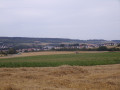
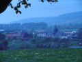
The Bresle Valley from Saint-Germain-sur-Bresle

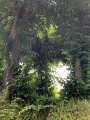
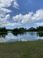
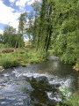
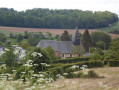
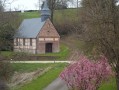
This walk, suitable for everyone, will take you through the Somme and Seine-Maritime departments, across fields and through woods. You’ll be able to explore part of the Bresle valley, the ponds at Neuville-Coppegueule and those at Vieux Rouen-sur-Bresle.

Details

3487612
Creation:
Last update:
Last review:
  • Walking
    Activity: Walking
  • ↔
    Distance: 9.18 mi
  • ◔
    Average duration: 4h 35 
  • ▲
    Difficulty: Moderate

  • ⚐
    Back to start: Yes
  • ↗
    Ascent: + 410 ft
  • ↘
    Descent: - 443 ft

  • ▲
    Highest point: 679 ft
  • ▼
    Lowest point: 272 ft

Photos

Description of the walk

Start at the glass recycling bin on the Route de Vieux Rouen (small car park).

(S/E) Leave Route de Vieux-Rouen, turn right onto Rue de l’Église (D316) until you reach the edge of the village.

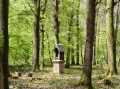
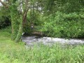
(1) Turn right at the Croix Cauchois, pass the Moulin Lecomte, following a stretch of the River Bresle, then head up to the left through Brétizel. You’ll reach the D316.

(2) Cross the D316 with care and continue to the Beaucamps-le-Jeune State Forest.

(3) At the mission cross, turn left (note: depending on the time of year, the cross may not be very visible) and continue straight on for about 500 m.

(4) At the junction (marker 205), turn left onto the Grande Allée and follow it to the edge of the forest (about 2 km).

(5) At the edge of the forest, head back down the D96 for about ten metres until you reach the next road on your right (towards Neuville-Coppegueule). At the three-way junction, keep right, heading due north.

(6) At the bend, keep left onto the track that passes under a power line. You’ll see the water tower on your right. Carry on straight ahead through the fields until you reach the junction with a road.

(7) Take this road on your right towards Neuville-Coppegueule and, at the entrance, turn left until you reach the next junction, where you’ll turn left again, then left once more a few hundred metres further on until you reach a road.

(8) After going round the plain, head back down to the right onto the road that joins the D316.

(9) Turn slightly left onto this departmental road towards the Neuville ponds. (Take care on the road).

(10) Head downhill to the right towards the ponds. Once you reach a hut, take the path to the right, go round the outside of the ponds and continue straight on towards the Vieux Rouen pond.

(11) Walk past a small pond and reach the Vieux Rouen pond. Turn right towards the Gaule Vieux Rouennaise hut and then turn right again towards the railway line.

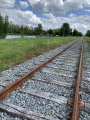
(12) Turn left and walk alongside the railway line; do not cross onto private property but use the bridge instead (watch out for trains – although there are currently none running, always exercise caution).

(13) Return to Saint-Germain and the starting point by heading left up the Route du Vieux Rouen (S/E).

Waypoints

  1. S/E : mi 0 - alt. 367 ft - Car park near the glass recycling bin, Route de Vieux Rouen
  2. 1 : mi 0.32 - alt. 381 ft - Croix Cauchois
  3. 2 : mi 1.07 - alt. 427 ft - Crossing the D316
  4. 3 : mi 2.25 - alt. 640 ft - Mission Cross
  5. 4 : mi 2.53 - alt. 666 ft - Grande Allée on the left
  6. 5 : mi 3.83 - alt. 673 ft - Exit from the national forest
  7. 6 : mi 4.31 - alt. 656 ft - Neuville-Coppegueule plain
  8. 7 : mi 4.95 - alt. 659 ft - Head towards Neuville-Coppegueule
  9. 8 : mi 6.3 - alt. 656 ft - Turn right
  10. 9 : mi 6.91 - alt. 351 ft - D316 road
  11. 10 : mi 7.25 - alt. 348 ft - Towards the ponds at Neuville-Coppegueule
  12. 11 : mi 8.29 - alt. 282 ft - Vieux Rouen pond
  13. 12 : mi 8.53 - alt. 282 ft - Railway line
  14. 13 : mi 8.82 - alt. 292 ft - Vieux-Rouen-sur-Bresle
  15. S/E : mi 9.18 - alt. 364 ft - Car park near the glass recycling bin, Route de Vieux Rouen

Notes

There are road crossings; always take care!!!

Worth a visit

Saint-Germain-sur-Bresle: the mill.
Vieux-Rouen-sur-Bresle: bakery / bar and tobacconist.
Neuville-Coppegueule: tobacconist’s and grocery shop.

Reviews and comments

4.5 / 5
Based on 2 reviews

Reliability of the description
4.5 / 5
Ease of following the route
4.5 / 5
Route interest
4.5 / 5
User 23812931

Overall rating : 4 / 5

Date of your route : May 19, 2025
Reliability of the description : ★★★★☆ Good
Ease of following the route : ★★★★☆ Good
Route interest : ★★★★☆ Good
Very busy route : No

Machine-translated

Sabinejefaiscequimeplait!!!

Overall rating : 5 / 5

Date of your route : Apr 09, 2021
Reliability of the description : ★★★★★ Very good
Ease of following the route : ★★★★★ Very good
Route interest : ★★★★★ Very good
Very busy route : Yes

A brilliant walk, with stunning scenery.

Machine-translated

Other walks in the area

For more walks, use our search engine .

The GPS track and description are the property of this route's author. Please do not copy them without permission.