Country:
 City:
City:




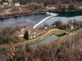
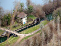
Car park at Busy, at the bottom of the Chemin du Moulinot, on the banks of the Doubs.
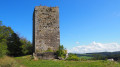
You’ll be immediately immersed in the atmosphere of the walk with the imposing silhouette of the keep of Montfaucon’s feudal castle, a thousand-year-old sentinel over our beautiful Doubs valley.
Markings: white-red and yellow-blue, with some unmarked sections.
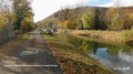
(S/E) Set off to the left (facing the river) along the towpath, skirting the foot of the Raie des Buis cliffs. You will soon catch sight, high up on the hill to your left, of the modest silhouette of Notre-Dame du Mont and, in the distance, the more imposing figure of Thoraise Castle, peeking out above the horizon.
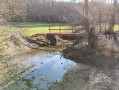
(1) At the lock, cross the small bridge and walk past the derelict site of the old mill. A little further on, when you spot the tip of a small islet through the trees on your right, head down the narrow path towards the bank of the Doubs for a lovely view of the river and Thoraise Castle.
(2) You’ll arrive at the Percée de Thoraise, an 185-metre tunnel that cuts through a circular bend in the Doubs. Walk round the basin via the steps and return to the lock by following the canal.
(1) Climb the hill on the far right along the ascending stony path, lined with ferns and moss-covered rocks. Ignore the paths on your left.
(3) After the fourth bend, almost at the top of the hill, just past a low wall, look out for the path that winds off to the left through a narrow rocky pass – we’ll come back this way later. For now, carry on straight ahead for a round trip (trail route 11 and mountain bike route 21) to the chapel.
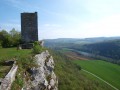
(4) The Notre-Dame du Mont viewpoint offers an exceptional view over the Doubs valley and its meanders, the Jura mountains and, in the foreground, the keep of the feudal castle of Montferrand. In the distance, Montfaucon hill. Retrace your steps.
(3) Turn right into this charming little rocky gorge, where the markings disappear. Soon, a small stone marker indicates a fork in the path. Continue down the slope along the edge to the left and you’ll come across a path at right angles (forest sign No. 4).
(5) Head down to the left and, a little further down, take the wider path on your right to reach the hamlet of La Pierre de Vorges, where you’ll already be accompanied by the murmur of the Moulin Caillet stream.
(6) Continue to the left along this lovely stony path until you reach the towpath, which you’ll follow to the right to get back to the car park. A short round trip that you’re sure to enjoy, given just how charming this little corner of the valley is (S/E).


 Visorando Member
 Average