Country:
 City:
City:


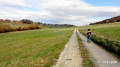
Park near the church in Busy.
(S/E) Facing the church, turn right and follow the village’s main street. Leave this street shortly after the car park, at the first bend, and continue straight on along Chemin de l’École.
(1) At a 90° bend, turn right onto Chemin de la Côte, which climbs up the hillside. This small road leads onto the N83 at a place called Le Comice.
(2) Take care when crossing the road. Take the path opposite, to the left of the house. Immediately after the building, ignore the path branching off to the left and continue along the lovely white path until you reach a junction.
(3) Carry on to the left, towards La Grange Rouge farm, which overlooks the valley. Cross the farmland (turning right then left between two buildings) to gradually descend the other side of the slope.
At the bottom of the slope, at the start of a wide bend to the right, leave the main track and continue straight on along a dirt track that crosses a large area of pasture (if you need to open the gate, don’t forget to close it behind you). The track bends to the right, crosses the stream at the bottom of the valley and joins the D104 at a junction.
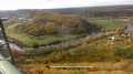
(4) Follow the D104 to the left for about 200 metres and take the first track on the right. After about forty metres, turn right again. After skirting the edge of the forest, the track gradually descends towards the bottom of the valley, dominated by the old village of Larnod. Ignore two tracks branching off to the left and then one to the right.
(5) Two hundred metres before a farm building, take a path on the left, which leads you to the village’s main street. Follow this street to the right for a few metres.
(6) Once you’ve passed the church, turn left into Rue des Sapins. Walk through the housing estates. After a bend to the left and a small junction, continue down Chemin du Rocher de Valmy.
At the bottom of the hill, as you leave the housing estates, not far from a football pitch, take the wide tarmac path that climbs towards the Rocher de Valmy (signposted). You’ll emerge into a clearing, part of which is occupied by an area set aside for religious ceremonies (with a stone-built altar and a cross).
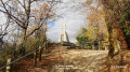
(7) Turn left onto the path leading up to the Rocher de Valmy. On this promontory stands a memorial stone in honour of members of the Resistance who died during the Second World War.
(8) After the viewpoint, take the same path back to the esplanade.
(7) Turn left onto the path that winds down through the forest. You’ll come out onto a forest track – this is theGR®59, linked to theGRP® Ceinture de Besançon – and take it to the left. You’ll rejoin the N83.
(9) Carry on straight ahead along a disused road that descends towards Aveney. Enter the housing estate in this village; pass the first street on your left, then the second (still on your left), before reaching a 180° bend.
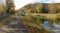
(10) Take the third street (Rue des Vergers) and join the towpath, which has been converted into a cycle path. Continue in the same direction alongside the canal until you reach the Double Écluse, where a few barges are moored.
(11) After this structure, follow the towpath further until you reach a junction.
(12) Turn left onto the small road that climbs into the forest; this is still theGR® path until you reach the first houses in Busy.
(13) At a hairpin bend, turn right onto a path leading uphill, which passes close to a sewage treatment works before coming out onto the main street in Busy.
(14) Turn right to return to the car park near the church (S/E).

 Visorando Member

 Easy
Easy