Around the Tour d’Albon – Porte de Drômardèche

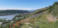
This magnificent route, winding through orchards and woodland, will take you on a tour of the Albon area. The long ridge path leading up to the Tour d’Albon offers a splendid panoramic view of the Rhône Valley, with vistas of the foothills of the Ardèche, Pilat and Vercors. The final descent is sure to delight you!

Details

1214140
Creation:
Last update:
Last review:
  • Mountain biking
    Activity: Mountain biking
  • ↔
    Distance: 11.79 mi
  • ◔
    Duration according to the author: 2.5 hrs 
  • ▲
    Difficulty: Moderate

  • ⚐
    Back to start: Yes
  • ↗
    Ascent: + 840 ft
  • ↘
    Descent: - 850 ft

  • ▲
    Highest point: 1,220 ft
  • ▼
    Lowest point: 564 ft
  • ⚐ Country: France
  • ⚐
    Area: Dauphiné
  • ⚐ City: Albon (26140)
  • ⚑
    Start/End: N 45.239159° / E 4.876939°
  • ❏
    IGN map(s): Ref. 3034E, 3034O

  • ◶
    Type of surface:
  •  
     
     
     33% Road  34% Byway  33% Path
  • ⇧
    Bike carrying: Not specified
  • ▲
    Difficulty: Not specified
  • Hour-by-hour weather

Description of the route

Park in the car park at the Saint-Martin-des-Rosiers stadium.
Mountain bike route no. 7

(S/E) From the stadium car park, turn left onto the small road.

(1) Pass through Les Petites Vignes and Les Grandes Vignes, then carry on straight ahead to reach the village of Saint-Romain-d’Albon. Turn right twice, head uphill and pass the cemetery.

(2) At the three-way junction, turn left then continue straight on along the track. Alternate between roads and tracks for 3 km until you reach a crossroads in the fields (alt. 230 m). Head downhill to the left to reach Les Cotons.
(3) Take the gravel track on the right. Further on, cross the D161 and continue straight ahead: watch out for cars! You’ll come to a small road; follow it to the right.

(4) Turn right onto the road, which becomes a track. You’ll reach a small road at the corner of a house; 100 metres further on, in Coussieux (alt. 228m), turn right. Continue along this road.

(5) Turn right, then immediately left. Continue along the track between the fields, then turn right to reach the Château du Cros.

(6) Cross the road and head uphill opposite. Carry straight on until you reach the Bois des Cros (alt. 310m), then turn right.

(7) At the next junction, head up to the left to join the wide track.

(8) Take the track on the right to walk along the ridge. Continue along the main track until you reach the road.

(9) Turn left until you reach a junction. Cross over to join the D301 opposite: watch out for cars! Turn right to walk alongside the campsite. Pass La Renardière and continue along the main track, passing under a power line, until you reach an aerial.

(10) Turn left onto the path to reach La Tour d’Albon.

(11) Turn left onto the small pebbly path. You’ll reach the D301; follow it to the left for 60 metres: watch out for cars!
At Les Terreaux (alt. 282m), head down to the right onto the small path. Join the road at Les Petites Vignes,

(1) Turn left and continue along the road you took on the way there to return to the stadium car park. (S/E)

Waypoints

  1. S/E : mi 0 - alt. 623 ft - Saint-Martin-des-Rosiers Stadium
  2. 1 : mi 0.41 - alt. 614 ft - Junction of the circular loop
  3. 2 : mi 2 - alt. 673 ft - Three-way junction after the cemetery
  4. 3 : mi 4.36 - alt. 640 ft - Les Cotons signpost
  5. 4 : mi 5.08 - alt. 689 ft - Junction of 3 roads
  6. 5 : mi 6.54 - alt. 748 ft - Coussieux
  7. 6 : mi 7.02 - alt. 804 ft - Château du Cros
  8. 7 : mi 7.52 - alt. 1,040 ft - Junction of 5 paths
  9. 8 : mi 7.73 - alt. 1,171 ft - Junction of track and path
  10. 9 : mi 8.88 - alt. 1,171 ft - Road just before the campsite - Col de Barbe Bleue
  11. 10 : mi 10.54 - alt. 1,053 ft - Branch office
  12. 11 : mi 10.82 - alt. 1,073 ft - La Tour d’Albon signpost
  13. S/E : mi 11.79 - alt. 623 ft - Saint-Martin-des-Rosiers Stadium

Notes

We strongly recommend taking the IGN map referred to on these pages with you. Mountain bikers must be self-sufficient; professional guides are available if required. Emergency number: 18 or 112.
For further information, contactthe Porte DrômArdèche Tourist Office: 04 75 23 45 33

Other walks in the area

For more walks, use our search engine .

The GPS track and description are the property of this route's author. Please do not copy them without permission.