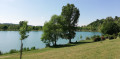
Between Valloire and Galaure – Porte de DrômArdèche

A very scenic route offering beautiful views of the Galaure Valley, the Pilat, the Ardèche and the Vercors. With numerous sections through woodland, the trails are relatively straightforward from a technical point of view.

Details

n°1214144
Creation:
Last update:
Last review:
  • Mountain biking
    Activity: Mountain biking
  • ↔
    Distance: 28.96 mi
  • ◔
    Duration according to the author: 6 hrs 
  • ▲
    Difficulty: Very difficult

  • ⚐
    Back to start: Yes
  • ↗
    Ascent: + 2,372 ft
  • ↘
    Descent: - 2,392 ft

  • ▲
    Highest point: 1,460 ft
  • ▼
    Lowest point: 741 ft
  • ⚐ Country: France
  • ⚐
    Area: Dauphiné
  • ⚐ City: Hauterives (26390)
  • ⚑
    Start/End: N 45.255461° / E 5.028446°
  • ❏
    IGN map(s): Ref. 3034E, 3134SB

  • ◶
    Type of surface:
  •  
     
     
    ■ 33% Road ■ 34% Byway ■ 33% Path
  • ⇧
    Bike carrying: Not specified
  • ▲
    Difficulty: Not specified
  • Hour-by-hour weather

Description of the route

Car park at the Palais Idéal du Facteur Cheval.
Mountain bike route marker no. 6
Mountain bike trail marker no. 4

(S/E) Leave the car park at the Palais Idéal du Facteur Cheval and turn left onto the small wooden bridge. Turn left onto the woodland path running alongside the stream.

(1) At the junction near the castle, turn left and continue along the road for 1.2 km: watch out for cars!

(2) At the junction, take the road leading down to the left, cross the stream and head back up to La Massetière.

(3) Cross the D51 and turn left opposite: watch out for cars! Continue uphill along the path that runs alongside the fields. At the top, take the road on the left to reach La Fayardaie.

(4) At La Fayardaie, continue left along the road and, at the next junction, take the road on the right.

(5) At La Pointe Marion, turn left and begin the descent leading to Lens Lestang via La Combe Marion.

(6) Join the D538 and follow it for about 100 metres. Turn left and keep left until you reach the Route des Châteaux. Follow it to the left.

(7) Turn left onto Impasse de la Creuse and continue to Château Double.

(8) After the château, at the ‘Le Double’ signpost, the path climbs slightly alongside a stream and joins the Massonne.

(9) At the Massonne, take the path leading uphill to the left as far as the ‘Les Cinq Croisées’ signpost.

(10) Cross the road and take the path opposite for about 2.5 km.

(11) At Château de la Pérouze, turn left. At the next houses, turn left again, then right at La Châtaigneraie.

(12) Cross the railway line, turn left and then right until you reach the junction with the D53 road.

(13) Cross the road, turn left twice, then right towards Les Simards.

(14) At a place called Les Simards, take the path that climbs to the left up to the ridges.

(15) Follow the ridges to the right for about 1.8 km.

(16) Turn left until you reach the D132.

(17) Cross the road and take the road opposite, which climbs and turns into a track. Join the road, then turn right to pass Le Télégraphe and Les Graillens.
Immediately afterwards, turn left then right until you reach the hamlet of La Tour.

(18) Turn left, passing close to the Tour de Mureils. Turn right then left to cross over the railway line and reach the D51.

(19) Follow it to the left. Further on, turn right towards Les Fontanis, then left along the Galaure. Follow this main track for about 1 km.

(20) When you reach the road, cross the bridge on the right and then turn left. Carry on until you reach Saint-Martin-d’Août.

(21) At the junction, carry on straight ahead, then turn left towards Les Gentons and the D362. Cross the road and you’ll arrive at Les Fayardès.

(22) After Les Fayardès, carry on along the road to the left and you’ll reach Montlivier.

(23) Turn left. The road turns into a track. Cross the stream via the footbridge and walk alongside the cemetery. Continue along the gravel track to reach the centre of Hauterives. Pass the roundabout and stay alongside the river until you reach the car park. (S/E)

Waypoints

  1. S/E : mi 0 - alt. 981 ft - The Postman Cheval’s Ideal Palace. Bridge over the - Galaure (rivière)
  2. 1 : mi 1.35 - alt. 1,089 ft - Turn left after the castle
  3. 2 : mi 2.08 - alt. 1,089 ft - On the left
  4. 3 : mi 2.34 - alt. 1,122 ft - Crossing the D51
  5. 4 : mi 3.01 - alt. 1,437 ft - The residents of Fayard
  6. 5 : mi 3.61 - alt. 1,430 ft - La Pointe Marion signpost
  7. 6 : mi 4.53 - alt. 1,060 ft - Junction with the D538
  8. 7 : mi 4.98 - alt. 1,020 ft - On the left: Impasse de la Creuse
  9. 8 : mi 5.77 - alt. 1,053 ft - Le Double signpost
  10. 9 : mi 7.08 - alt. 1,024 ft - La Massonne signpost
  11. 10 : mi 8.25 - alt. 1,325 ft - Les Cinq Croisées
  12. 11 : mi 10.72 - alt. 902 ft - Château de la Pérouze
  13. 12 : mi 11.92 - alt. 886 ft - Crossing the railway line
  14. 13 : mi 12.56 - alt. 850 ft - D53
  15. 14 : mi 13.55 - alt. 823 ft - Les Simards
  16. 15 : mi 14.1 - alt. 1,198 ft - Turn right onto the ridges
  17. 16 : mi 15.42 - alt. 1,207 ft - On the left
  18. 17 : mi 16.21 - alt. 856 ft - Crossing the D132
  19. 18 : mi 19.87 - alt. 997 ft - Hameau de la Tour
  20. 19 : mi 20.95 - alt. 751 ft - D51
  21. 20 : mi 22.97 - alt. 810 ft - Junction with the D53
  22. 21 : mi 24.3 - alt. 1,184 ft - Saint-Martin-d’Août
  23. 22 : mi 25.7 - alt. 1,198 ft - Les Fayardès
  24. 23 : mi 27.78 - alt. 988 ft - Montlivier
  25. S/E : mi 28.96 - alt. 981 ft - Car park at the Palais Idéal du Facteur Cheval

Notes

We strongly recommend taking the IGN map referred to on these pages with you. Mountain bikers must be self-sufficient; professional guides are available if required. Emergency number: 18 or 112.
For further information, contactthe Porte DrômArdèche Tourist Office: 04 75 23 45 33

Reviews and comments

4.7 / 5
Based on 1 review

Reliability of the description
5 / 5
Ease of following the route
4 / 5
Route interest
5 / 5
SERGE BE
SERGE BE

Overall rating : 4.7 / 5

Date of your route : Jun 23, 2025
Reliability of the description : ★★★★★ Very good
Ease of following the route : ★★★★☆ Good
Route interest : ★★★★★ Very good
Very busy route : No

I completed this route on a mountain bike and found it very enjoyable, with a few difficult sections due to lack of use (brambles and overgrown vegetation in places). Otherwise, I would recommend it.

Machine-translated

Other walks in the area

For more walks, use our search engine .

The GPS track and description are the property of this route's author. Please do not copy them without permission.