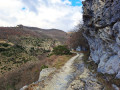
Mountain panoramas – Dieulefit-Bourdeaux region

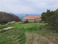
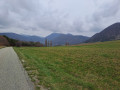
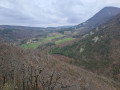
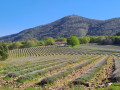
During this route, which is quite technical but enjoyable thanks to its variety, you’ll be surrounded by numerous mountains. Balcony-style paths will offer you stunning views of La Lance, Miélandre and Couspeau. Be sure to allow time for a special stop at the Col de Vesc or the church in Comps.

Details

n°1214127
Creation:
Last update:
Last review:
  • Mountain biking
    Activity: Mountain biking
  • ↔
    Distance: 12.85 mi
  • ◔
    Duration according to the author: 3 hrs 
  • ▲
    Difficulty: Difficult

  • ⚐
    Back to start: Yes
  • ↗
    Ascent: + 1,949 ft
  • ↘
    Descent: - 1,949 ft

  • ▲
    Highest point: 2,579 ft
  • ▼
    Lowest point: 1,207 ft
  • ⚐ Country: France
  • ⚐
  • ⚐ City: Dieulefit (26220)
  • ⚑
    Start/End: N 44.523416° / E 5.063213°
  • ❏
    IGN map(s): Ref. 3138OT

  • ◶
    Type of surface:
  •  
     
     
    ■ 33% Road ■ 34% Byway ■ 33% Path
  • ⇧
    Bike carrying: Not specified
  • ▲
    Difficulty: Not specified
  • Hour-by-hour weather

Description of the route

Start from Place de la Gare in Dieulefit.

Mountain bike route no. 10.

(S/E) From the square, follow the Route de Nyons (D538) until you reach the outskirts of Dieulefit.

(1) Turn left at the ‘Les Granges’ signpost onto the Route de Comps (D547), then right towards Beauvallon. Join a stony track, which is sometimes steep and technical.

(2) Take a lovely track through the truffle groves and lavender fields to reach Fabras.

(3) Continue along the track uphill to Paulhiet. Lovely view!

(4) Follow a track, then a fairly steep and stony path uphill; head towards Ravin Bouchet.

(5) Carry on along the path, then follow a single track – at times exposed and technical – to Longue Serre.

(6) This is followed by a technical descent and a short but steep climb to Vesc (fountain).

(7) Climb a road, then a steep track (carry your bike for 50m) to the Ruins of the Col de Vesc. Stunning views!

(8) Descend to the Col de Vesc and climb back up the path through the woodland on the opposite side to reach Serre la Motte.

(9) A fun, fairly steep descent in two sections follows, leading to the church at Comps: a lovely spot!

(10) From there, you can return to Dieulefit via the road. Alternatively, head down a track and join a single track – which is at times narrow and technical – to Les Traverses.

(11) Continue along the ridge, with a few sections where you’ll need to carry your bike; a stony descent, then join a track leading to Malemort-Hautes Rouvières.

(12) Head back down to Dieulefit via a single track (watch out for stones), passing through Le Grand Serre. Follow the signposts and return to Place de la Gare (S/E).

Waypoints

  1. S/E : mi 0 - alt. 1,230 ft - Place de la Gare. Cross the - Jabron (rivière) - Affluent du Rhône
  2. 1 : mi 0.95 - alt. 1,348 ft - Les Granges signpost
  3. 2 : mi 2.05 - alt. 1,693 ft - Les Marroux
  4. 3 : mi 2.5 - alt. 1,703 ft - Fabras signpost
  5. 4 : mi 3.22 - alt. 1,867 ft - Paulhiet signpost
  6. 5 : mi 4.23 - alt. 2,093 ft - Ravin Bouchet signpost
  7. 6 : mi 5.87 - alt. 2,037 ft - Longue Serre signpost
  8. 7 : mi 6.06 - alt. 1,952 ft - Vesc signpost (Fontaine)
  9. 8 : mi 7.47 - alt. 2,487 ft - Serre la Motte signpost
  10. 9 : mi 8.45 - alt. 2,572 ft - Signpost at Comps Church
  11. 10 : mi 9.44 - alt. 2,133 ft - Les Traverses signpost
  12. 11 : mi 10.08 - alt. 2,156 ft - Malemort-Hautes Rouvières signpost
  13. 12 : mi 11.3 - alt. 1,778 ft - Grand Serre signpost
  14. S/E : mi 12.85 - alt. 1,230 ft - Place de la Gare

Notes

We strongly recommend that you take the IGN map referred to on these pages with you. Mountain bikers must be self-sufficient; professional guides are available if required. Emergency number: 18 or 112.
Enquiries atthe Dieulefit-Bourdeaux Tourist Office: 04 75 46 42 49.
Email: ot@dieulefit-tourisme.com

Reviews and comments

5 / 5
Based on 1 review

Reliability of the description
5 / 5
Ease of following the route
5 / 5
Route interest
5 / 5
pierrikjacob
pierrikjacob

Overall rating : 5 / 5

Date of your route : Jun 17, 2020
Reliability of the description : ★★★★★ Very good
Ease of following the route : ★★★★★ Very good
Route interest : ★★★★★ Very good
Very busy route : No

A superb walk – a bit technical, but with a stunning view at the end. I’d definitely recommend this walk.

Machine-translated

Other walks in the area

For more walks, use our search engine .

The GPS track and description are the property of this route's author. Please do not copy them without permission.