


Refine your search for walks in Estagel
Estagel walks


 Circular route between Estagel and Tautavel
 Visorando Member
 14.28 mi
 +702 ft
 -666 ft
 1h 13
1h 13
 Moderate
 Departure from Estagel (Pyrénées-Orientales)
A short cycle route between the Corbières and the Fenouillet plain, through vineyards and the heath. The village of Tautavel is world-famous for the discovery, at the ‘Grotte de la Caune de l’Arago’ site, of the skull of the oldest man in Europe.
 The mysterious Touréze
 6.97 mi
+1,250 ft
-1,230 ft
4h 20
Moderate
Departure from Latour-de-France (Pyrénées-Orientales)
6.97 mi
+1,250 ft
-1,230 ft
4h 20
Moderate
Departure from Latour-de-France (Pyrénées-Orientales)
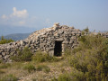
This circular loop, starting from Latour-de-France, takes you around the Touréze massif, with visits to several stone orri dotted along the route. Southern heath and a mix of tracks, roads and paths.
Around Tautavel
 4.80 mi
+538 ft
-548 ft
2h 40
4.80 mi
+538 ft
-548 ft
2h 40
 Easy
Departure from Tautavel (Pyrénées-Orientales)
Easy
Departure from Tautavel (Pyrénées-Orientales)
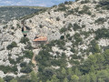
A getaway to the Catalan Corbières region, where you can discover Tautavel and its interesting heritage.
Circular route from Tautavel to the Tour del Far and the El Comador quarry
 5.56 mi
+1,447 ft
-1,421 ft
3h 50
Moderate
Departure from Tautavel (Pyrénées-Orientales)
5.56 mi
+1,447 ft
-1,421 ft
3h 50
Moderate
Departure from Tautavel (Pyrénées-Orientales)
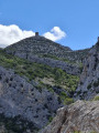
A very pleasant circular walk, with a 360° view from the top of the Tour del Far, and a lovely stroll along the ridge of the Serra that separates Tautavel from Cases de Pène. On the way back, you pass a solar farm and through the gorges of a former marble quarry, now disused.
The Tour del Far
 3.54 mi
+1,280 ft
-1,280 ft
2h 45
Easy
Departure from Tautavel (Pyrénées-Orientales)
3.54 mi
+1,280 ft
-1,280 ft
2h 45
Easy
Departure from Tautavel (Pyrénées-Orientales)
A round trip to the Catalan Corbières region will take you to the Tour del Far, where you can enjoy a magnificent 360° panorama.
Thishike is strongly discouraged in high winds.
The Tautavel Tower
 5.05 mi
+1,555 ft
-1,558 ft
3h 40
Moderate
Departure from Cases-de-Pène (Pyrénées-Orientales)
5.05 mi
+1,555 ft
-1,558 ft
3h 40
Moderate
Departure from Cases-de-Pène (Pyrénées-Orientales)
This is an alternative way to the Tour de Tautavel from Cases-de-Pène. Advantage: sheltered from the tramontana wind. Disadvantage: sunny in summer.
The Hermitage of Notre-Dame de Pène
 0.88 mi
+325 ft
-325 ft
0h 40
Easy
Departure from Cases-de-Pène (Pyrénées-Orientales)
0.88 mi
+325 ft
-325 ft
0h 40
Easy
Departure from Cases-de-Pène (Pyrénées-Orientales)
A short climb on a rocky trail leads to an old hermitage in a superb setting with a beautiful view from the top.
Roc Rodon
 9.46 mi
+1,644 ft
-1,640 ft
5h 45
Moderate
Departure from Cases-de-Pène (Pyrénées-Orientales)
9.46 mi
+1,644 ft
-1,640 ft
5h 45
Moderate
Departure from Cases-de-Pène (Pyrénées-Orientales)
A climb to Roc Rodon which, despite its modest altitude, offers exceptional views of the Pyrenees and the Corbières. After passing the Hermitage of Notre-Dame de Pène, a long ridge walk leads to the village of Calce. The route continues through the vineyards, leading to the Chapel of Sainte-Catherine before climbing back up to the ridge and returning to the starting point via a balcony path overlooking the Agly valley. A very varied and exotic route on the outskirts of Perpignan.
Serrat de la Pedrera
 4.15 mi
+282 ft
-262 ft
2h 10
Easy
Departure from Calce (Pyrénées-Orientales)
4.15 mi
+282 ft
-262 ft
2h 10
Easy
Departure from Calce (Pyrénées-Orientales)
This circular walk, located in the commune of Pézilla-la-Rivière - Calce, circles the Serrat de la Pedrera. Starting from the recycling centre, it follows vineyard paths, then a track through the heath. This is followed by a descent towards the Mas de les Fonts, then the return via vineyard paths.
Néfiach circular loop
 4.91 mi
+738 ft
-741 ft
2h 55
Easy
Departure from Néfiach (Pyrénées-Orientales)
4.91 mi
+738 ft
-741 ft
2h 55
Easy
Departure from Néfiach (Pyrénées-Orientales)
This circular route in the hills above Néfiach takes you on a route through the heath along various paths and tracks. Starting from the ford, it climbs towards Caladroy without actually reaching it, as it descends back into the valley below Caladroy, passing close to Pic Haut, which can be visited as an optional detour.
Força Réal Hermitage from Corneilla-la-Rivière
 10.71 mi
+1,545 ft
-1,545 ft
6h 15
Moderate
Departure from Corneilla-la-Rivière (Pyrénées-Orientales)
10.71 mi
+1,545 ft
-1,545 ft
6h 15
Moderate
Departure from Corneilla-la-Rivière (Pyrénées-Orientales)
You will cross dirt tracks and a few tarmaced sections, through vineyards, heath and olive groves... which will take you to Castell de Força Réal, at an altitude of 507 m...
No particular difficulty apart from the climb up the north face to the observation post.
Once at the top, enjoy a picnic and discover the breathtaking view of the Canigou massif and the Têt valley...
You can even see the sea on a clear day.
Return via some very pleasant paths...
Circular of the Last Cathar stronghold in Maury
 7.68 mi
+961 ft
-961 ft
4h 20
Moderate
Departure from Maury (Pyrénées-Orientales)
7.68 mi
+961 ft
-961 ft
4h 20
Moderate
Departure from Maury (Pyrénées-Orientales)
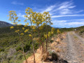
Hike through the Maury vineyards with panoramic views of the valley and unusual views of the Château de Quéribus.
Circular des Bergeries in Paziols
 6.53 mi
+761 ft
-787 ft
3h 40
Easy
Departure from Paziols (Aude)
6.53 mi
+761 ft
-787 ft
3h 40
Easy
Departure from Paziols (Aude)
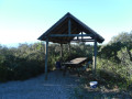
This circular starting from Paziols will take you through heath and vineyards. The route starts at the village cemetery and then heads south. At the end of the trail, the climb up to the plateau will take you past sheepfolds and vineyards. The descent to the village is via footpaths and then roads.
Pic Aubeill
 4.90 mi
+755 ft
-719 ft
2h 55
Easy
Departure from Bélesta (Pyrénées-Orientales) (Pyrénées-Orientales)
4.90 mi
+755 ft
-719 ft
2h 55
Easy
Departure from Bélesta (Pyrénées-Orientales) (Pyrénées-Orientales)
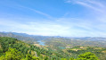
This circular route, marked in yellow, starts from the village of Belesta and climbs up to Pic d'Aubeil, then descends towards the sheepfold, the dolmen and finally the village.
In search of the boundary markers of 1258
 6.90 mi
+938 ft
-945 ft
4h 00
Moderate
Departure from Bélesta (Pyrénées-Orientales) (Pyrénées-Orientales)
6.90 mi
+938 ft
-945 ft
4h 00
Moderate
Departure from Bélesta (Pyrénées-Orientales) (Pyrénées-Orientales)
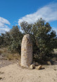
Before the current border was established, Roussillon was officially part of Spain between 1258 and 1659.
Very few boundary markers from this original border remain.
The trail allows you to discover three of them, as well as a cave and an ice well; it also offers superb views of the Pyrenees and the Corbières.
Les Rocs Nègres via the Col de la Heath
 10.68 mi
+1,818 ft
-1,814 ft
6h 30
10.68 mi
+1,818 ft
-1,814 ft
6h 30
 Difficult
Departure from Paziols (Aude)
Difficult
Departure from Paziols (Aude)
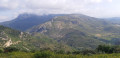
A varied hike starting from Paziols: heath, small wild and forgotten valleys, wide balcony trails offering magnificent panoramic views of the Corbières and the Pyrenees. A short section of challenging but safe terrain adds spice to this hike, which can be rounded off with a tasting of the renowned local wines.
Col de the Heath - Pas de la Serre - Chemin Cathare
 10.26 mi
+1,512 ft
-1,493 ft
6h 00
Moderate
Departure from Paziols (Aude)
10.26 mi
+1,512 ft
-1,493 ft
6h 00
Moderate
Departure from Paziols (Aude)
A very pleasant circular route connecting two villages in the Aude department. From Paziols, a ridge trail leads to the Col de la Heath. Then, crossing the Pas de la Serre allows you to switch to the other side of the mountain and reach Padern. Then the Chemin Cathare (GR®367), almost like a balcony, allows you to enjoy this wine-growing landscape. All that remains is to continue along a track through beautiful countryside to reach Paziols.
Elevation gain closer to 500 m.
The ridge of the Serre du Grau de Maury
 10.81 mi
+2,375 ft
-2,408 ft
7h 00
Difficult
Departure from Cucugnan (Aude)
10.81 mi
+2,375 ft
-2,408 ft
7h 00
Difficult
Departure from Cucugnan (Aude)
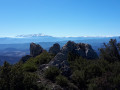
An exceptional walk, but:- a ridge walk of around 6 km from Grau de Maury to La Quille.- as the route runs right alongside steep cliffs and includes a section of rock-climbing, it is strongly advised against for anyone prone to vertigo.Only experienced walkers in good physical condition who are used to rocky terrain will be able to complete this walk safely.A GPX track is essential. Know when to turn back if necessary.
 Vingrau Route
 8.45 mi
+758 ft
-735 ft
2.5 hrs
Moderate
Departure from Vingrau (Pyrénées-Orientales)
8.45 mi
+758 ft
-735 ft
2.5 hrs
Moderate
Departure from Vingrau (Pyrénées-Orientales)
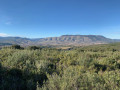
A lovely circular route starting from Vingrau, ideal for beginners to mountain biking.
Best avoided in hot weather as there is little shade and no water points along the route. There are two fairly technical sections on this route.
Mas Llençó - Trauc del Cavall - La Serra from Vingrau
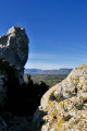 9.38 mi
+1,772 ft
-1,759 ft
5h 50
Difficult
Departure from Vingrau (Pyrénées-Orientales)
9.38 mi
+1,772 ft
-1,759 ft
5h 50
Difficult
Departure from Vingrau (Pyrénées-Orientales)
From the village of Vingrau, pass through the cliffs via the Trou (passage) du Cheval. From this point, it is essential to follow the very good recent markings and the numerous cairns, staying below the ridge without descending. The path below the Serra ridge is difficult: you will sometimes need to use your hands. It consists of constant ascents and descents. However, there is no danger (no drop). This section is not recommended in strong winds. There is an alternative route that avoids this ridge: see practical information.There are many viewpoints and panoramic views, including Canigó, various mountain ranges and the Mediterranean Sea.
La Serre de Vingrau
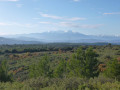 10.12 mi
+1,759 ft
-1,759 ft
6h 10
Moderate
Departure from Vingrau (Pyrénées-Orientales)
10.12 mi
+1,759 ft
-1,759 ft
6h 10
Moderate
Departure from Vingrau (Pyrénées-Orientales)
This is a fairly challenging route to reach the peaks of the iconic Vingrau mountain, a climber's paradise and world-famous site. After an easy approach walk to Trauc del Cavall, the rest of the hike involves a radical change of terrain that requires caution and endurance. However, the magnificent views to the east and west are well worth the effort.
Pas de la Serre - Roc de la Capéliane - les Crabiés - Pas de la Goutine
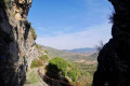 9.70 mi
+2,182 ft
-2,169 ft
6h 20
Moderate
Departure from Padern (Aude)
9.70 mi
+2,182 ft
-2,169 ft
6h 20
Moderate
Departure from Padern (Aude)
From Padern, climb up to the castle, cross the Pas de Massac and the Pas de la Serre.Then there is a superb passage along the ridge to reach the Roc de la Capéliane. Next, follow the tracks, with beautiful scenery, to descend to a discreet path that climbs back up along the Ruisseau de Grazels. Back at the crossroads of the two loops, cross the Pas de la Goutine to return to the village.This circuit may be considered quite difficult by some people.The GPX track is necessary at various points to confirm your position, particularly at (12) and (13).It is possible to do only part of this circuit. *
Vingrau - Circular around the Serra
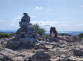 5.24 mi
+1,453 ft
-1,460 ft
3h 40
Moderate
Departure from Vingrau (Pyrénées-Orientales)
5.24 mi
+1,453 ft
-1,460 ft
3h 40
Moderate
Departure from Vingrau (Pyrénées-Orientales)
A superb landscape with views of the Corbières and Roussillon. Best done when there is no wind. This is a circular route of 4 hours and the route is easy. There are a few steep sections. It is limestone rock from start to finish, so good footwear is recommended. From here, you can see Aguilar Castle, Opoul Castle, Canigou, the sea, the Corbières and Roussillon!
At the foot of Quéribus Castle from Cucugnan
 5.28 mi
+1,286 ft
-1,299 ft
3h 35
Moderate
Departure from Cucugnan (Aude)
5.28 mi
+1,286 ft
-1,299 ft
3h 35
Moderate
Departure from Cucugnan (Aude)
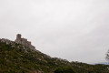
From the village, the route climbs to the foot of Quéribus Castle along well-marked paths.See: practical information.Please note that the descent after point (5) is quite steep.It is perfectly possible to do this route in the opposite direction, ascending from (6) to (5).
Ille-sur-Têt - Montalba-le-Château - Rodès via old paths and canals
 12.77 mi
+1,660 ft
-1,670 ft
7h 20
Difficult
Departure from Ille-sur-Têt (Pyrénées-Orientales)
12.77 mi
+1,660 ft
-1,670 ft
7h 20
Difficult
Departure from Ille-sur-Têt (Pyrénées-Orientales)
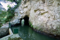
A hike to explore this low-lying mountain range, which was once farmed by humans. Numerous terraces bear witness to this past. Vines were once cultivated here. Mechanisation brought an end to farming in these wild and hard-to-reach areas.Yellow markings are virtually non-existent, and recent directional posts have been installed (as observed at the end of January 2024). These are not particularly relevant to the route. A GPX track is essential for this route, which features numerous paths.
Author’s note: The main sites of the fires in early July 2026 in the Pyrénées-Orientales were Ille-sur-Têt and Rodès. This walk has been affected by them. Much of the vegetation has been destroyed.