


écho09

 Visorando Member
 Premium user
 Sign up:
Published route(s)
 Cartiès (Dun) circular - St-Julien - Troye - Limbrassac
 7.51 mi
 +623 ft
 -614 ft
 4h 00
4h 00
 Moderate
 Departure from Dun (Ariège)
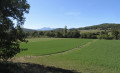
A nature route! A path through valleys and ridges with magnificent views of the Monts d'Olmes. Originally route no. 14 in the Pays de Mirepoix, the signposting is now quite old.
The Pic Galinié circular in Dun
 4.08 mi
+643 ft
-643 ft
2h 25
4.08 mi
+643 ft
-643 ft
2h 25
 Difficult
Departure from Dun (Ariège)
Difficult
Departure from Dun (Ariège)
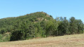
A real little circular hike (unmarked) with the most remarkable view of the Pays de Dun, enhanced along the way by the panoramas of the Cami del Castel and the orientation table. A gem not to be missed! But be careful on the very steep descent from Pic Galinié!
Lieurac - Le Bois de Mouillet circular
 8.47 mi
+1,604 ft
-1,585 ft
5h 20
Moderate
Departure from Lieurac (Ariège)
8.47 mi
+1,604 ft
-1,585 ft
5h 20
Moderate
Departure from Lieurac (Ariège)
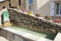
From hamlets to villages, forests to woods, set off to discover the hidden charms of this little corner of Ariège! Take a breather and discover a 400-year-old oak tree, small wash basins, old stone shepherds' huts (orrys), views of the Péreille Gorges... and a few steep slopes, one with a 17% gradient and another with a 20% gradient!
The Gréoulou circular horseshoe loop from Laroque and Lavelanet
 6.80 mi
+1,263 ft
-1,240 ft
4h 15
Moderate
Departure from Laroque-d'Olmes (Ariège)
6.80 mi
+1,263 ft
-1,240 ft
4h 15
Moderate
Departure from Laroque-d'Olmes (Ariège)
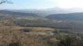
Set off to explore this part of the Plantaurel ridges with the unique Gréoulou horseshoe! Perched above Laroque d'Olmes and Lavelanet, this is an original circular route with a very steep climb up Sainte-Ruffine!
Remember to bring enough water.
Between crests and rivers, a circular in Plantaurel
 8.73 mi
+909 ft
-892 ft
4h 50
Moderate
Departure from Laroque-d'Olmes (Ariège)
8.73 mi
+909 ft
-892 ft
4h 50
Moderate
Departure from Laroque-d'Olmes (Ariège)
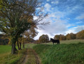
A circular loop in Plantaurel: greenways, woods, ridge views, the Touyre and Hers rivers, and history with the Saint-Roch Chapel and the Castella de Laroque d'Olmes. Something to satisfy all hikers.
Les Monts d'Olmes - Moulzoune and Taula circular aerial
 4.72 mi
+1,247 ft
-1,250 ft
3h 15
Moderate
Departure from Montferrier (Ariège)
4.72 mi
+1,247 ft
-1,250 ft
3h 15
Moderate
Departure from Montferrier (Ariège)
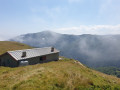
Wide open spaces with aerial views of the Monts d'Olmes massif; reminders of an industrial past with old quarries; paths through the forest, then along ridges offering magnificent panoramic views, a small lake, two huts... Simply bliss for a family walk that everyone can enjoy!
The Crête de Bouichet circular from Fa
 9.63 mi
+1,339 ft
-1,319 ft
5h 35
Moderate
Departure from Fa (Aude)
9.63 mi
+1,339 ft
-1,319 ft
5h 35
Moderate
Departure from Fa (Aude)
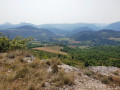
A circular aerial loop offering superb views of the mountains surrounding Quillan and Nébias and two villages, Fa and Rouvenac, with very discreet charms that are worth discovering. A small plateau with aerial solitude: pure bliss.
Cap du Carmil from Col des Marrous in a loop
9.36 mi
+2,103 ft
-2,096 ft
6h 10
Moderate
Departure from Alzen (Ariège)
An aerial loop with numerous panoramic views, in the heart of a magnificent beech forest, with a summit offering an exceptional panorama! Come and see the "blue mountains" at the end of a sunny morning.
The Belvédère du Diable and the Chalet de Carach from Quillan
 8.19 mi
+1,253 ft
-1,266 ft
4h 50
Difficult
Departure from Quillan (Aude)
8.19 mi
+1,253 ft
-1,266 ft
4h 50
Difficult
Departure from Quillan (Aude)
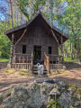
A challenging hike if you choose the circular Belvédère du Diable with its high, airy viewpoint! The route takes you through forests, along tracks and paths, with the amazing Chalet de Carach, the villages of Belvianes and Cavirac to discover, and a return trip along the Aude river: magnificent!
Please take note of the comments in the description regarding points (5) and (6).
Naurouze and the hillsides in a circular route starting from Avignonet-Lauragais
 10.90 mi
+856 ft
-843 ft
5h 45
Moderate
Departure from Avignonet-Lauragais (Haute-Garonne)
10.90 mi
+856 ft
-843 ft
5h 45
Moderate
Departure from Avignonet-Lauragais (Haute-Garonne)
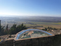
The first section to the Seuil de Naurouze offers historical, architectural and religious discoveries, as well as magnificent panoramic views, with the surprise of the hamlet of Montferrand.
The second part takes you up through the hillsides towards the Pyrenees once more, despite the presence of a few more local roads. A real escape, a breath of fresh air in the Lauragais!
Panoramic and historical loop in the Moulin-Neuf region
 11.19 mi
+1,240 ft
-1,224 ft
6h 15
Moderate
Departure from Moulin-Neuf (Ariège)
11.19 mi
+1,240 ft
-1,224 ft
6h 15
Moderate
Departure from Moulin-Neuf (Ariège)
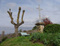
An exceptional panoramic view from the ridge, picturesque villages (Cazal des Faures, Tréziers, Roumengoux) and historic villages (Lagarde), a gigantic feudal castle, a short greenway and the sparkling clear waters of the River Hers. This loop is magnificent from Moulin-Neuf: enjoy!Remember to follow your GPS: this is a new route and the first part is not signposted!
The Picaussel Maquis as seen from Lescale
 6.39 mi
+1,660 ft
-1,680 ft
4h 25
Moderate
Departure from Puivert (Aude)
6.39 mi
+1,660 ft
-1,680 ft
4h 25
Moderate
Departure from Puivert (Aude)
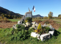
Set off on an exceptional commemorative walk in the footsteps of the Picaussel Maquis through forests and lush vegetation. This circular route does not follow the classic route back, but instead takes you to discover the Refuge du Maquis, the Maquis Memorial and the village of La Malayrède.
Warning! The climb up to the command post includes some very steep sections, as does the descent from La Malayrède: make sure you’re wearing sturdy footwear! Some sections are not signposted!
Sentier des Coteaux in Pamiers
 9.04 mi
+1,102 ft
-1,076 ft
5h 05
Moderate
Departure from Pamiers (Ariège)
9.04 mi
+1,102 ft
-1,076 ft
5h 05
Moderate
Departure from Pamiers (Ariège)
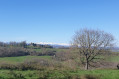
A lovely walk along the ridges of the hills, taking walkers on a journey of discovery through the Terrefort de Pamiers. This stretch of hills, with its woods and fords, offers vast panoramic views of Pamiers and the Pyrenees and, despite the sections on the road, provides a wonderful opportunity to explore the area.
Circular trail of the Couleurs de Rennes-le-Château starting from Espéraza
 9.22 mi
+1,490 ft
-1,506 ft
5h 30
Moderate
Departure from Espéraza (Aude)
9.22 mi
+1,490 ft
-1,506 ft
5h 30
Moderate
Departure from Espéraza (Aude)
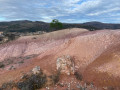
Path of lights and colours: the white of the limestone cliffs, the blood red of the earth, the green of the meadows and trees, the blue of the sky and mountains, the scent of pine trees and the winds that carry our dreams far away as we admire the exceptional panoramas.
Path of the mysteries of Abbé Saunière and his confessor of Espéraza: walk in their footsteps to the heart of their history and their landscapes.
Pech de Limouzy from Loubens
 3.80 mi
+863 ft
-846 ft
2h 30
3.80 mi
+863 ft
-846 ft
2h 30
 Easy
Departure from Loubens (Ariège)
Easy
Departure from Loubens (Ariège)
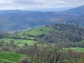
A family circular offering exceptional views of the Pyrenees and the plains of Ariège. This hike takes you through meadows, undergrowth and then forest, on very pleasant paths and tracks. It is also a livestock farming area, so please keep an eye on your dog.
Camon circular route orientation board
 2.54 mi
+325 ft
-295 ft
1h 25
Easy
Departure from Camon (Ariège)
2.54 mi
+325 ft
-295 ft
1h 25
Easy
Departure from Camon (Ariège)
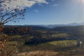
The famous village of roses! This short walk invites you to discover not only the town itself but also the beautiful setting in which it is nestled, thanks to its superb orientation board. Whilst the climb is a challenge (nearly 100 m in elevation), the view is extraordinary! We promise: it’s impossible to get lost… unless you lose yourself in your thoughts and reflections!
The Chemin du Minier in Sem
 6.17 mi
+1,749 ft
-1,749 ft
4h 20
Moderate
Departure from Sem (Ariège)
6.17 mi
+1,749 ft
-1,749 ft
4h 20
Moderate
Departure from Sem (Ariège)
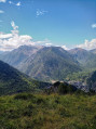
A magnificent circular route through the forest with numerous information panels along the route, offering welcome breaks during the tough climb and breathtaking panoramic views. With two must-see sights, the Refuge de Grail (closed) and the Col de Grisoul!
This short but steep hike in the Vicdessos valley reveals an important part of the mining history of the Ariège. Here, in the heart of the mountains, the Mines du Rancié began with modern open-pit iron ore extraction at an altitude of over 1,500 metres, before more and more tunnels were dug, descending ever deeper! Connected to each other, they saved many lives during the frequent rockfalls that led to their permanent closure in 1931, despite the fact that the deposit was far from exhausted.