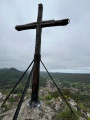
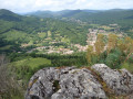
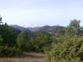
The Picaussel Maquis as seen from Lescale

Set off on an exceptional commemorative walk in the footsteps of the Picaussel Maquis through forests and lush vegetation. This circular route does not follow the classic route back, but instead takes you to discover the Refuge du Maquis, the Maquis Memorial and the village of La Malayrède.
Warning! The climb up to the command post includes some very steep sections, as does the descent from La Malayrède: make sure you’re wearing sturdy footwear! Some sections are not signposted!

Details

28645935
Creation:
Last update:
Last review:
  • Walking
    Activity: Walking
  • ↔
    Distance: 6.39 mi
  • ◔
    Average duration: 4h 25 
  • ▲
    Difficulty: Moderate

  • ⚐
    Back to start: Yes
  • ↗
    Ascent: + 1,660 ft
  • ↘
    Descent: - 1,680 ft

  • ▲
    Highest point: 3,258 ft
  • ▼
    Lowest point: 1,847 ft

Photos

Description of the walk

Start at Lescale. Walk up through the village until you reach the church. The road then turns right and leads straight to the Baraque du Souvenir (Second World War Memorial) and its car park.

(S/E) Head back down towards the church.

(1) At the crossroads, turn right for a short detour to the church (commemorative plaque and mural).

(1) Head down to the right along Rue des Orchidées, following the red and white markings ofthe GR®367. Continue to the left along Rue des Martyrs (information boards). After about fifty metres, take a path on the right. Follow theGR® down to a footbridge over the Blau.

(2) Head right along a forest path (yellow markings; let theGR® branch off to the left) which climbs gradually. When the Blau bends to the right, the path branches off to the left and climbs steeply. You’ll reach the Grotte du Maquis, to the right of the path. Continue climbing and, a little further up, you’ll reach the Saut de La Bourrique.

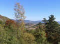
(3) Carry on along a flat section, then turn right and resume the climb. Pass a remarkable viewpoint (orientation table) and continue along the path uphill.

(4) At the junction, take thesecond path on the right, marked in yellow. The path runs along the hillside through the forest, then winds its way up until it reaches a flat stretch and a junction with the Maquis de Picaussel and Maquis command post trails.

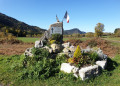
(5) Turn left onto the level track (unmarked) and you will soon come to the Maquis de Picaussel Command Post (Maquis Memorial), set amidst a magnificent tree-lined avenue. Continue along the gently sloping path, which veers to the left.

(6) After about 150 m, turn right. The route is marked by information signs (no trail markings). Wind your way uphill until you reach a wide track.

(7) Follow the track to the right and you’ll soon reach the Maquis Refuge (picnic table). Retrace your steps.

(7) Continue eastwards along the descending track (Route de Picaussel). Stay on this track and walk for a long while, gently downhill, until you reach the Stèle du Maquis, just before the D422.

(8) Turn left onto a path running parallel to the road. At the fork in the road shortly afterwards, keep to the right. Stay on the path running parallel to the road, which is sometimes difficult to follow: if necessary, join the road on the right and follow it to the village of La Malayrède. At the fork at the entrance to La Malayrède, turn left and walk through the village, passing in front of the church.

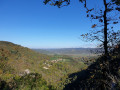
(9) Turn left, ignore a signposted path on the right and continue downhill towards the north-west, passing through a metal gate (open). There are a few yellow signposts… Descend at a leisurely pace until you reach a beautiful viewpoint.

(10) Continue the descent along steep hairpin bends. Further down, you’ll come out onto a track; follow it to the right for a few dozen metres. Join theGR® again and follow it to the left (red and white markings). Walk up the Blau to the small footbridge you crossed on the way there.

(2) Head back up to the village of Lescale by following the outward route in the opposite direction. This will take you back to the car park at the Baraque du Souvenir (S/E).

Waypoints

  1. S/E : mi 0 - alt. 2,067 ft - Car park at the Baraque du Souvenir
  2. 1 : mi 0.05 - alt. 2,047 ft - Saint-Étienne Church (Puivert)
  3. 2 : mi 0.51 - alt. 1,847 ft - Blau footbridge
  4. 3 : mi 0.97 - alt. 2,392 ft - Saut de la Bourrique (L'Escale)
  5. 4 : mi 1.42 - alt. 2,802 ft - Crossroads
  6. 5 : mi 1.72 - alt. 3,091 ft - Crossroads – Flat stretch
  7. 6 : mi 1.93 - alt. 3,077 ft - Junction
  8. 7 : mi 2.17 - alt. 3,248 ft - Junction – Access to the Refuge du Maquis
  9. 8 : mi 3.52 - alt. 2,877 ft - Memorial stone
  10. 9 : mi 4.52 - alt. 2,913 ft - La Malayrède
  11. 10 : mi 5.07 - alt. 2,648 ft - Viewpoint
  12. S/E : mi 6.39 - alt. 2,067 ft - Car park at the Baraque du Souvenir

Notes

Please note: there are no proper water points along the route.

Picnic tables at the Refuge du Maquis and at La Malayrède (at the bottom of the village).

Worth a visit

Don’t miss these stops on this commemorative walk:
- The Memorial Hut in Lescale.
- The Picaussel Maquis Command Post.

Always be cautious and plan ahead when you're outdoors. Visorando and the author of this route cannot be held responsible for any accidents occurring on this route.

The GR® and PR® markings are the intellectual property of the Fédération Française de Randonnée Pédestre.

Reviews and comments

4.3 / 5
Based on 3 reviews

Reliability of the description
4.7 / 5
Ease of following the route
3.3 / 5
Route interest
5 / 5
BARRABES
BARRABES

Overall rating : 4.7 / 5

Date of your route : Mar 15, 2026
Reliability of the description : ★★★★★ Very good
Ease of following the route : ★★★★☆ Good
Route interest : ★★★★★ Very good
Very busy route : No

A hike enjoyed in fine weather. No trouble following the route thanks to the GPS (very useful after La Malayrède). This route features a very steep climb as well as a steep descent. Beautiful views along the Maquis de Picaussel trail, passing by the cave, the Maquis refuge and the memorial stone.

Machine-translated

MamiLaure
MamiLaure

Overall rating : 3.3 / 5

Date of your route : Apr 14, 2025
Reliability of the description : ★★★★☆ Good
Ease of following the route : ★☆☆☆☆ Very disappointing
Route interest : ★★★★★ Very good
Very busy route : No

This walk was previously completed in July 2024, with some difficulties as the path appears to be little-used and nature has quickly reclaimed the area, both in the woods at the start of the walk and at the end, past the village of La Malayrede.
We re-did half the walk in early April 2025, as we lost the trail and wasted time in the woods after the Grotte du Maquis; due to the group’s fatigue, we returned to the village via the forest track, which had been badly eroded by the deforestation work carried out last autumn.
It’s a shame, as this walk is truly fascinating, not only for its scenery and its slightly challenging nature, but above all for passing through all the strategic sites that vividly illustrate the life of the Maquis: the cave, the command post, the refuge, the memorial stone and the House of Remembrance at L’Escale.
This walk deserves to be made safer at the difficult sections with renewed signposting.__

Machine-translated

Nanar11
Nanar11

It is worth noting for anyone wishing to undertake this walk that the route is reserved for experienced walkers; the start is very steep, with a few rather rotten wooden guardrails offering the only protection against the very deep ravine.
Best avoided with young children or pets...

Machine-translated

bergpaden
bergpaden

Overall rating : 5 / 5

Date of your route : Dec 18, 2022
Reliability of the description : ★★★★★ Very good
Ease of following the route : ★★★★★ Very good
Route interest : ★★★★★ Very good
Very busy route : No

An interesting itinerary.
Thank you
Bea

Machine-translated

Other walks in the area

For more walks, use our search engine .

The GPS track and description are the property of this route's author. Please do not copy them without permission.