


bzzz bzzz

 Visorando Member
 Premium user
 - Location: Fontjoncouse (11360)
- Gender: man
Sign up:
Published route(s)
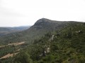
 Pic Saint-Victor from Fontjoncouse
 6.86 mi
 +1,581 ft
 -1,572 ft
 4h 30
4h 30
 Moderate
 Departure from Fontjoncouse (Aude)
The hike involves climbing the normal route up Pic Saint-Victor, the highest point in the County of Durban. At the summit, there are orientation tables and a thousand-year-old hermitage.
There is a sweeping view of the lakes and the sea, as well as the Pyrenees mountain range stretching to the peaks of Luchonnais.
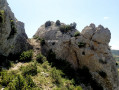
Roc Malpas
 3.70 mi
+738 ft
-722 ft
3 hrs
3.70 mi
+738 ft
-722 ft
3 hrs
 Very difficult
Departure from Fontjoncouse (Aude)
Very difficult
Departure from Fontjoncouse (Aude)
A circular hike to climb Roc Malpas via Pech Fourcan.
A wild and narrow summit.
Extensive panoramic views: in the foreground, Mont Saint-Victor, as well as the Roc de Tautavel, the sea, the lakes and Île Sainte-Lucie, the Pic des 3 Seigneurs and the Thézan plain.
See practical information.
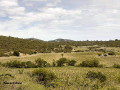
The sublime tour of Fontjoncouse
 11.23 mi
+1,273 ft
-1,250 ft
6h 15
Moderate
Departure from Fontjoncouse (Aude)
11.23 mi
+1,273 ft
-1,250 ft
6h 15
Moderate
Departure from Fontjoncouse (Aude)
Fontjoncouse is enclosed by four large limestone plateaus: to the north, the Selve plateau; to the south, the La Mulgue plateau; to the west, the Devès and Monedières plateau; to the east, the Pic Saint-Victor (the highest point in the municipality). This hike takes you across these large plateaus to discover the wonders of botany and geology, as well as the historical traces left by humans from the Neolithic period to the Middle Ages.
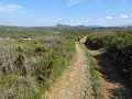
La Combe Paradis
 8.70 mi
+1,234 ft
-1,211 ft
5h 05
Moderate
Departure from Fontjoncouse (Aude)
8.70 mi
+1,234 ft
-1,211 ft
5h 05
Moderate
Departure from Fontjoncouse (Aude)
A large circular route starting from Fontjoncouse, crossing the limestone plateaus (Selve and Blaquière) and the "secret" Combe Paradis, taking the old Gallo-Roman road from Donos to Fontjoncouse.
The route is picturesque, following old paths that have been lost and rediscovered, with magnificent views of Mont Saint-Victor, the Mediterranean and La Clape, as well as the borders of the Hautes Corbières and the blue line of the Pyrenees.
A very wild route (Combe Paradis), home to golden eagles.
The Pech de Bugarach circular route from Caudiès-de-Fenouillèdes
 11.85 mi
+3,514 ft
-3,510 ft
10 hrs
11.85 mi
+3,514 ft
-3,510 ft
10 hrs
 Extremely difficult
Departure from Caudiès-de-Fenouillèdes (Pyrénées-Orientales)
Extremely difficult
Departure from Caudiès-de-Fenouillèdes (Pyrénées-Orientales)
Ascent of the summit of the Aude starting from the Pyrénées-Orientales. The route follows sections of the GR®367A, the GR®36 and an unmarked section on the south-east ridge of the Pech de Bugarach.
⚠️ Please be aware of the difficulties encountered on the challenging route between (10) and (15).
Summit of Pech de Bugarach from La Bastide
7.11 mi
+3,261 ft
-3,238 ft
6h 05
 Difficult
Departure from Camps-sur-l'Agly (Aude)
Difficult
Departure from Camps-sur-l'Agly (Aude)
Ascent of Pech Bugarach starting from La Bastide, a hamlet with a few inhabitants in the commune of Camps-sur-l'Agly. Climb to the summit of Pech de Bugarach and return via theCol de Péchine. A short hike but with a significant elevation gain.
⚠️ Please note the difficulty of reaching the summit from (2) and the tricky descent from (4). See the section: practical information.
Pic de la Camisette, starting from the Plaine d’Artigues
 7.40 mi
+2,657 ft
-2,657 ft
5h 45
Difficult
Departure from Artigues (Ariège)
7.40 mi
+2,657 ft
-2,657 ft
5h 45
Difficult
Departure from Artigues (Ariège)
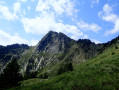
The ascent of the Pic de la Camisette, a granite peak, offers the chance to explore a wild area around the Étangs de la Camisette, the site of a tragedy in 1944 (a plane crash). Starting from Plaine d’Artigues, the route follows a section of the GR®7A, then a section off the beaten track but marked in yellow and with cairns.
La Peira Escrita and the Étang du Diable
 7.95 mi
+2,369 ft
-2,382 ft
5h 45
Moderate
Departure from Fontrabiouse (Pyrénées-Orientales)
7.95 mi
+2,369 ft
-2,382 ft
5h 45
Moderate
Departure from Fontrabiouse (Pyrénées-Orientales)
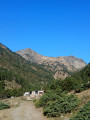
This walk takes you to the Peira Escrita valley, a historic landmark in Capcir, and on to the unexpected Étang du Diable, with its devilishly perfect circle! To do this, we’ll follow a section of the GR® de Pays Tour du Capcir (marked in red and yellow), then take an off-trail route marked with cairns.