


Alain C16.

 Association / Club / Walk leader
 Premium user
 Sign up:
Published route(s)
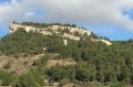
 Mont Gibaou, Baou Redon and the Grotte des Janots from Cassis
 3.97 mi
 +1,227 ft
 -1,211 ft
 2h 55
2h 55
 Moderate
 Departure from Cassis (Bouches-du-Rhône)
This hike from Cassis will take you to Mont Gibaou and Baou Redon between Cassis and Roquefort-La-Bédoule, following old orange markings in some places. These viewpoints offer a 360° view of the Calanques, the Etoile mountain range, the Garlaban, the Sainte-Baume massif, La Ciotat and the Gulf of Love, and the Bay of Cassis. You will descend through the Bois de la Marcouline and visit the Grotte des Janots, an ideal cave for exploring the underground world.
Tour des Barres de Font Blanche from the Grand Caunet
 5.10 mi
+791 ft
-787 ft
3h 00
Moderate
Departure from Ceyreste (Bouches-du-Rhône)
5.10 mi
+791 ft
-787 ft
3h 00
Moderate
Departure from Ceyreste (Bouches-du-Rhône)
This hike starting from Grand Caunet will take you to a beautiful panorama facing the Pic de Bertagne and Sainte-Baume, from where you can look down on Cuges-les-Bains. From there, you will pass under the Barres de Font Blanche and climb back up into the Font Blanche forest via the Vallon de Carafa. On the way back, shortly before arriving, you will discover the Gouffre du Grand Caunet, a karst feature unique to the region.
Loop crossing of the Gros Cerveau via the Val d'Aren
 7.00 mi
+1,739 ft
-1,739 ft
4h 45
Moderate
Departure from Le Castellet (Var) (Var)
7.00 mi
+1,739 ft
-1,739 ft
4h 45
Moderate
Departure from Le Castellet (Var) (Var)
This circular walk starting from La Cadière d'Azur will take you along theGR®®51to the Gros Cerveau ridge, where you can visit an old fort and a cave and enjoy an exceptional 360° view covering the Île de Porquerole and La Ciotat. The return journey is via a shaded path descending along the Val d'Aren.
Gréoux-les-Bains - Les Maurras - Notre-Dame des Oeufs
 11.21 mi
+1,752 ft
-1,755 ft
6h 40
Moderate
Departure from Gréoux-les-Bains (Alpes-de-Haute-Provence)
11.21 mi
+1,752 ft
-1,755 ft
6h 40
Moderate
Departure from Gréoux-les-Bains (Alpes-de-Haute-Provence)
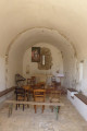
This circular walk, which follows some of the classic trails of Gréoux and some lesser-known paths, will take you from Gréoux-les-Bains to the hamlet of Maurras via a forgotten hamlet. On the way back, you will climb up to the Notre-Dame des Oeufs Chapel and from there to the pylons overlooking Gréoux, from where you will return to your starting point.
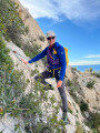
The Corniches Paretti, the Calanque du Devenson, the Couloir des Huluberlus
 7.79 mi
+2,831 ft
-2,831 ft
7 hrs
7.79 mi
+2,831 ft
-2,831 ft
7 hrs
 Extremely difficult
Departure from Marseille (Bouches-du-Rhône)
Extremely difficult
Departure from Marseille (Bouches-du-Rhône)
This route, combining hiking and climbing, will take you from Luminy to the Calanque du Devenson, reputed to be the most difficult of the Calanques to access, via the Balcon du Socle de La Candelle, the Pas de l'Oeil de Verre and the Corniches Paretti.
The ascent will be via the Corniche Aérienne and the Couloir des Huluberlus. The more traditional return route will take you along the Crête du Devenson, the Vallon de La Candelle and the Sentier des Treize Contours before returning to Luminy.
You are in the Calanques National Park, which is subject to specific regulations. Failure to comply with these regulations may result in a fine of up to €1,500.
Tête du Douard
 3.74 mi
+1,273 ft
-1,273 ft
2h 50
Moderate
Departure from Gémenos (Bouches-du-Rhône)
3.74 mi
+1,273 ft
-1,273 ft
2h 50
Moderate
Departure from Gémenos (Bouches-du-Rhône)
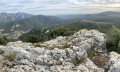
This circular hike starting from Gémenos will take you to the summit of the Tête du Douard, via a varied route that favours walking on trails, avoiding tracks as much as possible. This beautiful viewpoint offers a view of the Pic de Bertagne, the Montagne Sainte-Victoire, the Huveaune valley with Marseille in the background, the Bay of Cassis and the Grand Caunet massif. Along the way, you will climb the Gorges de la Petite Sainte-Baume with its unique atmosphere.
Traversée des Émigrés and Vire des Immortelles
 4.20 mi
+2,595 ft
-2,618 ft
5 hrs
Extremely difficult
Departure from La Ciotat (Bouches-du-Rhône)
4.20 mi
+2,595 ft
-2,618 ft
5 hrs
Extremely difficult
Departure from La Ciotat (Bouches-du-Rhône)
(Please note) The Immortels, Corniche des Grand Ducs and Fight-Club sectors are currently "closed to all visitors" until 15 August 2024. See the message posted on 20 May 2024.
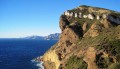
This hike starting from La Ciotat will take you above and below the Soubeyrannes Cliffs between the Grotte des Émigrés and Sainte-Frétouse. The outward route follows the Yellow ridge trail, offering breathtaking views of the Calanques and the Golfe d'Amour. The return route is more technical, alternating between walking and easy climbing, and follows the Black trail below the ridges on the sea side, then a system of ledges halfway up the cliff that will take you back to your starting point.
Pilon du Roi, Grand Puech, Aire de la Moure
 9.72 mi
+2,372 ft
-2,369 ft
6h 30
Moderate
Departure from Allauch (Bouches-du-Rhône)
9.72 mi
+2,372 ft
-2,369 ft
6h 30
Moderate
Departure from Allauch (Bouches-du-Rhône)
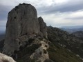
This hike starts at Logis Neuf near Plan-de-Cuques and takes you to Pilon du Roi, climbing up the beautiful valley of the same name. From there, follow the ridges offering magnificent panoramic views of the entire region to reach the Tête du Grand Puech. During the descent, you will discover the Aire de la Moure before returning, after a short climb, to your starting point.
The Coastal Path between La Garde and the Bec de l'Aigle Semaphore
 4.53 mi
+1,460 ft
-1,447 ft
3h 20
4.53 mi
+1,460 ft
-1,447 ft
3h 20
 Difficult
Departure from La Ciotat (Bouches-du-Rhône)
Difficult
Departure from La Ciotat (Bouches-du-Rhône)
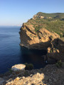
This challenging and technical route, which is exposed in places (please read the description carefully), starts from La Garde in La Ciotat and takes you close to part of the Soubeyranes Cliffs between Notre-Dame de la Garde and the Bec de l'Aigle semaphore. You will discover the unique characteristics of these cliffs, made of a mixture of sandstone, puddingstone and limestone. On the way back, you will cross ancient terraces and the ruins of forgotten farms before returning to your starting point via a small road.
See the chapter: practical information about the (4)
The Tour of the Soubeyran Massif
 14.00 mi
+3,274 ft
-3,284 ft
7 hrs
14.00 mi
+3,274 ft
-3,284 ft
7 hrs
 Very difficult
Departure from La Ciotat (Bouches-du-Rhône)
Very difficult
Departure from La Ciotat (Bouches-du-Rhône)
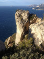
This long hike will take you around the Tour du Massif Soubeyran, bordered by the Mediterranean Sea and the D559 road linking Cassis to La Ciotat. For a good half of the route, you will follow the ridge line between Pas de Bellefille and La Ciotat. This balcony section offers breathtaking views of the Toulon-Marseille arc throughout the route. You will complete the route in a circular fashion with a tour of the valleys overlooking La Ciotat.
GPS is highly recommended!
Le Télégraphe from Les Plaines Baronnes
 7.65 mi
+1,345 ft
-1,352 ft
4h 40
Moderate
Departure from La Ciotat (Bouches-du-Rhône)
7.65 mi
+1,345 ft
-1,352 ft
4h 40
Moderate
Departure from La Ciotat (Bouches-du-Rhône)
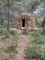
This circular hike starts from Chemin des Plaines Baronnes in La Ciotat, alternating between tracks and paths, and takes you to the summit of Le Télégraphe. The route offers some beautiful views of the Golfe d'Amour and the various surrounding mountains: Calanques, Sainte Baume, etc. Along the route, you can see the remains of ancient dwellings: jas, drystone shelters, Cade ovens, charcoal kilns... some of which have been restored by associations of enthusiasts.