


montagne54

 Visorando Member
 Premium user
 - Location: Nancy (54100|54000)
- Gender: man
Sign up:
Published route(s)
 Near Saverne
 14.99 mi
 +2,992 ft
 -2,982 ft
 7 hrs
7 hrs
 Very difficult
 Departure from Haegen (Bas-Rhin)
A beautiful hike with numerous castle ruins, including Haut Barr, known as the "eye of Alsace", and a trail through a forest with stunning autumn colours. The trails are very well marked and maintained by the Club Vosgien.The elevation gain is significant, so take this into account to fully appreciate all the charms of this hike.
Little Switzerland in Lorraine
 13.27 mi
+906 ft
-876 ft
6h 55
13.27 mi
+906 ft
-876 ft
6h 55
 Moderate
Departure from Dieulouard (Meurthe-et-Moselle)
Moderate
Departure from Dieulouard (Meurthe-et-Moselle)
A lovely walk to discover charming villages along the winding course of the Esch stream.
Little Switzerland Lorraine.
 13.68 mi
+1,073 ft
-1,063 ft
7h 15
Moderate
Departure from Gézoncourt (Meurthe-et-Moselle)
13.68 mi
+1,073 ft
-1,063 ft
7h 15
Moderate
Departure from Gézoncourt (Meurthe-et-Moselle)
Little Switzerland Lorraine in the vicinity of Gézoncourt.
Nideck Waterfall
 12.06 mi
+2,900 ft
-2,907 ft
8h 05
Moderate
Departure from Oberhaslach (Bas-Rhin)
12.06 mi
+2,900 ft
-2,907 ft
8h 05
Moderate
Departure from Oberhaslach (Bas-Rhin)
Nideck Waterfall, Ruins of Nideck Castle, Schneeberg, Ruins of Petit Ringelsberg, Ruins of Grand Rengelsberg.
Tour of the Ballon d’Alsace
 11.87 mi
+2,959 ft
-2,953 ft
8h 00
Moderate
Departure from Saint-Maurice-sur-Moselle (Vosges)
11.87 mi
+2,959 ft
-2,953 ft
8h 00
Moderate
Departure from Saint-Maurice-sur-Moselle (Vosges)
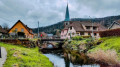
A hike that requires sure-footedness. The path is sometimes slippery from the start up to the Col de Rode Tête, setting off from La Jumenterie to reach Ronde Tête via Lake Alfeld and its waterfalls. The route passes through Sewen and its lake before heading up to Wisgrutt. From there, theGR®5takes us back to the foot of the Ballon d’Alsace to climb to its summit: the Vierge, an orientation table and stunning views of the surrounding area. Finally, we pass by the statue of Joan of Arc before returning to our starting point.
Cabane de Mille - FXB Panossière hut
 8.78 mi
+3,245 ft
-2,762 ft
6h 50
8.78 mi
+3,245 ft
-2,762 ft
6h 50
 Difficult
Departure from Liddes (Valais)
Difficult
Departure from Liddes (Valais)
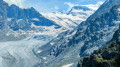
Between Mont Blanc and Monte Rosa, the Grand Combin stands out from everywhere. Forming the border between Switzerland and Italy, and the boundary between the Grand Saint-Bernard valley and the Val de Bagne, it rises to 4,314 m. The tour takes seven days; I added an extra day to visit the Fenêtres lakes, the icing on the cake. Each stage offers alpine accommodation.
The 3-Pass Circular: Leschaux, Rosset and Vanoise, starting from Pralognan
 13.37 mi
+5,676 ft
-5,699 ft
11h 05
Very difficult
Departure from Pralognan-la-Vanoise (Savoie)
13.37 mi
+5,676 ft
-5,699 ft
11h 05
Very difficult
Departure from Pralognan-la-Vanoise (Savoie)
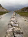
A superb route with a particularly varied character.
A high-mountain atmosphere, depending on the areas you pass through.
Lush and green, with flora unique in Europe.
Wildlife is ever-present, with marmots, chamois and ibex to be spotted with a keen eye.
Its mountain lakes: the iconic Lac des Vaches, Lac de la Patinoire and Lac du Long.
Spectacular views of the surrounding peaks: the Grande Casse, to name but one.
Beautiful panoramic views of the valley and the various surrounding glaciers.
Le Napremont
 6.34 mi
+2,526 ft
-2,539 ft
5h 05
Moderate
Departure from Pralognan-la-Vanoise (Savoie)
6.34 mi
+2,526 ft
-2,539 ft
5h 05
Moderate
Departure from Pralognan-la-Vanoise (Savoie)
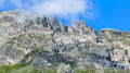
This circular route offers beautiful views and 360° panoramas of the surrounding area and peaks. In terms of difficulty: there is a difference in altitude in the undergrowth; there is a passage through a chimney, but this has been made easier by the installation of steps and a handrail.
A trail with beautiful flora dominated by the Dents de Portetta and the Aiguille d'Août.
A pleasant descent in the sunshine before returning to the undergrowth. A very beautiful route, even in hot weather.
From Lignod to Mont Zerbion via the Col de Portela
6.76 mi
+3,593 ft
-3,570 ft
6h 15
Very difficult
Departure from Ayas (Aosta Valley)
Wait until there is no snow to do this hike safely. Round trip hike. You must be sure-footed and experienced in mountain walking.
Starting from Lignod, pass in front of the church, which is currently being renovated, with its pretty fresco. Well-marked paths in the village allow you to leave it and climb towards Borbey. Pass a car park and take the path that continues to climb and gain altitude. You are on a Way of the Cross that climbs up to the Virgin of Mount Zerbion. The Col de Portela is visible and recognisable with its pylon. Cross the pass to reach Mount Zerbion and its virgin located at 2,723 metres above sea level, overlooking the Ayas valley.
Champoluc - Refuge de l'Arp
6.16 mi
+3,829 ft
-988 ft
6h 10
Difficult
Departure from Ayas (Aosta Valley)
Starting from the church square, this hike follows the Evançon torrent before turning left onto Rue de l'Ostrion, which gradually climbs. Passing by the small chapel overlooking the village of Champoluc and the Ayas Valley, you will reach the village of Mascognaz, an authentic and beautiful Walser village. The hike passes through Col de Palasina and then, after a slight descent, you will reach the wild Bataille lakes and then the Arp refuge at 2,400 metres.
Ascending journey to the heights of Vallorcine
 5.59 mi
+961 ft
-2,986 ft
3h 25
Difficult
Departure from Finhaut (Valais)
5.59 mi
+961 ft
-2,986 ft
3h 25
Difficult
Departure from Finhaut (Valais)
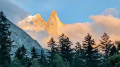
An easy hike overlooking the Trient and Vallorcine valleys, with superb views of the surrounding mountains such as the Mont Blanc massif and the 4,000-metre peaks of Valais. Caution for those prone to vertigo or fear of heights: there is a section with handrails, which is not dangerous but requires particular attention
Palon de Résy on the heights of Saint-Jacques-des-Allemands
5.87 mi
+3,323 ft
-3,330 ft
5h 45
Difficult
Departure from Ayas (Aosta Valley)
This is a fairly wild hike starting from Saint-Jacques-des-Allemands, a village after Champoluc. The trail begins with a continuous climb towards the Ferraro Refuge and then joins the Palon de Résy. There is a beautiful cross and a beautiful view of Mont Rose, its moraine, and Lac Bleu. Trail 8D then leads to several small mountain lakes called Résy. The trail continues to the "basin" of Alpe della Forca Supériore. From here, the trail descends to the refuge and then Saint-Jacques-des-Allemands.
A circular route through several villages in Lorraine starting from Custines
14.19 mi
+1,358 ft
-1,365 ft
7h 40
Difficult
Departure from Custines (Meurthe-et-Moselle)
Starting from Custines, a lovely circular route to explore the Mauchère Valley: beautifulviews of the heights of the Mauchère Valley. The trails offer magnificent panoramic views of the Moselle and Meurthe valleys. The confluence, known as Gueule d’Enfer, where the Moselle and Meurthe meet, is also visible from these viewpoints. The valley was also served by a railway line linking Pompey to Nomeny, which operated from 1810 until the 1950s. This line was decommissioned in the 1980s and subsequently converted into a cycle path, now shared by walkers.
Route of castles in the hills above Saverne
 12.07 mi
+2,234 ft
-2,218 ft
7h 30
Difficult
Departure from Haegen (Bas-Rhin)
12.07 mi
+2,234 ft
-2,218 ft
7h 30
Difficult
Departure from Haegen (Bas-Rhin)
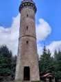
A trail rich in discoveries. Throughout the route, this trail offers numerous remarkable viewpoints as well as points of interest dotted along the way. These elements help to make this day a memorable experience, combining discovery and enjoyment. Each of the sites visited allows you to broaden your knowledge whilst enjoying a leisurely walk, ideal for immersing yourself in the region’s natural and historical heritage. Highlights of this hike: the Wuestenberg Plateau – the castles of Ochsenstein, Petit Geroldseck, Grand Geroldseck, Haut Barr and finally the Brostch Cave and Tower.