Tour of the Ballon d’Alsace

A hike that requires sure-footedness. The path is sometimes slippery from the start up to the Col de Rode Tête, setting off from La Jumenterie to reach Ronde Tête via Lake Alfeld and its waterfalls. The route passes through Sewen and its lake before heading up to Wisgrutt. From there, theGR®5takes us back to the foot of the Ballon d’Alsace to climb to its summit: the Vierge, an orientation table and stunning views of the surrounding area. Finally, we pass by the statue of Joan of Arc before returning to our starting point.

Details

47668174
Creation:
Last update:
Last review:
  • Walking
    Activity: Walking
  • ↔
    Distance: 11.87 mi
  • ◔
    Average duration: 8h 00 
  • ▲
    Difficulty: Moderate

  • ⚐
    Back to start: Yes
  • ↗
    Ascent: + 2,959 ft
  • ↘
    Descent: - 2,953 ft

  • ▲
    Highest point: 4,091 ft
  • ▼
    Lowest point: 1,640 ft

Photos

Description of the walk

Park at La Jumenterie. You can get there via the road leading from Saint-Maurice-sur-Moselle up to the Ballon d’Alsace.

(S/E) Go round the buildings on the left and follow the Blue Ring marked trail towards the Birkel viewpoint. Depending on the season, you’ll need sure-footedness and constant vigilance until you reach the Col de Ronde Tête.

(1) Pass the Birkel viewpoint and continue along the ‘Blue Ring’ marked trail to reach the Col de Ronde Tête.

(2) Carry on along the Blue Ring – Red Rectangle trail towards the Col des Charbonniers until you reach the start of a downhill path on the right marked Blue Ring – Red Saltire.

(3) Turn right and head for a four-way junction (elevation 1044). Continue along the Red Saltire trail, which branches off to the left.

(4) Turn left and follow the Red Saltire markings.

(5) Ignore the Red Rectangle with a white cross on the left and carry on straight ahead.

(6) Take a short break, if you wish, at the Chalet Hutte du Schaling and continue along the Red Saltire trail.

(7) Head towards “Wasserfall” on your right, following the Red Saltire signposts, and reach the waterfall, where you’ll need to climb a small ladder to get to it and take some lovely photos.

(8) Carry on to the Alfeld Lake dam, built in 1883 by the Germans.

(9) Keep the dam on your right, carry on for a few dozen metres, then turn left, following the Blue Rectangle signposting. Head straight on to the Sewen waterfalls.

(10) Continue to follow the Blue Rectangle signposts: be careful, as the path can be slippery depending on the weather.

(11) Stay on the Blue Rectangle path, ignoring the Blue Triangle on your left. You’ll reach the wayside shrine and Lake Sewen, where you can enjoy the beautiful view of the lake.

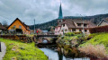
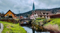
(12) Continue along the path until you reach Sewen, a few metres from the bridge over the Ruisseau de l’Alfeld. Cross the bridge, then turn immediately left towards the church.

(13) Turn right, walk past the church and turn right again into Rue Elbach. At number 28, turn left and cross the small bridge over the Doller.

(14) Turn right to leave the village, continuing to follow the Blue Rectangle.

(15) Turn right onto the bridge to cross the Doller again and follow the road to the left: Red Triangle and Red Cross signposts.

(16) At the junction, stay on the road and continue following the Red Cross markings, ignoring the Red Triangle on the right.

(17) Just before the farm, follow the path that climbs to the right and leads onto the dirt track to Grand Langenberg.

(18) Take the path opposite, cross another forest track and continue to follow the Red Cross signposts. The climb is long but steady.

(19) Carry on straight ahead until you reach the Wissgrut farmhouse inn, where you can have a bite to eat when it is open.

(20) Turn right, follow the path marked with a Red Rectangle and head for the Vierge du Wissgrut: a beautiful view of the Ballons of the Vosges.

(21) Follow the markings to reach the Plain de la Gentiane and then La Gentiane: a picnic area where you can enjoy your packed lunch.

(22) Continue straight on, following the ‘Red Rectangle’ markings, cross the D466, carry on straight ahead and rejoin the path at a place called La Chaumière.

(23) Pass the inn on the left by the roadside, then a picnic area. Follow the D465 for a short distance, then turn off to the right. You’ll reach a crossroads at the edge of the forest, not far from the Auberge du Ballon d’Alsace.

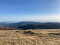
(24) Begin the climb leading to the Ballon d’Alsace: Red Rectangle. Reach the Vierge du Ballon (1,247 m): orientation table and lovely views of the surrounding area.

(25) Continue on to the Ballon d’Alsace.

(26) Turn left: follow the Yellow Disc markings. Head towards the statue of Joan of Arc.

(27) Turn right onto the Red Disc path, which is situated slightly above the statue. Head straight down to return to La Jumenterie (S/E).

Waypoints

  1. S/E : mi 0 - alt. 3,507 ft - La Jumenterie.
  2. 1 : mi 0.74 - alt. 3,645 ft - Birkel viewpoint.
  3. 2 : mi 1.18 - alt. 3,576 ft - Ronde Tête Pass. - Col de Ronde Tête
  4. 3 : mi 1.49 - alt. 3,583 ft - Crossroads, Red Saltire.
  5. 4 : mi 1.65 - alt. 3,412 ft - Turn left at the fork.
  6. 5 : mi 2.3 - alt. 2,874 ft - Junction, go straight on
  7. 6 : mi 2.61 - alt. 2,552 ft - Schaling Chalet.
  8. 7 : mi 2.9 - alt. 2,264 ft - Turn right at the fork - Cascade du Lac d'Alfeld
  9. 8 : mi 2.98 - alt. 2,260 ft - Cascade du Lac d'Alfeld
  10. 9 : mi 3.13 - alt. 2,051 ft - Lake - Lac d'Alfeld
  11. 10 : mi 3.45 - alt. 1,837 ft - Sewen Waterfalls website
  12. 11 : mi 3.74 - alt. 1,722 ft - Junction, go straight on
  13. 12 : mi 4.51 - alt. 1,647 ft - Lake Sewen - Lac de Sewen
  14. 13 : mi 5.11 - alt. 1,647 ft - Sewen, church
  15. 14 : mi 5.34 - alt. 1,686 ft - Source de la Doller
  16. 15 : mi 5.8 - alt. 1,906 ft - Doller Bridge. - Source de la Doller
  17. 16 : mi 6.24 - alt. 1,995 ft - Junction
  18. 17 : mi 6.39 - alt. 2,028 ft - Junction, turn right
  19. 18 : mi 6.76 - alt. 2,585 ft - Grand Langenberg Route
  20. 19 : mi 7.33 - alt. 3,169 ft - Junction, go straight on
  21. 20 : mi 7.85 - alt. 3,537 ft - Wisgrutt farmhouse inn.
  22. 21 : mi 8.15 - alt. 3,678 ft - Wissgrut
  23. 22 : mi 8.99 - alt. 3,474 ft - The Gentian
  24. 23 : mi 9.63 - alt. 3,579 ft - La Chaumière.
  25. 24 : mi 10.49 - alt. 3,914 ft - Ballon d’Alsace Inn, crossroads
  26. 25 : mi 10.73 - alt. 4,072 ft - Our Lady of Ballon - Ballon d'Alsace
  27. 26 : mi 10.86 - alt. 4,088 ft - Ballon d’Alsace (1,247 m)
  28. 27 : mi 11.24 - alt. 4,062 ft - Statue of Joan of Arc
  29. S/E : mi 11.87 - alt. 3,504 ft - La Jumenterie.

Notes

Wear good walking boots with sturdy, grippy soles. There is no accommodation available on the section before Wisgrutt.
You can have lunch at the Wisgrutt farmhouse inn when it is open.

Worth a visit

(S/E) La Jumenterie: it was the Dukes of Lorraine who believed that the harsh climate of the Ballon d’Alsace would produce hardy horses, and so they established a stud farm there.

(9) Lake Alfed and the Wasserfall waterfall are well worth a visit.

(10) The Sewen Waterfalls are a site well worth exploring.

Always be cautious and plan ahead when you're outdoors. Visorando and the author of this route cannot be held responsible for any accidents occurring on this route.

The GR® and PR® markings are the intellectual property of the Fédération Française de Randonnée Pédestre.

Reviews and comments

4.5 / 5
Based on 2 reviews

Reliability of the description
4.5 / 5
Ease of following the route
4 / 5
Route interest
5 / 5
Bibilydie
Bibilydie

Overall rating : 4.3 / 5

Date of your route : May 29, 2025
Reliability of the description : ★★★★☆ Good
Ease of following the route : ★★★★☆ Good
Route interest : ★★★★★ Very good
Very busy route : No

A challenging walk, particularly from Sewen up to Wissgrut – a long climb with quite steep gradients in places; I reckoned it was 21 km rather than 19 km,

Machine-translated

Terrl
Terrl
• Edited:

Overall rating : 4.7 / 5

Date of your route : Nov 02, 2024
Reliability of the description : ★★★★★ Very good
Ease of following the route : ★★★★☆ Good
Route interest : ★★★★★ Very good
Very busy route : No

A lovely walk with plenty of elevation gain; we did it with a 14-year-old – no particular difficulties, though it was still quite a workout. The path is undulating and varied, winding between the Alsace and Vosges slopes and the summit area. Beautiful panoramic views from the Ballon, with unobstructed views of the Swiss Alps. To top it all off, we had excellent weather for November.

Machine-translated

Other walks in the area

For more walks, use our search engine .

The GPS track and description are the property of this route's author. Please do not copy them without permission.