The 3-Pass Circular: Leschaux, Rosset and Vanoise, starting from Pralognan

A superb route with a particularly varied character.
A high-mountain atmosphere, depending on the areas you pass through.
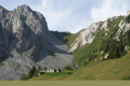
Lush and green, with flora unique in Europe.
Wildlife is ever-present, with marmots, chamois and ibex to be spotted with a keen eye.
Its mountain lakes: the iconic Lac des Vaches, Lac de la Patinoire and Lac du Long.
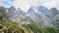
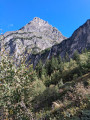
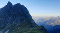
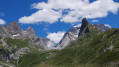
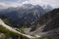
Spectacular views of the surrounding peaks: the Grande Casse, to name but one.
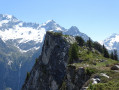
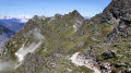
Beautiful panoramic views of the valley and the various surrounding glaciers.

Details

49167298
Creation:
Last update:
Last review:
  • Walking
    Activity: Walking
  • ↔
    Distance: 13.37 mi
  • ◔
    Average duration: 11h 05 
  • ▲
    Difficulty: Very difficult

  • ⚐
    Back to start: Yes
  • ↗
    Ascent: + 5,676 ft
  • ↘
    Descent: - 5,699 ft

  • ▲
    Highest point: 8,583 ft
  • ▼
    Lowest point: 4,610 ft

Photos

Description of the walk

Park in the Granges car park.

(S/E) Take the path towards the Col de Leschaux. You’ll reach the crossroads at a place called La Fenêtre.

(1) Continue the ascent to cross the Couloir des Rossets stream, then reach the junction leading to Mont Chevrier.

(2) Leave this path on your left and continue to the right. Follow a series of hairpin bends to reach the foot of the Col de Leschaux.

(3) Carry on and, via further hairpin bends, reach the pass.

(4) Follow the path on the right downhill. Take care on this fairly steep descent; use your hands for support if necessary, until you reach a junction at the top station of the Ancolie chairlift.

(5) Turn left to begin the ascent and reach the Col Noir.

(6) Continue, taking care, along the steep path to reach the Col Rosset.

(7) Continue downhill now until you reach a small lake. Start climbing again, still taking care, until you reach the junction for Lac de la Patinoire.

(8) Turn left to reach the lake quickly.

(9) Return via the same route to the previous junction.

(8) Turn left, then follow the path to the Chalet des Gardes. Continue slightly downhill until you reach theGR®55.

(10) Turn left onto it and, after a gentle climb, reach Lac Long at the foot of the Grande Casse.

(11) Continue along theGR® to reach the Refuge du Col de la Vanoise.

(12) Retrace your steps along this route to return to theGR® junction.

(10) Keep left on theGR® to reach the Pont du Chanton.

(13) Cross the Glière torrent, continue on to reach the Chalets de Glière. Keep straight ahead on theGR®; shortly afterwards, you’ll reach the junction at the Refuge des Barmettes.

(14) Continue downhill along theGR® following the red and white markings to reach the lower station of the Gentiane chairlift, at a place called Les Fontanettes.

(15) Here you have two options:
- if you’re feeling tired, you can take a free shuttle bus back to the car park (S/E),
- continue along theGR® – this is the route shown on the map – to reach the Barioz neighbourhood at the foot of the Pralognan ski lifts.

(16) Turn right onto Rue du Doron, then left onto Avenue de la Grande Casse. Cross to the right via Rue des Grands Prés and the Doron. Continue along Rue des Darbelays and Rue des Savines to return to the Granges car park (S/E).


Waypoints

  1. S/E : mi 0 - alt. 4,731 ft - Les Granges car park
  2. 1 : mi 0.52 - alt. 5,328 ft - Couloir des Rossets
  3. 2 : mi 1.28 - alt. 6,132 ft - Mont Chevrier junction
  4. 3 : mi 2.26 - alt. 7,556 ft - Below the Col de Leschaux (2,564 m)
  5. 4 : mi 2.83 - alt. 8,419 ft - Col de Leschaux (2,564 m)
  6. 5 : mi 3.98 - alt. 7,661 ft - GS Ancolie Chairlift
  7. 6 : mi 4.59 - alt. 8,238 ft - Col Noir (2,512 m)
  8. 7 : mi 4.81 - alt. 8,435 ft - Col Rosset (2,570 m)
  9. 8 : mi 5.29 - alt. 7,907 ft - Alt. 2,411 m. Fork in the path. Return to the lake
  10. 9 : mi 5.61 - alt. 8,294 ft - Lac de la Patinoire
  11. 10 : mi 6.49 - alt. 7,690 ft - Junction. Return via the refuge – Lac des Vaches
  12. 11 : mi 7.3 - alt. 8,159 ft - Lac Long (Vanoise)
  13. 12 : mi 7.63 - alt. 8,258 ft - Refuge du Col de la Vanoise
  14. 13 : mi 9.41 - alt. 7,254 ft - Chanton Bridge
  15. 14 : mi 10.34 - alt. 6,598 ft - Refuge des Barmettes (2,012 m)
  16. 15 : mi 11.55 - alt. 5,390 ft - Les Fontanettes
  17. 16 : mi 12.3 - alt. 4,652 ft - Le Barioz – Doron de Bozel (river) – a tributary of the Isère
  18. S/E : mi 13.37 - alt. 4,731 ft - Les Granges car park

Notes

Take enough water to reach the Col de la Vanoise. There are no water supplies along the route before you reach the Refuge du Col de la Vanoise.
Good walking shoes and walking poles. A good level of fitness and a head for heights are essential to enjoy this hike.
Hats – Sunglasses – Sun cream – A small personal first-aid kit. 2–3 energy bars in your rucksack.
(8) Chalet des Gardes: this building is not open to the public; it is closed.
(14) Refuge des Barmettes: water is available here.

Worth a visit

A spectacular route with views of the Vanoise ice cap and its peaks.

Always be cautious and plan ahead when you're outdoors. Visorando and the author of this route cannot be held responsible for any accidents occurring on this route.

The GR® and PR® markings are the intellectual property of the Fédération Française de Randonnée Pédestre.

Reviews and comments

4.9 / 5
Based on 3 reviews

Reliability of the description
5 / 5
Ease of following the route
4.7 / 5
Route interest
5 / 5
Jemzolo
Jemzolo

Overall rating : 5 / 5

Date of your route : Jul 02, 2026
Reliability of the description : ★★★★★ Very good
Ease of following the route : ★★★★★ Very good
Route interest : ★★★★★ Very good
Very busy route : Yes

A brilliant walk, with few people up to point 8… but after that, there are hordes of walkers of all sorts who’ve taken the cable car to see the lakes.
Once I reached the Col de Vanoise, I carried on to the two lakes (Lac Rond, which is magnificent, and Lac du Col de la Vanoise), which were much less crowded.
To avoid the crowds on the GR, from the Col de Vanoise I headed back down via the Lac des Assiettes, then further down at a fork I turned left onto the Sentier des Arolais?? (not sure of the spelling), which descends alongside the Ruisseau de l’Arcelin and joins the Fontanettes. From there, the descent to the village is very quick, though crossing through it to the car park where I’d set off is a bit less fun. But the walk is truly beautiful.

Machine-translated

User 10282693

Overall rating : 4.7 / 5

Date of your route : Sep 26, 2025
Reliability of the description : ★★★★★ Very good
Ease of following the route : ★★★★☆ Good
Route interest : ★★★★★ Very good
Very busy route : No

A beautiful hike that makes you feel like you're alone in the world (I went at the end of September).
Fabulous scenery, fairly easy route to follow but some sections are very steep.
Ideal for those who want to tackle some elevation gain with beautiful climbs surrounded by stunning scenery.

Machine-translated

StéfySVG
StéfySVG

Overall rating : 5 / 5

Date of your route : Aug 13, 2024
Reliability of the description : ★★★★★ Very good
Ease of following the route : ★★★★★ Very good
Route interest : ★★★★★ Very good
Very busy route : No

A very challenging hike, with some stunning scenery.
There weren’t many people out and about when I was there.
Lunch break at the chairlifts.
A night at the Col de la Vanoise mountain hut, which I highly recommend, and a return journey in a thunderstorm – but just as magnificent.
I’d love to do it again

Machine-translated

Other walks in the area

For more walks, use our search engine .

The GPS track and description are the property of this route's author. Please do not copy them without permission.