


Mairie Le Bas Ségala

 Local authority
 Premium user
Sign up:
Published route(s)
 The Cayla Bridge circular from Cadour
 5.73 mi
 +1,043 ft
 -1,060 ft
 3h 35
3h 35
 Moderate
 Departure from La Bastide-l'Évêque (Aveyron)
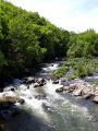
A beautiful hike in the heart of the wild gorges of the Aveyron, following in the footsteps of a distant past, of which the Pont du Cayla is a magnificent reminder. Panoramic views of the Aveyron valley and a walk along the riverbank.
 Between Lézert and Serènes
 24.12 mi
+2,661 ft
-2,657 ft
4 hrs
24.12 mi
+2,661 ft
-2,657 ft
4 hrs
 Difficult
Departure from La Bastide-l'Évêque (Aveyron)
Difficult
Departure from La Bastide-l'Évêque (Aveyron)
A mountain bike route to explore the Bas Ségala area, criss-crossed by the picturesque streams of the Lézert and the Serènes. This route connects the villages of La Bastide-l’Évêque, Saint-Salvadou and Vabre-Tizac. Alternative routes allow the route to be split into two sections for walking tours.
Around La Bessière and Pont de Vézis
 4.43 mi
+791 ft
-817 ft
2h 45
4.43 mi
+791 ft
-817 ft
2h 45
 Easy
Departure from La Bastide-l'Évêque (Aveyron)
Easy
Departure from La Bastide-l'Évêque (Aveyron)
A route to discover the diversity of the landscapes and architecture around La Bastide l’Évêque: the picturesque village of La Bessière; the Pont de Vézis, a bridge dating from the early 20th century built to support the commune’s mining industry; and the plateaus offering magnificent views over the Ségala and the unspoilt valleys of the Lézert and the Aveyron.
The Bardeliers Trail
 6.10 mi
+1,070 ft
-1,024 ft
3h 45
Moderate
Departure from La Bastide-l'Évêque (Aveyron)
6.10 mi
+1,070 ft
-1,024 ft
3h 45
Moderate
Departure from La Bastide-l'Évêque (Aveyron)
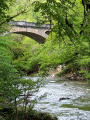
This route, running between the Lézert Valley, the Aveyron Gorges and the Ségala Plateau, allows you to explore the landscapes and villages that have been shaped over time around La Bastide l’Évêque.