Cadour and its surroundings via La Crouzette from La Bastide-l’Évêque

A walk to explore the village of Cadour and its surroundings, with beautiful views over the Aveyron valley.

Details

n°53495722
Creation:
Last update:
Last review:
  • Walking
    Activity: Walking
  • ↔
    Distance: 6.19 mi
  • ◔
    Average duration: 3h 35 
  • ▲
    Difficulty: Moderate

  • ⚐
    Back to start: Yes
  • ↗
    Ascent: + 814 ft
  • ↘
    Descent: - 843 ft

  • ▲
    Highest point: 1,906 ft
  • ▼
    Lowest point: 1,368 ft

Photos

Description of the walk

The route starts in the village of La Bastide-l’Évêque from the tourist office car park.
This route is signposted SP7 and SP7A from the alternative route.

(S/E) Passing the state school, head towards the D69 junction at the top of the village.

(1) Turn right towards Rieupeyroux and continue along this road. After the hamlet of Lafon, there is a road on the left.

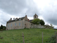
(2)Turn onto this road, then very soon after, carry on straight ahead along the dirt track that runs alongside the motocross track at Groulet(note the spire of Cadour’s bell tower on your right). You’ll reach the hamlet of Ginestous, which offers a magnificent view over the Aveyron Valley.

(3) Carry on along the track to the right as you leave Ginestous to join the D118.

(4) Turn right onto this departmental road to reach the hamlet of Pouzoulet and, from there, follow the SP7 A alternative route.

(5) Turn right onto the road towards Cadour. Drive through the village until you reach the square. Pass the cross and turn right between the houses.

(6) Continue to the right until you reach the old school, which stands at a corner at a junction.

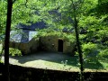
(7) Turn right, passing the hamlet of La Crouzette and an old mill before joining the D69.

(8) Keep left and follow this road to the junction with Les Mines de Vézis. Turn right to join the SP 7 at the hamlet of Mazuc de Vézis, continuing straight on.

(9) Carry on along the road, passing through Mazuc de Vézis and Les Aliberts. As you leave this hamlet, carry on until you reach a track on the left.

(10) Take this track, which leads to the village hall in La Bastide-l’Évêque. Walk behind the village hall, skirting a pond, before reaching Rue des Lacs.

(11) Cross the street and continue along the path that runs alongside the gardens and leads to the village square. Take the second alleyway on the right, then the second on the right again towards the starting point (S/E).

Waypoints

  1. S/E : mi 0 - alt. 1,545 ft - Tourist Office car park - La Bastide-l'Évêque
  2. 1 : mi 0.07 - alt. 1,568 ft - D69 towards Rieupeyroux
  3. 2 : mi 0.75 - alt. 1,801 ft - Fork in the road towards Ginestous, motocross track
  4. 3 : mi 1.28 - alt. 1,634 ft - Ginestous
  5. 4 : mi 1.67 - alt. 1,385 ft - D118 – Pouzoulet, Le Cayla
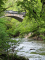
  6. 5 : mi 2.19 - alt. 1,430 ft - Pouzoulet - Pont du Cayla
  7. 6 : mi 3.55 - alt. 1,818 ft - Cadour
  8. 7 : mi 3.77 - alt. 1,834 ft - Former school in Cadour
  9. 8 : mi 4.62 - alt. 1,824 ft - D69
  10. 9 : mi 5.02 - alt. 1,896 ft - The Mazuc de Vézis
  11. 10 : mi 5.57 - alt. 1,729 ft - Path after Les Aliberts
  12. 11 : mi 5.93 - alt. 1,539 ft - Road beyond the pond
  13. S/E : mi 6.19 - alt. 1,545 ft - Car park at the La Bastide l’Evêque Tourist Office - La Bastide-l'Évêque

Worth a visit

Along the route:
La Bastide l’Évêque, a bastide founded in the13th century, and its14th-century church
The ‘Oreilles en Balade’ audio trail at La Bastide l’Évêque.
Panoramic views over the Aveyron valley

Nearby:
Les Martinets du Lézert, copper forges
The Pont du Cayla bridge in the Gorges de l’Aveyron at La Bastide l’Évêque, 5 km away.
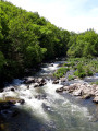
The Aveyron and Lézert valleys
Saint-Salvadou and its neo-Gothic church, 12 km away.
Fontaine des Fées and Neolithic remains, 14 km away.
Vabre-Tizac and its ancient fortified village with a13th-century arched gateway, 15 km away.
The Croix de Bleyssol (15th century, listed as a Historic Monument) 16 km away.
Bois du Bruel, a fun interpretive trail 16 km away: the trail is dotted with little games and puzzles about the biodiversity and history of the woodland. This site is one of the Aveyron’s sensitive natural areas.

Reviews and comments

4.7 / 5
Based on 1 review

Reliability of the description
5 / 5
Ease of following the route
5 / 5
Route interest
4 / 5
pascal2002
pascal2002

Overall rating : 4.7 / 5

Date of your route : Mar 23, 2026
Reliability of the description : ★★★★★ Very good
Ease of following the route : ★★★★★ Very good
Route interest : ★★★★☆ Good
Very busy route : No

A very pleasant walk with no major difficulties

Machine-translated

Other walks in the area

For more walks, use our search engine .

The GPS track and description are the property of this route's author. Please do not copy them without permission.