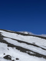
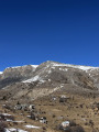
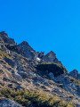
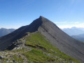
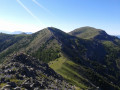
Mont Démant as seen from the Col de l’Espaul

Nestled at the heart of rugged, untamed nature lies Mont Demant. Every step on its rocky slopes is a battle against gravity, a struggle against fatigue, but also a communion with a breathtaking landscape. As you climb, the view opens out onto deep valleys and distant peaks, silent witnesses to the courage required. Once you reach the summit of Mont Demant, silence reigns, broken only by the wind caressing the rocks. It is a moment suspended in time, where personal achievement blends with the immensity of the world. Conquering Mont Demant is not just about climbing a mountain; it is about pushing your own limits and experiencing the very essence of adventure.

Details

70295924
Creation:
Last update:
Last review:
  • Walking
    Activity: Walking
  • ↔
    Distance: 6.41 mi
  • ◔
    Average duration: 4h 55 
  • ▲
    Difficulty: Moderate

  • ⚐
    Back to start: Yes
  • ↗
    Ascent: + 2,303 ft
  • ↘
    Descent: - 2,303 ft

  • ▲
    Highest point: 8,035 ft
  • ▼
    Lowest point: 5,732 ft

Photos

Description of the walk

Start from the Col de l’Espaul.

(S/E) Head north along an ascending track.

(1) At a fork in the road, keep left (ignore the track leading down to the right). Climb, keeping a northerly bearing, until you reach the first houses in the hamlet of La Colle (marker 8). 

(2) Then leave the track as it turns right and continue straight on along a path (signpost; clearly visible yellow markings). The path climbs and gradually turns eastwards.

(3) At marker 44, carry on straight ahead (ignore the path leading down to the right). Climb via a few hairpin bends, generally heading north.

(4) Pass between several large boulders and follow the path (cairns). Climb northwards, then make numerous switchbacks through the scree. This will take you to the Crête de Tartaris.

(5) Follow the ridge to the right (north), taking care to avoid the sheer drop on the left. This will take you to the summit.

(6) The descent follows the same route in the opposite direction to the Col de l’Espaul (S/E).

Waypoints

  1. S/E : mi 0 - alt. 5,732 ft - Col de l'Espaul
  2. 1 : mi 0.17 - alt. 5,823 ft - Fork in the road
  3. 2 : mi 0.74 - alt. 5,902 ft - Marker 8 – Junction
  4. 3 : mi 1.49 - alt. 6,453 ft - Marker 44 – Junction
  5. 4 : mi 1.91 - alt. 6,877 ft - Passage between rocks
  6. 5 : mi 2.95 - alt. 7,946 ft - Tartaris Ridge
  7. 6 : mi 3.2 - alt. 8,035 ft - Mont Démant ou Montjoyo
  8. S/E : mi 6.41 - alt. 5,732 ft - Col de l'Espaul

Notes

No water sources. Make sure you wrap up warm due to the cold wind at the summit. No difficult sections.

Worth a visit

360° panoramic view from the summit.

Reviews and comments

5 / 5
Based on 2 reviews

Reliability of the description
5 / 5
Ease of following the route
5 / 5
Route interest
5 / 5
Cy7
Cy7

Overall rating : 5 / 5

Date of your route : Jul 20, 2026
Reliability of the description : ★★★★★ Very good
Ease of following the route : ★★★★★ Very good
Route interest : ★★★★★ Very good
Very busy route : No

A lovely walk for those who don’t feel up to going all the way to Le Mounier; it takes you as close as possible to it and lets you enjoy the ever-changing scenery...

Machine-translated

Florence Bayada
Florence Bayada

Overall rating : 5 / 5

Date of your route : May 03, 2026
Reliability of the description : ★★★★★ Very good
Ease of following the route : ★★★★★ Very good
Route interest : ★★★★★ Very good
Very busy route : No

and chamois!!!
No marmots yet, though

Machine-translated

Other walks in the area

For more walks, use our search engine .

The GPS track and description are the property of this route's author. Please do not copy them without permission.