Country:
 City:
City:


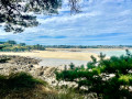
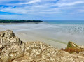
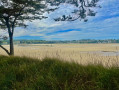
Head to the car park at Place de Lankare (or Lan Carré), opposite the Saint-Efflam water sports centre.
(S/E) Leave the car park heading east and take the first street on the right: Rue de Kerizellan. At the right-hand bend, take the path on the left. Turn left again, then after 50 metres take the path on the right (it climbs quite steeply).
(1) Do not take the path on the left (you’ll take this later, on the way back from the Grand Rocher viewpoint). Carry straight on.
(2) Carry on straight ahead along the path until you reach a road; follow this for 20 metres to the left. Take thefirst path on the left (signposted ‘panorama’). At the end of the path, turn left, then, 50 metres further on, turn right to reach the viewpoint overlooking Grève Saint-Michel.
(3) Turn round and walk due south to return to the junction you passed on the way out.
(2) Turn right to reach the next junction by following the route back in the opposite direction to the outward journey.
(1) Turn right on the descent. Before reaching the road, take the hairpin bend to the left to join the D786.
(4) At the pedestrian crossing, cross over and, if the tide allows, head down onto the beach. Walk along the beach to reach the first cove.
If not, walk along the D786, past the car park facing the sea, and take the first road on the right, Rue des Carrières.
GR®34 Red and white markings
(5) At the top of the slipway, turn right and continue along the leafy path to Les Carrières. Carry on along the road, which becomes a track at its end.
(6) Carry on straight ahead to join the Route du Toulinet, then the path that continues from it. Continue due north along this path, which ends at a road.
(7) At the sharp left-hand bend, take a path straight ahead. This path circles Anse Toull Kurun, Porz Mellec Beach, Pointe de Plestin and Pointe de Toull ar Vag before reaching Tossen ar C’hoz Beach. Please note: throughout this section, some sections present a few difficulties.
Unmarked
(8) If the tide allows, head down to the beach, cross the rocky headland and climb back up via the slipway.
If not, continue along the path and, when it joins the road, follow it, keeping to the right at all times.
GR®34 Red and white markings
(9) Take the path through the pine forest on the left. It descends due south to reach the ancient Hogolo thermal baths. Continue along this path until you reach the road.
(10) Cross the road and continue straight ahead towards the Sainte-Barbe Chapel.
No signposting
Walk past the chapel on your left and take the path opposite. Take the road to the right, then go straight on at the junction (due east). Continue along the road.
(11) Turn left, then take the second street on the right. After about a hundred metres, take the path on the left. Turn right at the end of this path, then take the first path on the right, going round the campsite with it on your right. This brings you back to the path you took on the way there.
(6) Take the path on the right which joins the road running along the beach. Follow it until you reach the first street on the right.
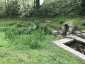
(12) Turn right at the Saint-Efflam Fountain and walk up the road to the departmental road. Follow it to the junction where there is a pedestrian crossing.
(13) Cross the D786 and retrace your steps to take the path on the right, which initially runs alongside the road.
Continue along the path, cross a footbridge and you’ll come out onto a road that leads straight back to the car park where you started (S/E).




 Visorando Member
 Easy
Easy