


Refine your search for walks in Klintzkopf
Klintzkopf walks


 Around the Klintzkopf
 Visorando Member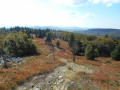
 8.95 mi
 +1,978 ft
 -1,952 ft
 5h 50
5h 50
 Moderate
 Departure from Linthal (Haut-Rhin)
Lake, high-altitude forest and stubble fields: a concentration of the beauty of the Vosges with the added bonus of a magnificent panorama.
Refreshments available at a farmhouse inn along the route.
Particularly pleasant in autumn when the beech trees turn yellow and mushrooms abound in the undergrowth.
Chaumes and forests of Lauchen
 10.29 mi
+1,995 ft
-1,985 ft
6h 30
Moderate
Departure from Linthal (Haut-Rhin)
10.29 mi
+1,995 ft
-1,985 ft
6h 30
Moderate
Departure from Linthal (Haut-Rhin)
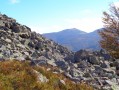
Near the source of the Lauch, on the secondary ridge between Breitfirst and Petit Ballon, Lauchen is an area of stubble fields with remarkable views and forests, including the most beautiful and highest altitude beech forests in the Vosges mountains. It is also a peaceful area, within the Guebwiller integral biological reserves, dominated by the Klintzkopf, home to the emblematic animal of the Vosges, the capercaillie or wood grouse.
Sengern, Grand Ballon, Markstein, Petit Ballon and Sengern in 2 or 3 days
 25.15 mi
+5,623 ft
-5,646 ft
3 days
25.15 mi
+5,623 ft
-5,646 ft
3 days
 Difficult
Departure from Lautenbachzell (Haut-Rhin)
Difficult
Departure from Lautenbachzell (Haut-Rhin)
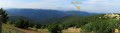
A very varied route to reach the highest point of the Vosges and walk along the ridges, enjoying numerous panoramic views of the surrounding valleys. The Petit Ballon massif also offers a very beautiful setting.
On the ridges: Grand Ballon – Markstein – Petit Ballon
13.44 mi
+2,110 ft
-3,022 ft
8h 00
Difficult
Departure from Murbach (Haut-Rhin)
An easy route, gently undulating across the highest peaks of the Vosges, through stubble fields and forests. Magnificent views over the surrounding valleys.
From the Col du Platzerwaesel to the Klintzkopf
6.70 mi
+1,194 ft
-1,152 ft
4h 05
Moderate
Departure from Sondernach (Haut-Rhin)
Please note that the circular route starting from (5) is closed to traffic from 1 December to 30 June, to ensure the animals’ peace and quiet. It is essential to comply with this ban.
A pleasant walk which, in addition to the scenery of the Hautes Vosges, allows you to discover the fifth highest peak in the Vosges. The route passes through magnificent beech forests in places, and the stop at two farmhouse inns is a definite highlight.
Walks near Klintzkopf
Markstein – Petit Ballon – Linthal
 Tourist office12.88 mi
+1,407 ft
-3,619 ft
7h 10
Difficult
Departure from Oderen (Haut-Rhin)
Tourist office12.88 mi
+1,407 ft
-3,619 ft
7h 10
Difficult
Departure from Oderen (Haut-Rhin)
Take the time to admire the landscapes and views that make this second day’s walk so special. The route follows the ridges for the most part, leading to the Petit Ballon via the Klintzkopf. Once again, you’ll be able to fully enjoy the panoramic views over the plains and valleys on either side of the mountain. This route, which passes through forests and stubble fields, will allow you to discover the richness of the local flora.
Ascent to the Grand Ballon from Sengern (Guebwiller) via the lake
 5.78 mi
+2,910 ft
-39 ft
5h 10
Difficult
Departure from Lautenbachzell (Haut-Rhin)
5.78 mi
+2,910 ft
-39 ft
5h 10
Difficult
Departure from Lautenbachzell (Haut-Rhin)
A challenging climb to the Grand Ballon from Sengern (past Guebwiller). The route passes by the beautiful Lac du Ballon and the Gustiberg farmhouse inn, both of which offer very pleasant places to stop for a break.
Linthal – Grand Ballon – Markstein
12.20 mi
+3,553 ft
-1,319 ft
8h 40
Difficult
Departure from Linthal (Haut-Rhin)
A very physically demanding first day with a wide variety of landscapes.
Starting from Linthal, the most mountainous village in the Guebwiller region, the first day of this multi-day hike will take you to the Auberge du Steinlebach, via the Grand Ballon – the highest peak in the Vosges mountains, rising to an altitude of 1,424 metres – and the Markstein resort. The ascent is quite challenging and requires a good level of fitness. Along the way, you’ll pass the Gustiberg farmhouse inn, Lake Ballon and the Haag farmhouse inn…
Petit Ballon - Sengern
 5.91 mi
+604 ft
-2,608 ft
3h 15
Moderate
Departure from Luttenbach-près-Munster (Haut-Rhin)
5.91 mi
+604 ft
-2,608 ft
3h 15
Moderate
Departure from Luttenbach-près-Munster (Haut-Rhin)
The route begins in alpine pastureland, then passes through very shady forests.
Schiessrothried Lake - Charlemagne car park
 5.08 mi
+2,352 ft
-1,398 ft
4h 25
Moderate
Departure from Metzeral (Haut-Rhin)
5.08 mi
+2,352 ft
-1,398 ft
4h 25
Moderate
Departure from Metzeral (Haut-Rhin)
From Schiessrothried, tour of Petit Hohneck, Dagobert's cave, Frankenthal and Col de Falimont.
This route is not accessible in winter. The route is closed between (3), (4), (5) and (6) from 1 November to 30 April 2022 (Prefectural Order of 18 May 2022).
From Lac de Blanchemer to Lac de Longemer
 6.46 mi
+738 ft
-1,532 ft
3h 35
Moderate
Departure from La Bresse (Vosges)
6.46 mi
+738 ft
-1,532 ft
3h 35
Moderate
Departure from La Bresse (Vosges)
Second stage of this hike with bivouac. This time, Lac Lalande, Lac de Retournemer, Cascade Charlemagne and Cascade de Retournemer will be on your route, allowing you to discover magnificent colours.
From Lac de Blanchemer to the Chalet de Rouge Mousse
 7.13 mi
+1,880 ft
-2,054 ft
4h 55
Moderate
Departure from La Bresse (Vosges)
7.13 mi
+1,880 ft
-2,054 ft
4h 55
Moderate
Departure from La Bresse (Vosges)
Starting from Lac de Blanchemer, the route follows theGR®531, taking you via the Rainkopf (alt. 1,305 m), before descending towards the Tourbière de Machais, the Col de Bramont and the Étang de Sèchemer to reach the Chalet de Rouge Mousse.
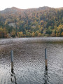
Charlemagne car park - Schiessrothried Lake
 5.84 mi
+728 ft
-1,683 ft
3h 20
Moderate
Departure from Xonrupt-Longemer (Vosges)
5.84 mi
+728 ft
-1,683 ft
3h 20
Moderate
Departure from Xonrupt-Longemer (Vosges)
day1: hike around Hohneck, snowfield route and descent to Schiessrothried Lake.
From the Chalet de Rouge Mousse to the Cabane des Champis
 6.55 mi
+1,732 ft
-968 ft
4h 30
Moderate
Departure from La Bresse (Vosges)
6.55 mi
+1,732 ft
-968 ft
4h 30
Moderate
Departure from La Bresse (Vosges)
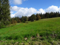
Starting from the Chalet de Rouge Mousse, the route takes you to Lac des Corbeaux, then via the GR®533 to La Roche Beauty (viewpoint), and on to Mont Moyenmont (alt. 969 m) to reach La Chaume des Champis and its hut.
From the Cabane des Champis to Lac de Blanchemer
 8.77 mi
+1,627 ft
-2,201 ft
5h 25
Moderate
Departure from La Bresse (Vosges)
8.77 mi
+1,627 ft
-2,201 ft
5h 25
Moderate
Departure from La Bresse (Vosges)
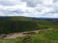
Starting from Les Champis, the route passes through the Marécage Rouge Feigne, the Col de Thiaville (alt. 1,112 m), the Hohneck (alt. 1,363 m) and the Col du Wormspel (alt. 1,277 m) before descending towards Lac de Blanchemer.