Route de Furfande, Pic du Gazon

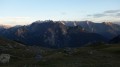
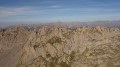
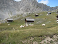
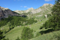
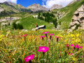
A pleasant walk through the mountain pastures, dotted with lovely ridges and perfectly complemented by the easy climb up the panoramic Pic du Gazon.

Details

807249
Creation:
Last update:
Last review:
  • Walking
    Activity: Walking
  • ↔
    Distance: 11.13 mi
  • ◔
    Average duration: 8h 10 
  • ▲
    Difficulty: Difficult

  • ⚐
    Back to start: Yes
  • ↗
    Ascent: + 3,491 ft
  • ↘
    Descent: - 3,491 ft

  • ▲
    Highest point: 8,973 ft
  • ▼
    Lowest point: 6,181 ft

Photos

Description of the walk

From Arvieux, head down the Col d’Izoard road (D902), pass the hamlet of Les Moulins and turn right onto the D802 towards Villargaudin, then take the track (suitable for all vehicles) which heads north and loops back south towards Le Queyron. Park at the end of the track in the second car park.

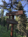
(S/E) At the entrance to the car park, take theGR®-58f and head down towards Le Queyron (signposted). Follow theGR® along the hillside, ignoring any junctions, cross a steep section, then reach the Col de la Lauze.

(1) At the signpost, leave theGR® – which you’ll use for the return journey – and take the Tour de Furfande path to the left. After another traverse along the hillside above the Gorges du Guil, head down towards the picturesque Furfande summer chalets. Cross this group of chalets heading west.

The path curves gently to the left towards the south-west for about 400 metres, then takes a sharp right-hand bend towards the north. On this path, follow a steady climb through the mountain pasture to join theGR®541.

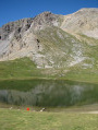
(2) Head uphill along theGR®, skirting the upmarket chalets of La Vallette on your right, then head eastwards towards the chalets of Les Granges de Furfande. On this ascent, you’ll catch a glimpse of the small Lake Valette on your left, which is often dry.

Climb the small grassy hill on the right to visit the beautiful Oratory of Notre-Dame de Furfande.
Head eastwards, keeping the sign for Viaret de Furfande in sight.

(3) At the signpost, leave theGR®541to your left and take its alternative route to the right towards the refuge.
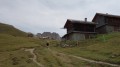
Cross along the hillside and head for the welcoming Furfande refuge.

(4) Behind the refuge, follow the path northwards up the slope until you join theGR®41. Head north towards the cross at the Col de Furfande.

(5) Leave theGR® and head north-west up towards the Pic de Vacivier.

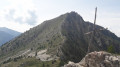
(6) Walk along the slope below the summit of Vacivier, then descend towards a small saddle. Climb up the grassy ridge to the north, then head for the summit of the Pic du Gazon, marked by its cairn.

(7) Descend back down to the refuge.

(4) Turn left onto theGR®58to the Col de la Lauze.

(1) Descend back down the same route you took on the way up to the car park (S/E).

Waypoints

  1. S/E : mi 0 - alt. 6,450 ft - Car park
  2. 1 : mi 1.75 - alt. 6,831 ft - Trail junction at > - Col de la Lauze (1970m)
  3. 2 : mi 4.11 - alt. 7,165 ft - Trail junction, turn right
  4. 3 : mi 4.57 - alt. 7,516 ft - Trail junction, turn right
  5. 4 : mi 5.31 - alt. 7,520 ft - Refuge de Furfande
  6. 5 : mi 5.98 - alt. 8,196 ft - Col de Furfande (2456m)
  7. 6 : mi 6.41 - alt. 8,599 ft - Below the - Pic du Vacivier (2631m)
  8. 7 : mi 6.9 - alt. 8,967 ft - Pic du Gazon (2744m)
  9. S/E : mi 11.13 - alt. 6,450 ft - Car park

Notes

I’ve made a video, complete with the names of the peaks, which shows the route and the atmosphere of the walk.
What can I say about this route?
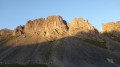
It’s a route along trails that presents no difficulty other than its length. For this reason, it’s a good idea to spend the night at the refuge and enjoy the sunset, which bathes the ridges in a beautiful evening light.
However, although the path is level and well-trodden, it crosses steep slopes above the Guil Valley. Please ensure you keep a close eye on children.

Always be cautious and plan ahead when you're outdoors. Visorando and the author of this route cannot be held responsible for any accidents occurring on this route.

The GR® and PR® markings are the intellectual property of the Fédération Française de Randonnée Pédestre.

Reviews and comments

5 / 5
Based on 2 reviews

Reliability of the description
5 / 5
Ease of following the route
5 / 5
Route interest
5 / 5
sabinefebvre
sabinefebvre

Overall rating : 5 / 5

Date of your route : Aug 14, 2023
Reliability of the description : ★★★★★ Very good
Ease of following the route : ★★★★★ Very good
Route interest : ★★★★★ Very good
Very busy route : Yes

A lovely circular walk, with the added bonus of the Furfande mountain hut where you can have a drink

Machine-translated

serge13140
serge13140

Overall rating : 5 / 5

Date of your route : Aug 21, 2018
Reliability of the description : ★★★★★ Very good
Ease of following the route : ★★★★★ Very good
Route interest : ★★★★★ Very good

A lovely walk – personally, I preferred to do it in the opposite direction to the description; it was less strenuous for my taste.

Machine-translated

Other walks in the area

For more walks, use our search engine .

The GPS track and description are the property of this route's author. Please do not copy them without permission.