


Refine your search for walks in Beuil
Beuil walks


 Pin Pourri from Beuil
 Visorando Member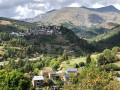
 5.41 mi
 +1,558 ft
 -1,568 ft
 3h 50
3h 50
 Moderate
 Departure from Beuil (Alpes-Maritimes)
A very beautiful walk/hike that begins with a crossing of the beautiful Couillole valley. The Ibac de Frache is a magnificent coniferous forest. The descent through the mountain pasture areas from Pin Pourri is still used for transhumance.
Tête de Chamia and Mont Brussière, starting from Beuil
 7.65 mi
+2,507 ft
-2,507 ft
5h 40
7.65 mi
+2,507 ft
-2,507 ft
5h 40
 Difficult
Departure from Beuil (Alpes-Maritimes)
Difficult
Departure from Beuil (Alpes-Maritimes)
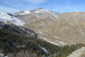
A walk through summer pastures, partly off the beaten track.
Lac de Beuil and Tête du Garnier
 4.48 mi
+1,211 ft
-1,227 ft
3h 05
Moderate
Departure from Beuil (Alpes-Maritimes)
4.48 mi
+1,211 ft
-1,227 ft
3h 05
Moderate
Departure from Beuil (Alpes-Maritimes)
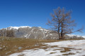
Starting from the hamlet of Les Launes, this circular hike takes you to Lac de Beuil, nestled in a sinkhole at the foot of Tête de l'Ubac, before climbing to Tête du Garnier for a magnificent panorama over the entire Beuil-Valberg area, as far as Mont Mounier and Mercantour in the distance.
Les Cluots
 7.59 mi
+2,835 ft
-2,828 ft
5h 55
Difficult
Departure from Beuil (Alpes-Maritimes)
7.59 mi
+2,835 ft
-2,828 ft
5h 55
Difficult
Departure from Beuil (Alpes-Maritimes)
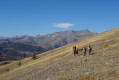
This hike, starting from the Gorges du Cians road, takes you up Les Cluots, a mountain located in a steppe area above the red pelite of the Cians.
Set back from the Mercantour massif, the summit offers a superb 360° panorama of the Alpes-Maritimes.
La Tête de Pommier from Le Cians
 4.76 mi
+2,060 ft
-2,054 ft
4h 00
Moderate
Departure from Beuil (Alpes-Maritimes)
4.76 mi
+2,060 ft
-2,054 ft
4h 00
Moderate
Departure from Beuil (Alpes-Maritimes)
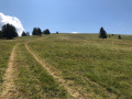
A very lovely walk, sometimes through woodland, sometimes across alpine pastures, offering a stunning 360° panorama from the summit of the Tête de Pommier.
Tour of Mont Brussière via the hamlet of Ars
 4.65 mi
+1,247 ft
-1,266 ft
3h 15
Moderate
Departure from Beuil (Alpes-Maritimes)
4.65 mi
+1,247 ft
-1,266 ft
3h 15
Moderate
Departure from Beuil (Alpes-Maritimes)
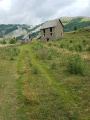
This mountain hike is accessible to people who are prone to vertigo. As you walk along the Ars ridge, you will have a 360° view of Mont Brussière and the summit of Le Content. In summer, you may be lucky enough to see a golden eagle and a rich variety of mountain flora, with many different butterflies fluttering overhead. You may also encounter cows, sheep and goats, but please take care not to disturb them.
Plateau Saint-Jean
 4.61 mi
+1,129 ft
-1,112 ft
3h 05
Moderate
Departure from Beuil (Alpes-Maritimes)
4.61 mi
+1,129 ft
-1,112 ft
3h 05
Moderate
Departure from Beuil (Alpes-Maritimes)
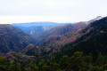
From the Éguilles car park, at the end of the road of the same name, you will descend the Vallon de Challandre and then climb back up to the Plateau Saint-Jean with some beautiful views of the Gorges du Cians and the Tête de Rigaud towering above them.
After a short detour to the Chapelle Saint-Jean chapel, you will cross the plateau with Mont Mounier in your sights.
Mont Mounier from the Col de l'Espaul
 10.80 mi
+3,681 ft
-3,668 ft
8h 10
Difficult
Departure from Péone (Alpes-Maritimes)
10.80 mi
+3,681 ft
-3,668 ft
8h 10
Difficult
Departure from Péone (Alpes-Maritimes)
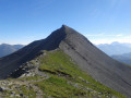
Mont Mounier (2,817m) is one of the must-see peaks in the Alpes Maritimes: magnificent panoramas, 360° views from the summit, a beautiful ridge at the end, a fairly steady and easy 1,100m climb with views of the summit almost all the way.
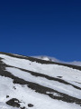
Mont Démant as seen from the Col de l’Espaul
 6.41 mi
+2,303 ft
-2,303 ft
4h 55
Moderate
Departure from Péone (Alpes-Maritimes)
6.41 mi
+2,303 ft
-2,303 ft
4h 55
Moderate
Departure from Péone (Alpes-Maritimes)
Nestled at the heart of rugged, untamed nature lies Mont Demant. Every step on its rocky slopes is a battle against gravity, a struggle against fatigue, but also a communion with a breathtaking landscape. As you climb, the view opens out onto deep valleys and distant peaks, silent witnesses to the courage required. Once you reach the summit of Mont Demant, silence reigns, broken only by the wind caressing the rocks. It is a moment suspended in time, where personal achievement blends with the immensity of the world. Conquering Mont Demant is not just about climbing a mountain; it is about pushing your own limits and experiencing the very essence of adventure.
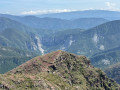
Colles Planes via the Cians ledges
 7.49 mi
+1,650 ft
-1,611 ft
4h 55
Moderate
Departure from Beuil (Alpes-Maritimes)
7.49 mi
+1,650 ft
-1,611 ft
4h 55
Moderate
Departure from Beuil (Alpes-Maritimes)
A magnificent round-trip hike offering views overlooking the Gorges du Cians and their red schist cliffs. Stunning views throughout the route. Plenty of flowers, including a few martagon lilies in early June. The final section of the route is off-trail but presents no difficulty in finding your way by sight.
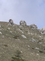
Walk to see marmots from Col de l'Espaul
 3.23 mi
+702 ft
-709 ft
2h 05
3.23 mi
+702 ft
-709 ft
2h 05
 Easy
Departure from Péone (Alpes-Maritimes)
Easy
Departure from Péone (Alpes-Maritimes)
A short, very easy trail, ideal for a family walk, in an area frequented by marmots.
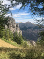
The Bois Noir ridge from the Cime de Raton
 8.02 mi
+2,310 ft
-2,339 ft
5h 40
Difficult
Departure from Beuil (Alpes-Maritimes)
8.02 mi
+2,310 ft
-2,339 ft
5h 40
Difficult
Departure from Beuil (Alpes-Maritimes)
A beautiful hike that will allow you to discover a lovely forest and a superb 360° panorama from the Cime de Raton. The ridge line that follows offers a succession of sweeping views with picture-postcard scenery. The route is not very busy.
 Valberg and the marmot trail
 Local authority3.71 mi
+210 ft
-210 ft
1 hr
Easy
Departure from Péone (Alpes-Maritimes)
Local authority3.71 mi
+210 ft
-210 ft
1 hr
Easy
Departure from Péone (Alpes-Maritimes)
Ideal for learning to ride a mountain bike, this ride, high above the resort, takes you to the hamlet of La Colle, the starting point for the walk to the marmot site, home to the Alps’ iconic animals. The route begins on a tarmac road and continues along a dirt track.
The Tour de Roya via the Green Trail in Valberg
3.36 mi
+768 ft
-761 ft
2h 15
Easy
Departure from Péone (Alpes-Maritimes)
Starting from the Valberg Golf Club car park, a short (1h40) but intense trail marked as a Green Trail. Lac de Beuil invites you to take a break; you’ll enjoy the return via the Sentier Yoga on the balcony path.
Discovering Roubion
 3.29 mi
+1,437 ft
-1,414 ft
2h 45
Moderate
Departure from Roubion (Alpes-Maritimes)
3.29 mi
+1,437 ft
-1,414 ft
2h 45
Moderate
Departure from Roubion (Alpes-Maritimes)
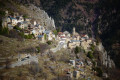
Starting from the charming village of Roubion – well worth a visit for its painted doors – you’ll head up towards Les Buisses via the Chapel of Saint-Sébastien (with its remarkable frescoes).
After climbing Le Puy, you’ll descend through the forest to the Vallon de Saint-Sébastion, passing through some impressive and surprising natural arches.
Finally, a final climb will offer you another view of the village.
The Col de la Couillole and Pin Pourri in a circular route from Roubion
 9.09 mi
+2,359 ft
-2,356 ft
6h 15
Moderate
Departure from Roubion (Alpes-Maritimes)
9.09 mi
+2,359 ft
-2,356 ft
6h 15
Moderate
Departure from Roubion (Alpes-Maritimes)
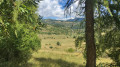
This is a magnificent hike that starts in the picturesque medieval village of Roubion, with part of the trail already described on Visorando. Partly shaded by the forest, it will guide you through the Bois du Falcon and the meadows to the foot of Mont Buissière, at the Col de la Couillole, then to the Pin Pourri, where you can admire the Tête de Giarons and its vast meadows. The return journey will take you through the charming hamlet of Villars.
Mont Mounier as seen from the Montagne de l’Estrop
 10.63 mi
+2,703 ft
-5,919 ft
7 hrs
10.63 mi
+2,703 ft
-5,919 ft
7 hrs
 Very difficult
Departure from Péone (Alpes-Maritimes)
Very difficult
Departure from Péone (Alpes-Maritimes)
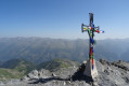
This hike forms thesecond stage of the ascent of Mont Mounier.
Starting from the Montagne de l’Estrop, you’ll climb to the Col de Crousette for a beautiful view over the valley of the same name and the Haute-Tinée. You’ll then reach the Mont Mounier ridge, which you’ll follow to the summit.
The descent takes you through the hamlet of La Colle before climbing back up towards the Tête de Charnaye, then down again towards the altisurface, and finally the final descent to the Pont d’Aygue Blanche.
From the Longon Refuge to Saint-Dalmas
 15.05 mi
+3,540 ft
-5,518 ft
10h 00
Difficult
Departure from Alpes-Maritimes
15.05 mi
+3,540 ft
-5,518 ft
10h 00
Difficult
Departure from Alpes-Maritimes
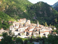
This nineteenth stage continues the long traverse of the Mercantour. From the Refuge de Longon, the path descends the Vallon du Longon diagonally across the slope to the hamlet of Rougios, before following the Fracha forest road and then taking a shortcut to the pretty Provençal village of Roure. Via a stony descent, it cuts across the hairpin bends of the M130 and M30 roads and reaches Saint-Sauveur-sur-Tinée, which it passes through before climbing up to the Chapelle Saint-Roch. Running along the hillside, it crosses the Vallon du Romarinier, passes through the hamlet of Roubinastre, crosses the Ravin de l’Esclosé and arrives at Rimplas. The GR®5 descends gently towards the small pass of Ragias and crosses the Vallon Gros, before climbing back up to the ridge on that side of the slope and then skirting the hamlet of La Bolline. From there, it climbs to the hamlet of La Roche and then ascends the ridge of the Vallon de Bramafam to reach Saint-Dalmas Valdeblore.
More walks in Beuil
Select a point of interest below: