Country:
 City:
City:





(S/E) The walk along the Ottosteinweg starts at one of the car parks on the banks of the Main, for example opposite Mainzer Str. 23 or the Pfarrkirche car park. You can also reach Miltenberg by train from Aschaffenburg and Wertheim. From here, the route initially follows the riverside promenade.
(1) We walk towards the Main bridge with its red-brick gatehouse, which is clearly visible from a distance.
(2) At the gatehouse, we turn right and walk straight on along Ziegelgasse and Untere Walldürner Straße until we reach St John’s Church on the right-hand side, behind which we turn right onto Burgweg. From here onwards, the Ottosteinweg is signposted throughout with the M2 marker.
(3) On the left is the Stadtpark; on the right, we’re accompanied by the remains of the old city wall and the
Old Jewish Cemetery. At the end of Burgweg, the path forks. We continue to the right along Conradyweg, which then joins the path leading up from Schnatterloch on the market square.
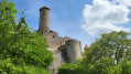
(4) We follow this path to the left and, at the next junction, can take a detour to the right to Mildenburg Castle and the Art and Icon Museum.
Otherwise, carry on straight ahead; at the fork a few metres further on, we first turn left, then
right up the hill. The path here is unpaved and therefore somewhat narrower and steeper.
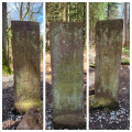
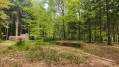
(5) Beyond the next junction, which we pass straight on, lies the ‘Felsenmeer’ on the left-hand side – a sea of large sandstone boulders formed by the erosion of rock millions of years old. At the next junction, we turn right and come across a woodland playground and the Ottostein, after which the circular walk is named.
Beyond the Ottostein, we turn right onto the wide gravel path and follow the route up the Greinberg, turning left at the next junction. At the next junction, we continue straight ahead, then turn right at the first fork and left at the second. The forest track curves widely to the right around the wooded flank of the Grauberg.
(6) After about 1.3 km, we turn left onto the path and then right, emerging directly at the tennis courts. Behind the courts, we turn left, pass the restaurant and the car park, and reach Obere Walldürner Straße via the steps on the right.
We turn left and follow the road straight on, slightly downhill. We walk past some beautiful old villas on the left-hand side. We pass St John’s Church (2) and Burgweg on our left and continue straight on along Untere Walldürner Straße (which we have already walked along in the opposite direction on the way there).
(7) At the next junction, we see Engelsplatz on the right, with the Franciscan Church and the museum opposite; we keep to the left onto the main road.
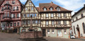
(8) The Hauptstraße takes us straight on through Miltenberg’s beautiful historic old town, past the ‘Zum Riesen’ inn and the (9) Old Town Hall, to the Schnatterloch market square.
(10) A detour to the left takes us past the fountain to Schnatterloch and the Schnatterloch Tower, which take their name from a trickle of water that seeps through the town wall at this spot when it rains.
(S/E) At the end of Hauptstraße, we come back to the junction of Mainzer Straße and Mainstraße on the banks of the Main, where the boat landing stage and the car park are located.
(If you started from a different car park, you can take one of the many alleys in the old town to the right. You’ll always end up at the promenade between the gatehouse and the jetty.)
 Visorando Member

 Difficult
 Easy
Easy