From Schwansee via Alpsee to the royal castles

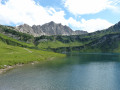
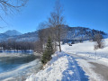
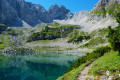
This scenic circular walk takes you away from the tourist crowds, first along the shores of Lake Schwansee, then along the Fischersteig path over the ridge to the crystal-clear Alpsee on the opposite side. As you walk around the lake, you come very close to the royal castles of Neuschwanstein and Hohenschwangau.

Details

n°31933754
Creation:
Last update:
Last review:
  • Walking
    Activity: Walking
  • ↔
    Distance: 6.82 mi
  • ◔
    Average duration: 4h 00 
  • ▲
    Difficulty: Moderate

  • ⚐
    Back to start: Yes
  • ↗
    Ascent: + 978 ft
  • ↘
    Descent: - 968 ft

  • ▲
    Highest point: 2,887 ft
  • ▼
    Lowest point: 2,592 ft

Photos

Description of the walk

The starting point of the walk is the car park at Schwansee, just around 500 metres as the crow flies from Neuschwanstein Castle. You can reach it via Parkstraße, just past Alterschrofen.

(S/E) From the car park, we do not continue along the wide, tarmac road (Königssträßchen), but take the nature trail to the left of it. This leads straight ahead through a small wooded area at the end of the car park. At the fork, we keep to the right and soon reach the shore of Schwansee, where there is also a kiosk and toilets.

(1) We continue straight on, past the bathing jetty on Schwansee. There is a kiosk on the right-hand side (not always open). We keep to the left, following the shore of Schwansee.

(2) On the opposite side of the lake, after just under 1 km, we turn right onto the Fischersteg (signposted), which leads us in a zigzag pattern up a relatively steep slope over the wooded hilltop.

(3) At the top of the ridge, we come to a wide path, which we follow briefly to the right before immediately turning left onto the narrow track that leads us over hill and dale to the viewpoint high above the Alpsee. From the viewing platform, we continue to the left along a narrow nature trail. It takes us through the woods along the mountainside of the Alpsee. We slowly walk round the Alpsee in idyllic surroundings.

(4) On the western shore, after a short detour following a sweeping left-hand bend, we reach the Mariendenkmal on the shore of the emerald-blue mountain lake. It’s worth taking a short break here, as you can already see the two royal castles glimmering in the distance on the opposite shore.

From here, we continue walking to the left close to the shore; in places, the narrow path is secured with a wooden handrail. On the southern side, we walk along a wider path through the forest. At the southern tip of the Alpsee, the path curves to the left.

(5) We pass the Alpsee lido, which offers a welcome chance to cool off in summer. The lido was opened as far back as 1900. Incidentally, the Alpsee is considered the cleanest lake in Bavaria. We continue round the Alpsee, with views of the two royal castles.

(6) Just past the Alpsee boat hire on the left, we reach the tourist section of the route. On fine days, this area is teeming with people.

(7) Straight ahead, we can see the Museum of the Bavarian Kings, with hotels and guesthouses behind it.

(8) If you like, you can take a detour to Hohenschwangau Castle (on the left) and Neuschwanstein (slightly to the right, up on the hill) (it’s best to buy tickets online in advance).

Otherwise, we keep to the left along the shore, following Fürstenstraße along the northern bank. After just a few metres, it becomes quiet again. Tourists rarely walk more than a few metres around the lake.

(9) We reach the fishing jetty again, which leads us down the hillside to the right. At the bottom (2) we turn right and then keep slightly to the left on the König-Ludwig-Weg through the birch-covered moorland around Schwansee.

(S/E) Just before the jetty and the kiosk, we turn right and arrive back at the car park from which we set off.


Waypoints

  1. S/E : mi 0 - alt. 2,635 ft - Schwansee hiking car park near Alterschrofen
  2. 1 : mi 0.41 - alt. 2,621 ft - Jetty on Lake Schwansee
  3. 2 : mi 1.25 - alt. 2,700 ft - Fishing jetty
  4. 3 : mi 1.74 - alt. 2,759 ft - Alpsee viewpoint
  5. 4 : mi 2.77 - alt. 2,697 ft - Mary’s Monument
  6. 5 : mi 3.99 - alt. 2,733 ft - Alpseebad Hohenschwangau
  7. 6 : mi 4.58 - alt. 2,720 ft - Boat hire
  8. 7 : mi 4.75 - alt. 2,694 ft - Museum of the Bavarian Kings
  9. 8 : mi 5.19 - alt. 2,694 ft - Turn-off to Hohenschwangau Castle
  10. 9 : mi 5.59 - alt. 2,851 ft - Fishing jetty
  11. S/E : mi 6.82 - alt. 2,621 ft - Hiking car park

Notes

The circular walk around the two lakes in Hohenschwangau leads directly through the mountain slopes in Hohenschwangau, parts of which are designated as a nature reserve. Apart from the fishing jetty, the path is relatively flat, but in places it is narrow and criss-crossed with tree roots. In wet or snowy conditions, parts of the path can become very muddy and slippery, so the walk is not recommended in adverse weather conditions.

Equipment

  • Although the walk is manageable in dry weather with comfortable shoes, we still recommend lightweight, ankle-high walking boots.
  • On the circular route, the only places to stop for refreshments are at the Königshäuser. However, these can get very busy during the peak season. If you’re planning to stop for a bite to eat, you should check the exact opening times in advance. In hot weather, it’s important to carry plenty of drinks.
  • The circular route is not suitable for pushchairs or buggies.
  • Dogs must be kept on a lead (nature reserve)

Further information is available at https://mit-mama-nach.de/rundwanderung-u...

Worth a visit

  • Neuschwanstein Castle
  • Hohenschwangau Castle
  • Museum of the Bavarian Kings

Where possible, you should buy tickets for the castles online in advance; otherwise, you may have to put up with very long queues. Please note the opening times!

Food and drink
Various hotels and restaurants near the royal castles

Reviews and comments

5 / 5
Based on 1 review

Reliability of the description
5 / 5
Ease of following the route
5 / 5
Route interest
5 / 5
mit-mama-nach.de
mit-mama-nach.de

I’m really pleased that you enjoyed the tour. Thank you very much for the great review. Best wishes, Michaela

Machine-translated

User 21639781

Overall rating : 5 / 5

Date of your route : Sep 07, 2026
Reliability of the description : ★★★★★ Very good
Ease of following the route : ★★★★★ Very good
Route interest : ★★★★★ Very good
Very busy route : Yes

A very varied and beautiful walk, combining nature and culture, with a fair bit of elevation gain!

Machine-translated

Other walks in the area

For more walks, use our search engine .

The GPS track and description are the property of this route's author. Please do not copy them without permission.