Country:

 City:
City:


Start: Mareugheol, car park near the cemetery. To get there, take the A75, exit 17 (Saint-Germain-Lembron).
In the centre of Saint-Germain-Lembron, turn right onto the D909 towards Issoire and, after 500m, turn left onto the D720 and follow the signs for Mareugheol.
Signposting: Yellow
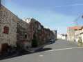
(S/E) From the car park, head towards the cemetery and, at the corner, turn right onto Rue du Fort. At the end of the fortified wall, turn right onto Place de la Fontaine, then left onto Rue du Lavoir.
Cross the Route de Saint-Germain-Lembron (take care) and head straight on into Rue des Suquets. At the end, turn left and follow the path leading to a cross.
(1) At the cross, turn left and head down towards the road (D720), then cross it (take care). Take the path opposite, slightly to the right, turn onto the first path on the right between the fields, and cross the ford over the Lembronnet.
Turn left immediately and continue straight on towards Antoingt, ignoring the paths coming from your right. Join the D124.
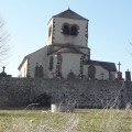
(2) Turn left for 60 metres, then right towards the church. Go round the old fort on the right and head for Place du Foussat. Before Place de l’Église, take the street on the right which joins the D124.
At the D124, turn right onto Chemin du Chamaret.
.
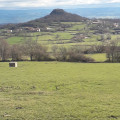
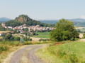
(3) At the crossroads, continue straight ahead towards the Vodable hill. At the three-way junction, take the path on the right, passing in front of the sewage treatment plant.
(4): At the farm, veer to the right. At the Croix de Nazareth, continue along the road on the left, heading up to the centre of the village of Vodable.
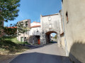
(5) At the church, turn right, go through the Porte Neuve and, before the country inn, turn left to climb the Chemin de Panassat. Continue round the hill, turn right, and pass the oven.
(6) Turn left, then turn left again onto Rue de la Liberté. Pass a street on your left, then turn left at the next junction. Walk for about a hundred metres and turn left once more onto Rue Gautier de Biauzat, joining the D124.
Cross the D124. At the fork in the road, keep right and join the road leading to Colamine.
(7) Turn left and continue along the road to Violle Basse, leaving Colamine on your right.
At the cross, take the road on the left towards the hamlet of Les Bordes.
(8) Before entering the hamlet, turn left onto a track which, after a bend to the right, follows and then passes under a power line.
(9) At the junction, turn left and carry on to the first houses in the hamlet of Longchamp. Turn right onto Rue du Four and walk through the centre of the hamlet.
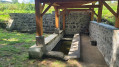
(10) After the wash house, turn left onto Chemin du Bourey, then follow the road to the car park at the start (S/E).

 Visorando Member
 Easy
Easy