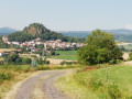
The Bois des Bordes

A shaded route, ideal in summer, following the ‘maquisards’ trail through the Bois des Bordes.

Details

n°56623483
Creation:
Last update:
Last review:
  • Walking
    Activity: Walking
  • ↔
    Distance: 3.75 mi
  • ◔
    Average duration: 2h 10 
  • ▲
    Difficulty: Easy

  • ⚐
    Back to start: Yes
  • ↗
    Ascent: + 489 ft
  • ↘
    Descent: - 479 ft

  • ▲
    Highest point: 2,684 ft
  • ▼
    Lowest point: 2,257 ft

Photos

Description of the walk

Park at the hamlet of Violle Basse, on the grassy verge at the Y-junction marked by a metal cross.

(S/E) Take the tarmac road on the right towards Violle Haute.

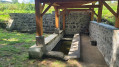
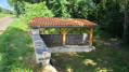
(1) Leave the tarmac and follow the path on the left, which passes a little further on by the Lana fountain and washhouse, dating from the late 19th century and now renovated, opposite the underground cistern that supplies it. The Lambronnet stream flows right past it when it is not dry. You will come to a fork in the path.

(2) Take the path on the right, then turn left at the next junction.

(3) As you emerge from the woods, turn left onto the D32 for about 150 metres, then take the first path on the left. Further on, you’ll rejoin the tarmac road.

(4) At the end of the tarmac road, turn left. Carry on straight ahead at the junction you come to shortly afterwards: the tarmac gives way to a dirt track.

(5) At the end of the track, which appears to be a dead end, take a path straight ahead through the undergrowth. It descends a steep slope through the woods, with a few sections between rocks. This was once a hideout for the Maquis resistance fighters; there are still some remnants to be discovered. Further on, the very shady path becomes a track again and joins a tarmac road at the edge of the woods.

(6) Turn left to pass in front of Les Bordes and return to a junction you passed earlier on the way there.

(2) Turn right to pass by the wash house again and head towards Violle Haute.

(1) Carry on straight ahead to return to the starting point (S/E).

Waypoints

  1. S/E : mi 0 - alt. 2,257 ft - Violle Basse
  2. 1 : mi 0.16 - alt. 2,300 ft - Violle Haute
  3. 2 : mi 0.41 - alt. 2,356 ft - Crossroads at the end of the circular loop
  4. 3 : mi 1.18 - alt. 2,671 ft - D32
  5. 4 : mi 2.19 - alt. 2,487 ft - Crossroads, turn left
  6. 5 : mi 2.4 - alt. 2,516 ft - Start of the ‘maquisards’ trail
  7. 6 : mi 3.11 - alt. 2,293 ft - Exit from the woods, Les Bordes
  8. S/E : mi 3.75 - alt. 2,257 ft - Violle Basse

Notes

The route is mostly shaded, so some sections may remain damp.
There is a section with a few small rocks to go round after point (5).

Worth a visit

In the maquis section of the Bois des Bordes, it is said that the maquis fighters carved Lorraine crosses into the trees – do look out for them. A few metal structures remain at ground level.

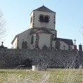
To reach Violle Basse, you pass by the characteristic church at Colamine (open at weekends in summer) and its cemetery, which features 19th-century graves, a lepers’ cross and a tithe stone.

Reviews and comments

4.2 / 5
Based on 2 reviews

Reliability of the description
4.5 / 5
Ease of following the route
4 / 5
Route interest
4 / 5
User 15259518

Overall rating : 4.3 / 5

Date of your route : Sep 07, 2026
Reliability of the description : ★★★★★ Very good
Ease of following the route : ★★★★☆ Good
Route interest : ★★★★☆ Good
Very busy route : No

A short, easy walk, much of which is through woodland

Machine-translated

Kruella
Kruella

Overall rating : 4 / 5

Date of your route : Aug 20, 2024
Reliability of the description : ★★★★☆ Good
Ease of following the route : ★★★★☆ Good
Route interest : ★★★★☆ Good
Very busy route : No

A really lovely walk, which took less time than stated

Machine-translated

Other walks in the area

For more walks, use our search engine .

The GPS track and description are the property of this route's author. Please do not copy them without permission.