


Trip to the Rigi, scenic walk from Rigi Kulm to Wolfertschen


A trip to the Rigi: depart from Arth-Goldau to Rigi Kulm by cogwheel train, then enjoy a scenic walk from Rigi Kulm to Wolfertschen-first. From there, you can take the train back to Krabel and ascend in a cable car to Rigi Scheidegg, or descend directly by train to Arth-Goldau.
Details
Creation:
Last update:
Last review:
–
–
-
 Activity: Walking
 -
 Distance: 1.60 mi
 -
 Average duration: 0h 55
 -
 Difficulty: Easy
 -
-
 Back to start: No
 -
 Ascent: + 161 ft
 -
 Descent: - 1,096 ft
 -
-
 Highest point: 5,873 ft
 -
 Lowest point: 4,777 ft
-
 Country:
Switzerland
Country:
Switzerland
-
 Area: Alps
 -
 City:
Arth
City:
Arth -
 Start: N 47.055342° / E 8.484435°
 -
 End: N 47.047017° / E 8.477006°
 -


 Hour-by-hour weather


Waypoints
- S : mi 0 - alt. 5,758 ft - Rigi Kulm
- 1 : mi 0.25 - alt. 5,856 ft - Radio tour
- 2 : mi 1.1 - alt. 5,184 ft - Rigi Staffel
- E : mi 1.6 - alt. 4,823 ft - Rigi Wölfertschen-First
Other walks in the area
From Rigi Kulm to Rigi Kaltbad-First
 Visorando Member
 2.79 mi
+184 ft
-1,227 ft
1h 25
Easy
Departure from Arth (Canton of Schwyz)
2.79 mi
+184 ft
-1,227 ft
1h 25
Easy
Departure from Arth (Canton of Schwyz)
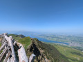
This short hike is mainly downhill after the ascent by train. The return journey can be made by train or cable car. This hike offers exceptional views of Lake Lucerne.
Rigi Kaltbad – Goldau
 6.13 mi
+479 ft
-3,609 ft
3h 15
6.13 mi
+479 ft
-3,609 ft
3h 15
 Moderate
Departure from Weggis (Canton of Lucerne)
Moderate
Departure from Weggis (Canton of Lucerne)
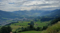
This second stage will take you from Rigi Kaltbad to Goldau. You’ll need to join Trail No. 63 at Rigi Klösterli. This route is mainly downhill. You’ll enjoy views of Lake Zug and Lake Lauerz.
Küssnacht am Rigi – Rigi Kaltbad
 5.79 mi
+4,098 ft
-804 ft
6h 15
5.79 mi
+4,098 ft
-804 ft
6h 15
 Difficult
Departure from Canton of Schwyz
Difficult
Departure from Canton of Schwyz
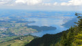
This first stage will take you from Küssnacht am Rigi, on the shores of Lake Lucerne, to Rigi Kaltbad. The hike is fairly short but quite steep as you make your way up to the Rigi. At Rigi Staffel, you’ll enjoy panoramic views of the Alps, Lake Lucerne, Lake Sempach and Lake Zug. The Rigi is accessible from all directions via seven cable cars and two funiculars.
From Küssnacht am Rigi to Einsiedeln via the Schwyzer Höhenweg
40.10 mi
+13,566 ft
-12,123 ft
5 days
Difficult
Departure from Canton of Schwyz
This scenic route will take you on a journey to discover the three legendary mountains of the canton of Schwyz: the Rigi, the Rossberg and the Mythen. You’ll enjoy panoramic views of Lake Lucerne, Lake Zug, Lake Lauerz and Lake Ägeri.
Goldau – Sattel
8.46 mi
+3,848 ft
-2,982 ft
7h 15
Difficult
Departure from Arth (Canton of Schwyz)
This third stage will take you from Goldau to Sattel. The route follows the Rossberg ridge. First, you’ll pass through Gnipen, where , 200 years ago, a massive rockslide formed a cone of boulders. In the heart of this rocky landscape lies the Goldau Wildlife Park. You will then climb to the Wildspitz, the highest point of the stage. As you descend towards Sattel, you’ll enjoy views over Lake Ägeri.
Vitznauerstock summit
 6.07 mi
+3,576 ft
-3,550 ft
5h 55
Difficult
Departure from Canton of Lucerne
6.07 mi
+3,576 ft
-3,550 ft
5h 55
Difficult
Departure from Canton of Lucerne
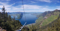
Starting in Vitznau, climb to the summit of the Vitznauerstock/Gersauerstock for a superb view of Lake Lucerne.
Sattel – Holzegg
7.94 mi
+3,215 ft
-1,220 ft
6h 25
Difficult
Departure from Sattel (Canton of Schwyz)
This fourth stage will take you from Sattel to Holzegg. The route begins with a fairly steep climb up to Mostelberg. As you round the Angelstock and then follow the eastern slope of the Mythen, you’ll enjoy panoramic views of the lakes and mountains of Central Switzerland. In Holzegg, you’ll be at the foot of the Gross Mythen. A difficult and demanding trail leads up to this summit
Unterägeri - Cham via the Alpenpanorama Weg
 10.96 mi
+748 ft
-1,745 ft
5h 40
Difficult
Departure from Unterägeri (Canton of Zug)
10.96 mi
+748 ft
-1,745 ft
5h 40
Difficult
Departure from Unterägeri (Canton of Zug)
This stage will take you from Unterägeri to Cham. You will gradually arrive at Lake Zug after a short climb to the Brunegg mountain pasture. On the way down, you will pass the pretty chapel of St. Verena. You can enjoy a lovely walk along the lake in Zug.
For more walks, use our search engine .
The GPS track and description are the property of this route's author. Please do not copy them without permission.

