From Salazac to Saint-Christol-de-Rodières via Grange de la Dame

A short, picturesque walk from Salazac to the smallest village in the Gard-Rhône region, Saint-Christol-de-Rodières, returning via the hamlet of Grange de la Dame.

Details

44622657
Creation:
Last update:
Last review:
  • Walking
    Activity: Walking
  • ↔
    Distance: 4.59 mi
  • ◔
    Average duration: 2h 45 
  • ▲
    Difficulty: Moderate

  • ⚐
    Back to start: Yes
  • ↗
    Ascent: + 715 ft
  • ↘
    Descent: - 725 ft

  • ▲
    Highest point: 823 ft
  • ▼
    Lowest point: 367 ft
  • ⚐ Country: France
  • ⚐ City: Salazac (30760)
  • ⚑
    Start/End: N 44.261099° / E 4.525812°
  • ❏
    IGN map(s): Ref. 2939OT, 2940OT
  • Hour-by-hour weather

Description of the walk

Park in the car park at Salazac.

(S/E) Follow the Route de Goudargues round the car park, then turn right, after a small cross, to follow the Chemin de la Peyrigouse Sud.

(1) Turn left onto the path leading down into the forest (yellow markings). Follow this path through the pine forest until you reach a stream at the far end, then head back up towards Saint-Christol-de-Rodières. You’ll rejoin the tarmac road at Le Pâtis.

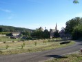
(2) Turn left and continue to follow the yellow markings, which take you back to the tarmac road and then lead you to turn right into the heart of the village. Take a short detour to the left to visit the church and the charming houses on the little square. Then return to the road via Rue du Puits de Valette and continue to the left.

(3) Leave the main road by turning right onto a smaller road (Chemin du Cimetière) which leads into a sort of small housing estate. Walk past the cemetery on your left and head into the forest: take in the variety of tree species. You’ll come out onto a very narrow, barely tarmacked road known as Chemin de Saint-Julien.

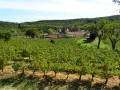
(4) Turn right and leave the yellow signposts behind. Follow the road. Pass the Maison des Crozes on your left, keep to the right at the next junction, and continue downhill to cross the Valat de Saint-Christol, arriving at Grange de la Dame, where you will see a small vineyard on your left.

(5) Carry on straight ahead, leaving the access road to the Mas du Sabotier on your left, and join the RD141.

(6) Cross the road carefully, then follow it round to the right, using the well-maintained verge, which is perfectly safe.

(7) Here, follow the yellow signposting at the junction, which directs you to the left, along the road signposted ‘Cabaresse’. Follow this road for a few hundred metres until a path appears ahead of you, leading into the forest.

(8) Take this path, marked with yellow signposts, and head up to the Domaine de Cassagnol (no motorised vehicles permitted).

(9) Continue to follow the yellow markings as they turn right onto the tarmac road, and walk for about a hundred metres. At the start of the right-hand bend, look out for some red markings and a footpath: follow this, leaving the yellow markings behind. The path climbs, through thorny bushes and rockroses, to a solitary post and a wider track.

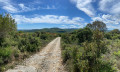
(10) Take this wider path straight ahead and rejoin the yellow markings (incorrectly shown on the IGN map). Follow this narrow path, bordered by dry stone walls, and climb gradually at first, then a little more steeply, up to the Salazac car park (S/E).

Waypoints

  1. S/E : mi 0 - alt. 807 ft - Car park
  2. 1 : mi 0.16 - alt. 768 ft - Path on the left
  3. 2 : mi 0.81 - alt. 722 ft - Le Pâtis
  4. 3 : mi 1.12 - alt. 709 ft - Road on the right
  5. 4 : mi 1.77 - alt. 623 ft - Chemin de Saint-Julien, yellow markings discontinued
  6. 5 : mi 2.48 - alt. 433 ft - Grange de la Dame
  7. 6 : mi 2.9 - alt. 456 ft - RD141
  8. 7 : mi 3.05 - alt. 453 ft - Return to the yellow markings, on the left
  9. 8 : mi 3.27 - alt. 423 ft - Path on the right
  10. 9 : mi 3.82 - alt. 587 ft - Cassagnol
  11. 10 : mi 4.03 - alt. 646 ft - Yellow markings resume
  12. S/E : mi 4.59 - alt. 804 ft - Car park

Notes

(S/E) You can take a short walk around the village of Salazac itself.
There are water points: one in Salazac near the car park (the little hut near the cypress tree, almost opposite the church), and one in Saint-Christol behind the church: a small valve to turn on and then close again.

Worth a visit

Reviews and comments

4 / 5
Based on 3 reviews

Reliability of the description
3.7 / 5
Ease of following the route
4 / 5
Route interest
4.3 / 5
Chout
Chout

Overall rating : 4.3 / 5

Date of your route : Mar 18, 2026
Reliability of the description : ★★★★☆ Good
Ease of following the route : ★★★★☆ Good
Route interest : ★★★★★ Very good
Very busy route : No

Please note that between point 1 and point 2, the descent can be very muddy after periods of rain. Walking poles and sturdy footwear are essential.
The church square is the perfect spot for a break.
From point 4 to point 6, the route follows a tarmac road.
After point 4, at a bend, you can leave the main road and take the old road on the right. You’ll be treated to an unobstructed view of Mont Ventoux and the peaks of the Vercors. You rejoin the main road at the Maison des Crozes.
A long stretch on tarmac, but the scenery is lovely
Before point 9, please be discreet as you pass the Domaine de Cassagnol. Please respect the boundary fence
Point 9: a wide right-hand bend; the path is on the left, marked with pink and blue dots

Machine-translated

Sissou30
Sissou30

We’d be delighted! Thank you for letting us go on such lovely walks.

Machine-translated

Elyria
Elyria

Thank you for your feedback.
I’ll take another look at the description to make it clearer as soon as possible! Thank you for trying it out and for sharing your feedback in any case!

Machine-translated

Sissou30
Sissou30

Overall rating : 3.7 / 5

Date of your route : Apr 06, 2025
Reliability of the description : ★★★☆☆ Average
Ease of following the route : ★★★★☆ Good
Route interest : ★★★★☆ Good
Very busy route : No

Hello. I’m a beginner, but I managed to complete this route in just two hours. There are quite a few climbs (and descents, of course 😉), but I really enjoyed it. I did have a few difficulties with the instructions for the route, as they weren’t always very clear – for example: ‘forget the path on the left’ – it would have been clearer to say ‘turn right’. There’s also a mistake at the end of the route where the directions tell you to turn right when you actually need to go left… though in the end, it was common sense and logic that helped me realise the directions were wrong, but it’s a bit confusing. So, throughout the route, I had doubts about the directions on four occasions, but in the end I didn’t go wrong and finished in two hours. Even a beginner managed it, so don’t hesitate!! I’d just advise against doing it in the height of summer, as there are lots of sections where it gets very hot in the blazing sun!

Machine-translated

botom
botom

Overall rating : 4 / 5

Date of your route : Jun 19, 2024
Reliability of the description : ★★★★☆ Good
Ease of following the route : ★★★★☆ Good
Route interest : ★★★★☆ Good
Very busy route : No

A lovely walk with a good stretch through the woodland!
Please note, the elevation gain is lower than the model suggests!
It’s actually around 275 metres!

Machine-translated

Other walks in the area

For more walks, use our search engine .

The GPS track and description are the property of this route's author. Please do not copy them without permission.